
This is a guide for people wanting to through-hike the Te Araroa Trail in New Zealand going from south to north.
What is the Te Araroa Trail? It’s a walking track about 3,000 km long from Bluff at the southern tip of the South Island / Te Wai Pounamu to Cape Reinga at the top of the North Island / Te Ika-a-Māui that was officially opened in 2011. It ranges over mountains and farmland, through forest, along beaches, on back roads, and in a few parts, through towns and suburbs. It takes about 4 to 5 months to walk.
Why Northbound (NoBo)?
Most people walking the Te Araroa (TA) go from north-to-south. So why go the other way? And why is it mainly Kiwis who are doing it? Well, it’s because they know the weather is warmer the further north you go. Most TA hikers going SoBo (south bound) will start around November and end up in Southland in March or April, walking into autumn in the coldest part of the country. Better to walk away from the increasingly cooler, wetter weather. Doing this also gives you a larger window of start dates if you are walking the entire country, because you end up in the so-called ‘winterless north’ (17 degrees average in April vs 10.5 in Invercargill in the same month). See FAQs page for more on when to go.
Are there any good reasons for going north to south, besides the fact that the main guides are written that way? Well, maybe they have been written in that direction because the Whanganui River section in the North Island consists of canoeing downstream. If you want to do the North Island NoBo, then working round that is tricky but do-able. Or you could always walk the South Island NoBo and the North Island SoBo.
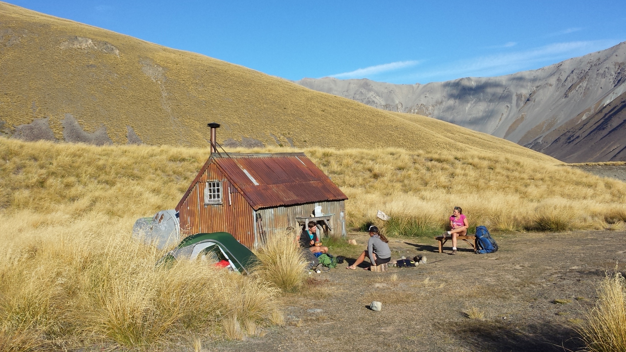 Camp Stream Hut, Two Thumb Range, South Island
Something else to consider is people. Since the default direction is south bound then if you are doing the same you will find yourself with a cohort of others also going south. The composition of the group of people going at your speed and on your route will change over time, but the end result is that doing the TA SoBo can be quite a social experience and making friends on the trail is what some people like about it. When you go NoBo there will be a much smaller group of you, which might create a closer sort of connection. But most people you encounter will be hikers coming towards you. You will meet most of them around the middle of the day, or in the evening in huts and campsites. These are good opportunities to swap info about what is coming up on the trail but you won’t see these people again. And over the course of your hike they will bunch, so at the beginning you will only meet the few who started early, and towards the end, the small number who started late. So, the huts and campsites can be empty at the beginning and end but fill up around the middle.
South Island vs North Island?
If you have only limited time, the South Island is the more spectacular, more back country part of the total Te Araroa Trail. The North Island certainly has its moments, but it does involve more road walking, less time away from civilisation, and takes a little longer. I have walked the full South Island trail in one go, and the North Island in sections.
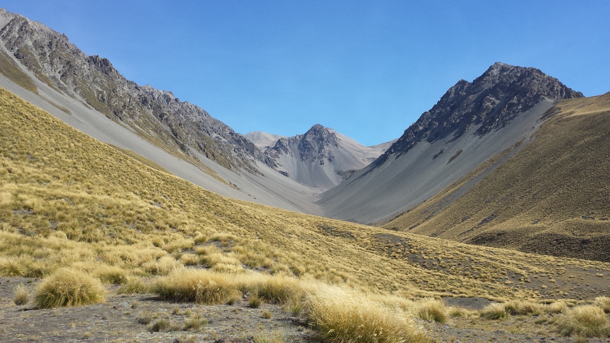 Between Camp Stream and Crooked Spur huts, South Island
Why Through-Hike?
Well, it’s a matter of personal choice, but it seems to me that if you want to say you have walked the Te Araroa Trail, you need to have walked all of it. Many people pick and choose sections, and no doubt by leaving out the boring bits that gives them a more enjoyable experience. Some, particularly Kiwis who can’t get enough days off work, do a section at a time, and by adding them all together eventually get to say they’ve done the TA. Others doing them in sequence regularly go off-trail for supplies and rest. Or simply stay another day or two at a nice spot. And others again, particularly the majority who are visiting from overseas, might want to see a bit more of New Zealand than simply the TA, and head off on diversions here and there. There is a trail saying, ‘Hike your own hike’, meaning there is no right or wrong way and you shouldn’t judge people who are doing it differently from yourself. My approach to the South Island was to do it in one continuous hike, walking every single metre, and so that’s the way I’ve written this guide: for through hikers. Hence it covers the whole she-bang, including the sometimes tedious bits of road between back country trails. But I’m sure it will also be useful for people who want to do sections only as well.
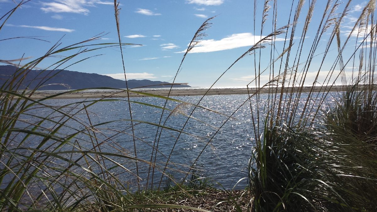 Kapiti Is from Waikanae Beach, North Island
Why This Guide?
I have written it because the official guides are not so well suited for through-walkers going north. The southbound guides have a good amount of information but because they are oriented towards the greatest number of users (section hikers) a lot is repeated and bits between sections are left out. Using the guides in reverse, as I did, is quite tricky. The official northbound guides (at the time of writing, for the South Island only) are better, but their layout is still not space efficient, meaning there is more paper to carry than you need, and they have not been updated since 2017. They also exclude details of accommodation, transport and options for going off-trail, requiring you to go to the southbound guides for that anyway. So, the pages here offer the best planning and take-with-you NoBo guide I am aware of.
How are the Guides Written?
My guides are divided up into sections of approximately eight hours walking a day. These are generally between places where you can stay the night. But because towns, huts and campsites are not evenly spaced eight hours apart, there are parts where some days are longer and a few are very short, effectively turning these into rest days (‘nero days’ – near zero – or zero days, in trail jargon).
Times of each section are the actual times it took me. They include short rest stops every hour or hour and a half, but exclude lunch breaks. I would say I was walking at a fairly average speed. The schedule of days is based upon a strategy of sending food parcels ahead at nearly every opportunity, which meant there were no off-trail trips that added extra time. But it did mean a lot of work organising before departure.
The guide assumes you are using the official TA maps, so for the sake of brevity, not every twist and turn of the trail is covered. In many places you can manage with the maps only. Also, to keep the text short, comment on the landscape and its history has unfortunately had to be kept to a bare minimum. There is a little more in the TA guide notes and on the Department of Conservation (DoC) website as well as in the DoC brochures that cover some sections. See the Links page for these and other sources of information.
I have been reluctant to add in accommodation prices and transport timetables because these will always change, but some are included as indicative. Please check them if you are going to rely on them. And feel free to send through updated information.
How to Use the Guides
You can print out the guides. I’ve deliberately not included pretty pictures in the guide pages so you don’t have images taking up space. You can send them as printed instalments to yourself on the trail with food parcels to further cut weight. As with the maps, once you’ve finished with them they are good for starting fires, or you can leave them in huts for other people. If you have an e-book reader there is software online to convert pages to the file format required. Or you can save them to your cellphone. There are several routes to either printing or cellphone saving:
You can just print the web pages as they are of course. Or you can download them to your computer as pdf files (for offline viewing, later printing, or perhaps to transfer to your phone). To make the pdfs, start by printing the web pages but choose ‘print to pdf’ as your printer and save the file. Go to ‘more settings’ if the font looks too big or small and select a particular percentage rather than ‘default’ under ‘Scale’. You can also adjust margins (useful if you want to have a wide left for making notes, say), and create headers with page numbers, etc. I’d definitely add page numbers, either this way or by hand if you are going to carry the pages as print-outs with you.
If you are just going to read the guides on your phone then I recommend saving the web pages offline. In the Chrome browser on your phone click the three dots at top right, then select the download arrow symbol. If this doesn’t appear, try ‘more tools’. To later reload the page offline, select Downloads from the three dots menu. On iPhones using Safari, first make sure that under Settings and Safari that Reading List is set with Automatically Save Offline on. When you have the web page you want to save displaying in Safari then select the icon with the arrow over a square at the bottom of the screen and then scroll down to ‘Add to Reading List’. To later retrieve the page offline, just select the open book icon at the bottom of the Safari screen and select the saved page. I strongly suggest testing that you have indeed saved an offline version with either the Chrome or Safari browser by going offline, perhaps even restarting your phone as well, to simulate being on the TA trail with no cellphone signal or wi-fi.
Finally, you can copy and paste the pages into your usual word processor and print out the pages, or again save them to your phone. This method will lose some of my formatting, but it allows you to make your own edits.
The core component of this site are the day-by-day walking guides. But there is lots more here. And there is of course the official website, which you should certainly visit if you are going to take up the Te Araroa challenge.
Updates
The TA Trust issues revisions to the route each year around September and I incorporate these into my pages soon afterwards. You can check the bottom of each page to see when I’ve last updated it. The official TA maps and notes have been updated for the 2025/26 season now and I have made changes to my notes accordingly. I have also checked that listings for accommodation and transport providers are still current wherever I can.
You are probably aware that weather patterns are going crazy all over the world these days. Check out the long range forecast for the coming months (scroll down to the one you want under ‘Issues’). As at 4 Nov 2025, the forecast for Nov through to January is hotter than usual temperatures across the country with more rain in the north of the North Island than normal, and less in Otago and Southland than usual.
Lastly, check out my new donations page. There are 117,000 words in this website. That is at the upper end of an average book. How much would you pay for a Lonely Planet guidebook, say?
Good hiking!
Athol McCredie, 17 November 2025
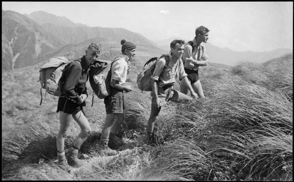
Members of Hutt Valley Tramping Club on Tarn Ridge, Tararua Range, 1942, by Ian Powell, National Library of NZ (PA1-o-651-08)

Hi
What months did you actually do the South Island?
LikeLike
February and March and the first week of April. I had one day of walking in heavy rain, one overnight heavy rain (staying in a hut fortunately) which made all the streams rise to torrents the next day, and one other day of light rain in the bush. That was it for rain, but every year is different. Also, some very hot days in Otago. By the time April came up there were fewer daylight hours each day for walking compared with when I had started, which wasn’t something I had considered.
LikeLike
Hi there, thank you so much for this information. I want to start the South Island NOBO in December and was stressing about the canoeing trip on North Island. So your post helped me like- why not doing North Island SOBO? I would probably be there around February. Do you have any concerns when starting North Island later than the people that go SOBO all the way? I reckoned no as I thought it’s mainly about reaching the mountains on South Island at the right time. Would appreciate a lot to hear back from you. Love from Germany, Theresa
LikeLike
That sounds like an excellent plan as it solves the Whanganui River canoeing issue. Also, the Northland forests can be notoriously muddy, but by February they should be drier. And you won’t be competing for bunks in backcountry huts with other TA walkers in the South Island. It may be a bit rainy in Southland in December, and possibly the big rivers in the South Island will have more water in them if you start NoBo in December, so I would consider that you might need to divert around the Ahuriri and Rangitata rivers.
LikeLike
Great information thanks 😊
Do you have a list of places where you can send your food boxes in advance?
Many thanks in advance
Jill
LikeLike
See my Food page for a link to Brad McCartney’s site. Also, I have marked towns/places for resupply on the South Island overview map.. And you can simply go through my guides and see comments about places as you go. I’m reluctant to make a list specifically for places that will accept a food box as I would then have to keep updating both this and the same information in the guides.
LikeLike
Kia ora Athol, I wanted to reach out to you once again, being on trail at the moment, and thanking you so much in behalf of myself and basically every other Nobo hiker I met. We are all using your notes, the „bible“ of TA Nobo. I can only guess how much time and effort went into these pages. Thank you!!!
LikeLike
Thank you! I hear the odd comment that lots of NoBos are using them, but I never really know because I don’t get much feedback. So good to have your feedback. I hope it’s all going well for you.
LikeLike
Hi! Many thanks for your notes! They’re super usefull. I have used nothing else except for Farout. One minor update: Anne Hut has no radio anymore, or it’s in the ranger cabin but couldn’t verify. Cheers!
LikeLike
Thank you! Glad they worked for you. I see that the DoC website also says that the radio has now been removed, so I will edit the Anne Hut info.
LikeLike
Dear Athol,
Many thanks for your great site! I will definitely use it for my TA, hopefully starting this December… May I ask you a question I’m not very confident about: I have to start beginning of December and as I already know, that the southern island is much more spectacular than the northern one (seen both as a tourist, not a hiker) I would love to make the northern one first… I will for sure not be very fast – I tried myself on the Kungsleden this year and 20-25km per day is my “I’m a happy hiker” limit (means more is possible, but actively limiting the fun). So I plan with full 6 months for the thru-hike.
I thought of starting the northern island in beginning of December Sobo and then switch to the southern one Nobo. Is that a good idea – or do you maybe have a better one for that particular boundary conditions?
Best regards,
Maik
LikeLike
To do the TA in six months I think it might be better to start in November with your plan to start in Northland. Quite a lot of people going SoBo on the whole trail do this anyway. It may just mean more rain at the start, and probably more mud on the Northland forests. But yes, you can mix up whether to go NoBo or Sobo and on which island. Though it is hard to say which idea is best. Starting NoBo on the South Island early (November) means the risk of snow in Otago, Canterbury and Marlborough, and some sections over farmland being closed for lambing. But if you are finishing in the South Island in May, say, then there is also the risk of snow and bad weather there. Still, I think most options will work. If you do the North Island Dec, Jan, Feb SoBo and then the South Island NoBo in Mar, April, May you probably only need to worry about the small possibility of snow on the Waiau Pass in Marlborough. But doing the whole trail NoBo works pretty well I think: South Island Dec, Jan, Feb; North Island Mar, Apr, May.
If you are limited to 20-25 km a day, there are some sections that might make this more difficult or less efficient because of the distances between towns or between huts, so will mean more camping and planning. I have written my guides on the assumption that walkers can do up to 30-35 km a day in many places, so you will need to adjust these.
LikeLike
Hi Athol,
many thanks for your more than helpful reply! I definitely cannot start earlier than Dec. but your comment „If you do the North Island Dec, Jan, Feb SoBo and then the South Island NoBo in Mar, April, May you probably only need to worry about the small possibility of snow on the Waiau Pass in Marlborough.“ helped me a lot – I guess, that will be my way…
W.r.t. the average distances between the huts: this year on the Kungsleden I already managed to sleep almost 4 weeks in a tent (and 3 nights in emergency huts on top of some extra mountains, I approached) in wind, rain, storm and ice and carried my food for the first 3 weeks: I did this also to prepare myself for longer trails outside – so hopefully I will be fine with camping almost all the time. At least that’s the plan: or is there something I’m not aware of (maybe regulations or laws) or I haven’t considered? I already upgraded my tent to an “indestructible” model, which is self-supporting, so I guess it should survive in almost all conditions…
May another silly question, if you find time to aber answer: when I’m going North Island SoBo and South Island NoBo (I really want to finish on the South Island, it’s that magical in my opinion – and if I’m faster, there is maybe no better place to have some days to spend than Abel Tasman), what would be the best way to come from the south end of the northern to the south end of the southern island?
Best regards and many thanks for your last answer already!
Maik
LikeLike
OK, obviously you won’t have a problem with sleeping in a tent. The issue may be finding somewhere to camp sometimes though. The NZ forest is generally dense and trails are often around hillsides, so it can be really hard to find a clear, flat space for a tent. Beech forest, which you find in some places, is much more open though. Also, yes, finding somewhere legal to camp can be another issue. This can mean finding places to camp where you won’t be seen, or trying to find a farm house where you can ask permission. Remember to bury your poo and take out your rubbish. Bad behaviour by some campers makes land owners less tolerant.
As for getting from Wellington to Bluff, I think that flying is the best option. Air NZ have direct flights (2hrs) as well as some transferring in Christchurch (or you can fly Jetstar Wellington to Christchurch and then Air NZ from Christchurch to Invercargill). The alternative is to take the ferry (the Interislander or Bluebridge) to Picton and then a bus (Intercity), but there is no through bus, so it will take you two days. Organising this is complicated and may cost as much as a flight.
LikeLike
Thanks so much for publishing this guide. I’m feeling much more confident about starting my walk in 2 days after carefully reading your notes. I hope to follow your plan as far as Wanaka, with some rest days built in. Then I’ll see if I have the juice to keep to your schedule. Still confused about the Rangitata area….the crossing (or not) and wheter to send a bounce box, but I figure I can check with SOBO walkers to see how they handled that section. Cheers!
LikeLike
When I started at Bluff I was pretty unconfident about being about to do the TA. I set my target as Queenstown. I figured that if I got that far then it was still quite an achievement and something I could always be proud of. The thing is though, once you start, that’s what you are doing every day. So I just kept going once I got to Queenstown. I didn’t even think about quitting. It’s just like the routine of going to the office each morning. You may feel exhausted at the end of each day, but you do it again over and over until one day you finish. Then you feel that not doing the TA leaves a big hole in your life. Also, those three rivers – the Ahuriri, Rangitata and Rakaia – were by far my biggest worry about doing the South Island TA. But they all worked out one way or another. The good thing is that going northbound you encounter them with increasing size and difficulty, so the first is the easiest.
LikeLike
hey, ive just stumbled across your blog whilst doing research for my trip! Fantastic info! Im looking to maybe get an opinion from you if possible!
im looking to start to a section of the TA going Northbound from queenstown to Nelson starting in late Oct and finishing around 20th Dec in Nelson. do you think this is probably too early? Ive lived in the queenstown area for the past year and ive hiked plenty in November so just wanted to get another opinion really.
Thanks!
LikeLike
Possibly. It is entirely weather dependent. You might be lucky, you might not. The point is that there is greater chance of a snowstorm, a rainstorm, high rivers, and cold in Oct and Nov than in Jan and Feb, say. I would check out the NIWA quarterly long range weather forecast in July and Oct (see in my Weather and Hazards page for the link) and also plan for it to take longer that if you did it after Christmas, as you may need to wait out bad weather or or a high river.
LikeLike
Hi Athol,
first of all thanks so much for creating this site and providing all the valuable info. I’m in the initial stages of planning my route and consider – like you did – hiking the South Island in its entirety, but the North Island just in sections, to omit road walking whenever possible. Can you tell me which sections are the ones that consist of road walking? Or is there some kind of map or overview available which provides this information? If I skip the road parts, how long would it take to do the North Island?
Also, I do have some fear of heights, it’s not extreme, but if I were confronted with say a 30 cm path right next to a 100 meters (or more) drop I would most likely turn back. Would you recommend to skip Richmond Ranges entirely, or is it possible to somehow do at least a part of it? If I have to skip sections on South Island would I usually have to hitchhike? Is there any other area besides Waiau Pass that you would not recommend to people with fear of heights?
Thanks!
LikeLike
I think you would have to read the notes to figure out the road walking. Also, the road walking can be shortish in places and act to connect off-road bits, so the answer is complicated. Roughly though: Palmerston North to Whanganui (though there is the beach walking section via Koitiata for part of this); Whanganui to Pipiriki; Mangapurua to Kurua Rd; National Park to Mangahuia Track (short); Owhango to Taumarunui; Taumarunui to the start of the Timber Trail; Pureora to Mangaokewa North Rd shelter; Kaimango Rd to Pirongia Mountain; Other side of the mountain to Hamilton; Mercer to Auckland CBD (but there are bits of off-road walking); and there are large chunks in Northland, in part due to track closures. Also, in Wellington and Auckland there are chunks through suburbs, but these are generally pleasant enough and via footpaths and pathways. I think the main one people avoid is that long stretch into Auckland via Ramarama, Manurewa, etc. And an issue is that you just can’t avoid some bits. e.g. Pureora to the Mangaokewa Nth Rd shelter is a full day’s walk, but how would you get to the shelter otherwise? Mind you, the bush section from the shelter to Te Kuiti is unpleasant, so you could get a Timber Trail operator to take you from Pureora to Te Kuiti and skip the whole section, which i think people do. But this section raises another issue: is it walking on a road as such you wan to avoid, or the dangers and stress of walking by traffic? There is very little traffic on the longest part of the section from Pureora just mentioned.
As for heights, yes, the scariest bit of the entire trail, North and South Island, would have to be a point in the Richmond Range, just after Mt Rintoul I’m afraid. No easy way to avoid this. Followed by Waiau Pass, followed possibly by the Escarpment Track from Pukerua Bay north of Wellington (though a least you will probably have plenty of company if it is a fine weekend, which can be reassuring), and followed in turn by the ridge from Dracophyllum Hut to Pukematawai in the Tararuas, but the last is relatively minor.
LikeLike
Hi, just to add to the discussion as I also have fear of heights: the Motatapu trail was challenging for me, close to Highland Creek hut. Breast hill was also challenging, but slightly less, same for Waiau pass which I found quite easy actually (I find climbing less scary). Everything is personal of course!
LikeLike
Hi, thank you very much for such a thorough and thoughtful guide, it has been incredibly helpful for planning TA.
I’m planning to start the South Island NOBO in early February. Based on your experience, would you still recommend continuing with the North Island SOBO at that point (as a way to avoid the Whanganui River upstream issue, or just for comfort of using the guides), or would staying NOBO for the North Island be just as sensible given that timing?
LikeLike
I would tend to stick with going NoBo. It you switch to SoBo then you would reach the Whanganui River around mid-May. The river will have more water in it then and could be flowing fast. The DoC page on canoeing the river says: ‘Only attempt the trip at this time (1 May – 30 Sept) if you are very experienced in canoeing remote New Zealand rivers in winter.’ Mid-May may not be as risky as that sounds but you would need to check that canoe companies are still operating then. Also, you will be close to June when you get to the Tararua Range, and there can be snow on the high slopes by then. Even if not, the chances of good weather to do this traverse are not high at this time of year.
LikeLike
many thanks for a great site.
We are about to start the North Island on sobo on Jan 12 2026 and will end at Wellington.
we will do the SI next summer. Can you recommend the best start date bearing in mind we hope to spend Xmas at home. I am thinking starting by Jan 1-2 ?
LikeLike
I’m not clear if you are planning to go Nobo or Sobo on the South Island, but I cover the best time to do only the South Island Nobo under FAQs. Quote: ‘…I would suggest beginning in late January/early February, when NZers have mostly finished their summer holidays but you have two months of the driest, most settled weather ahead of you.’
LikeLike