
THE WHANGANUI RIVER QUESTION
How are northbound hikers to tackle what is, by definition, a southbound experience: paddling down the Whanganui River? Below are my speculative thoughts. I would be interested in hearing what NoBos have done in practice about this section. I think many flip-flop, to get the experience of canoeing the Whanganui River; others do what I did, take the jetboat upriver; and some decide to road walk from Whanganui to Ohakune. These are the most practicable options.
Following the outline of possible alternatives there is a detailed guide for #A, the jetboat option below.
A. Road walk Whanganui to Pipiriki and jetboat to Mangapurua
The simplest option that still allows you to stick to the trail is to walk or cycle 78k on the road from Whanganui (aka Wanganui) to Pipiriki. There are various accommodation options along the way, including campgrounds at Ranana and Pipiriki and the convent at Jerusalem. Then you could take the jetboat to the Mangapurua landing (Bridge to Nowhere). It is in fact cheaper than hiring canoes and going downstream, though rather less respectful of the peace and quiet of the river. This option also stays closer to the TA trail in that you can continue walking north from the landing, whereas it seems most people going SoBo don’t actually do the official route of walking to the Mangapurua landing because of the difficulty (or expense) of getting a canoe dropped off there for them to begin paddling. So you can turn a disadvantage into an advantage. See below for more details.
B. Road walk Whanganui to Ohakune and then Round the Mountain track
Or you could always continue road walking from Pipiriki to Ohakune. This will get you back onto the TA trail near Whakapapa with the least amount of walking, AND you would have walked the whole distance. The traffic is not heavy on the first part of 27 km Pipiriki to Raetihi and the next bit from Raetihi to Ohakune is only 11 km. Or there is a network of tracks that you could follow from Matahiwi, south of Pipiriki (52 km from Whanganui) to Raetihi, to save some road walking. And from Ohakune you can take a road up Mt Ruapehu to join the Round-the-Mountain track and get to Whakapapa, joining up with the TA just before. Going around the mountain yields some great tramping. There are backpackers, cottages and campgrounds to stay at Raetihi and Ohakune (make sure not to camp near the park floodlights at the Raetihi campground if you want some sleep at night). Also, compared to the official route, it is not actually more road walking because the official route has 36 km from Whakahoro to Fisher Track and another 6 km on SH47 after Waimarino / National Park. OK, there is the road section up the mountain from Ohakune in this option which adds more road walking, but it is pleasant and mostly through forest, with almost no traffic. And there is the lovely, short Mangawhero Forest Walk at the start, and further up you can go up the Blyth Track running parallel to the road. So it is about 8 hours from Jerusalem to Raetihi (where there is a campground), then 8hrs to the Mangaturuturu Hut on the Round the Mountain Track (going clockwise), and 8–9 hrs from there to Whakapapa Village. Going via the Blyth track might add an hour to Mangaturuturu Hut. On the way, Ohakune has a decent supermarket and there are good cafes there too, plus outdoor (ski) stores. In summary, 3 days from Jerusalem to Whakapapa versus 3 days, 6hrs taking route ‘A’ above.
C. Road walk to Raetihi and then northwest on roads to join the trail at Mangapura trig
This is quite a lot of walking but it means you spend more time on the official walking trail. As above, first get to Raetihi, then turn off from the road north out of town onto Ruatiti Rd and stay on this all the way, going via Orautoha. Then you turn west to join up with the Mangapura–Kaiwhakauka Track and continue on to Whakahoro.
D. Flip-flop the section
An alternative is temporarily going SoBo, and this may be the most common approach. This involves getting from Whanganui to a point such as Ohakune where you can depart to go downriver. For example, Intercity buses depart five days a week on the route at 11:30 am from Whanganui, and take 1 hr 30 mins. Yeti Tours are based in Ohakune. They drive you to the river, set you off, and come down to pick up the canoe in Whanganui, so you could get a ride back up with them after you have finished paddling. It is about three days (20 hours) paddling from Whakahoro Landing to Pipiriki and a similar time, if not more, down to Whanganui city. See the official notes for details as well as the DoC information and many other online sources.
E. Paddle upstream
More challenging options include padding upstream on the river. In mid-summer the river is pretty slow moving for long stretches. It is possible to travel upstream but it will involve hauling or carrying canoes around the many (very small) rapids. Māori used to get their large, heavy canoes up these sections by polling, pulling them up with ropes, or jumping out and pushing and pulling the vessels.
F. Walk west of the river
Walking up west of the Whanganui River could be another possibility, but you will need to get across the river at some point and there is a fair bit of road walking, but no more than the distance some do from Pipiriki to Whanganui. For example, you could road walk from Whanganui to Taumatatahi 78 km to the northwest, beginning on the main road to Watotara 34 km to the west of Wanganui and then up the Waitotara River on back roads. You continue north on tramping tracks, through the Waitotara Forest, and meet up with the ancient Māori Matemateaonga track going east to Ramanui. There is a private campground with cabins there and it is close to the Bridge to Nowhere Lodge, both on the west bank of the river. These places will have jetboats pulling in for supplies, so they could probably get you across the river to the Mangatiti Stream track more or less opposite, from where you join up with the Bridge to Nowhere track, or go direct to the Bridge to Nowhere track from the Mangapuroa landing, as above. You could call the Bridge to Nowhere Lodge for advice on this idea.
G. Walk the Ruahines
Avoiding the Whanganui River altogether by walking up through the Ruahine, Kaweka and Kaimanawa ranges could be an alternative. It has the advantage that you end up actually walking the length of the North Island if you are a hard-core through-hiker, rather than floating down a river for a section, which seems to me a bit of a cheat anyway. However, this route through the mountains and bush will require carrying food for many days and is pretty rugged. The Ruahine section, ending at a spot called Kuripapango on the Napier–Taihape Rd, takes around seven days, and you would need to add a day to that for walking from Palmerston North to the start of the track near Ashhurst. Ashhurst has a Four Square grocery store, but little in the way of accommodation except a campground at the Domain (showers and toilets), and a couple of cheapish Airbnbs. In a 2017 account by Anthony and Fiona (click through and scroll down to Day 13 to start), they continued road walking past Ashhurst to the head of the Pohangina Valley and then took a further 11 days, with some additional days to wait out rain and the extra one from Ashhurst to Pohangina. They continued on from there to the Napier–Taupō road, west of Taupō, which is further north than you want to go if you wish to catch up with the TA again at Ruapehu. They had laid food depots on the route earlier.
So how do you get from the Ruahines to Ruapehu? With difficulty. You could road walk or hitchhike out to Taihape (or nearby) on the Napier–Taihape road, and then walk north on State Highway 1 (probably not much fun) to Waiouru and then to Ohakune, or continue along the Desert Road from Waiouru. Or you could road walk for several days over back country roads from Taihape to SH49 near Tangiwai and get to Ohakune that way. There appear to be tracks and gravel roads running beside the rail line from Tangiwai to Ohakune, but I don’t know if they have public access.
If you want to press on through the Kaweka and Kaimanawa ranges a problem is that the ideal spot for exiting on the Desert Road to cross over into Tongariro National Park and ultimately meet up with the Tongariro Crossing via the round-the-mountain track is that the army’s live ammunition training ground is in your way. Fancy taking a bullet? Going south of this prohibited area really amounts to the road walking just mentioned. Going north around it is a long hike through rugged country to exit near the Rangipo powerhouse, not far south of Tūrangi and it will involve crossing private land (for much of it contact Helisika (027 900 9004) for permission). I don’t know how long this will take, but let’s say five to seven days, and there is no marked track all the way, so you may have to bush bash, or walk up rivers, so now you have about two weeks in total from Palmerston North without resupply through some remote and difficult terrain. However, once at Tūrangi you could easily catch a ride to Whakapapa Village on Mt Ruapehu and rejoin the TA. Taking a ride here wouldn’t prevent you from later saying you walked the length of the North Island because Tūrangi is further north than Whakapapa.
H. Road walk Palmerston North to Ohakune
Finally, the above route suggests another option from Palmerston North that is very simple: go up the Pohangina Valley road and then along back country roads of your choice to Ohakune to avoid walking the main highway. It means a lot of road walking, with the only accommodation camping on farmland (permission required), but would be over country few see.
THE GUIDE

Click on 3D map to enlarge, click again to zoom
Raumai Rd, Santoft 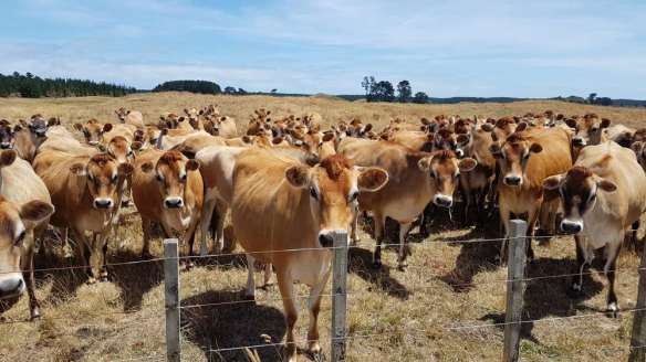
Cattle, Raumai Rd 
Raumai Rd, 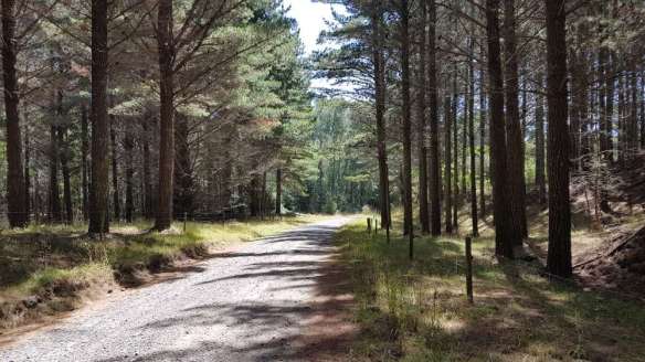
Forestry Rd, Santoft 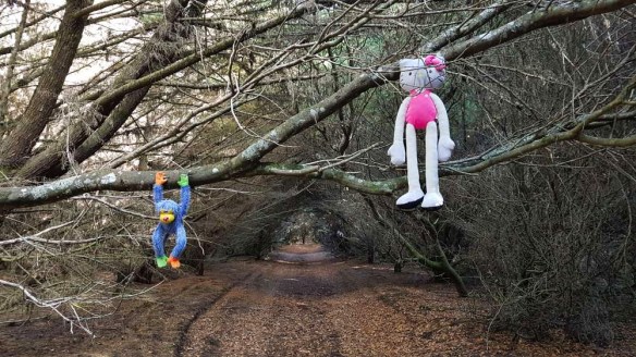
Santoft Forest near Kotiata 
Beach at Kotiata 
Kotiata bach 
Kowhai Park, Whanganui 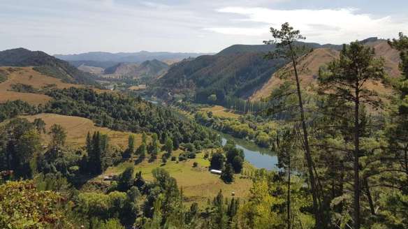
Whanganui River looking towards Pungarehu 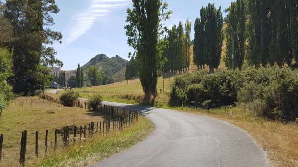
Whanganui River Rd 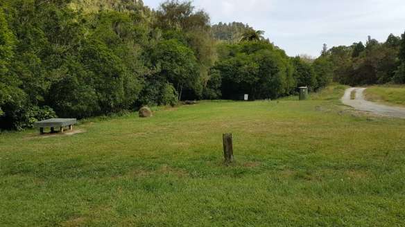
Otumaire campsite, near Atene 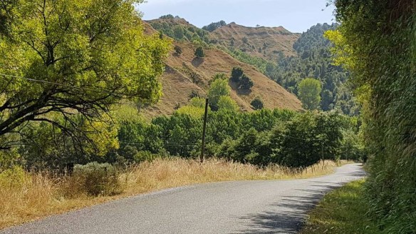
Whanganui River Rd 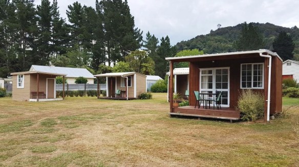
Matahiwi Roadside Cabins, Whanganui River Rd 
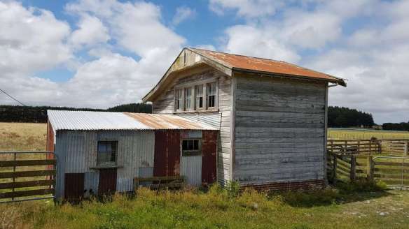
Abandoned house north of Matahiwi Gallery and Cafe 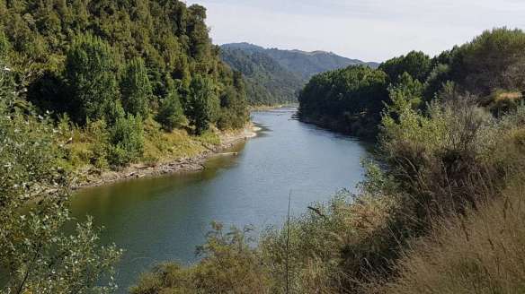
Whanganui River from the road 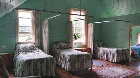
Jerusalem convent 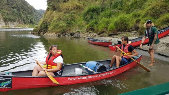
Canoeists on Whanganui River north of Pipiriki 
Whanganui River north of Pipiriki 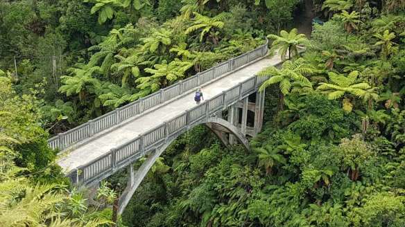
Bridge to Nowhere 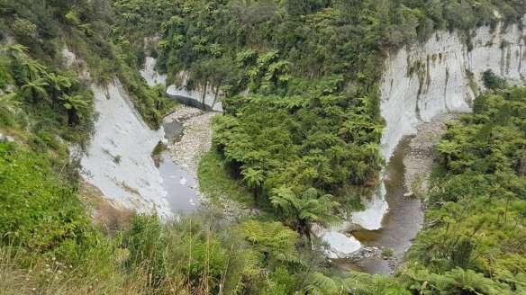
Mangapurua-Kaiwhakauka Track 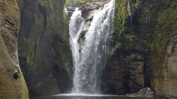
Blue Duck Falls, near Whakahoro 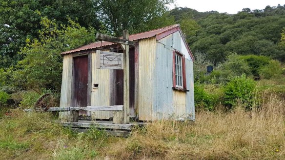
Old post office at Whakahoro 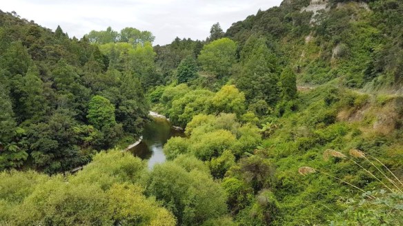
Oio Rd 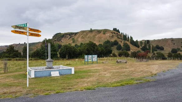
War memorial at Upper Retaruke Rd 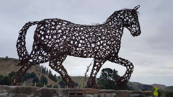
Horseshoe horse at Oio-Upper Retaruke Rd junction 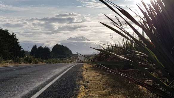
Volcanic Loop Highway (Highway 47) and Mt Ngauruhoe 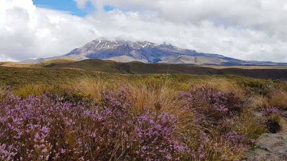
Mt Ruapehu from Mangatepopo Track 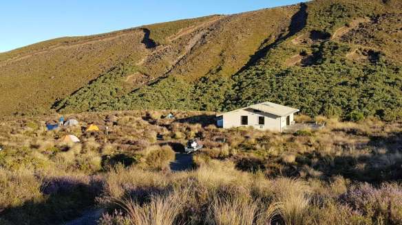
Mangetepopo Hut 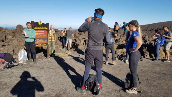
Devils Staircase, Tongariro Crossing 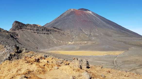
Mt Ngauruhoe from Tongariro Crossing 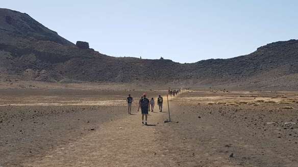
South Crater, Tongariro Crossing 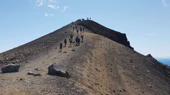
Up to high point of Tongariro Crossing 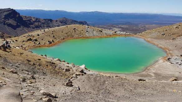
Emerald Lake, Tongariro Crossing 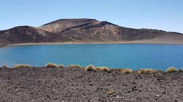
Blue Lake, Tongariro Crossing
Bulls to Whanganui: 60.5 km
13. Bulls to Koitiata: 7.5 hrs, 32 km (maps 72, 71, 70)
Note that there are no water sources or toilets on this section. From the centre of Bulls head south-west on High St for 5 km (after about 2 km it becomes Parewanui Rd). Turn right into Raumai Rd by the golf course and keep right when it later meets Sandridge Rd. It then becomes Turakina Beach Access Road. Keep right a short way in (not left or you will end up on the NZRAF bombing range, though I’m sure there will be warnings!) And then you find yourself on the beach. You then walk north-west along the beach.
An alternative (the trail route up until 2019-20) is to turn right into Santoft Rd from Raumai Rd. I’m not sure why the trail has changed, but there is little distance difference. Perhaps the pine forest owners don’t want you walking down their forestry roads. This original route does save you a few km of beach walking, and I’d consider it in windy weather as it can be unpleasant on the beach. To take this route, turn left into Fusilier Rd from Santoft Rd after a culvert, just before Santoft itself. This is a forest road through trees heading west. When it ends at a carpark, turn right. After 1.3 km your route goes left onto the beach, but the point is easy to miss. The beach exit is just north of where the sailing ship the Fusilier was wrecked in 1884. There are a number of wrecks along this sandy coast as it was a lee shore, something to be avoided in a sailing vessel. In this case the captain decided to beach the vessel in a storm to save lives. The ship is mostly (or entirely?) covered in sand now.
There is a severe fire risk with the forests above, so no camping in them, nor lighting fires on the beach.
If taking the Fusilier Rd option you can also continue along a route marked by a buried gas line, but note that there are very few points of exit to the beach and there is no hope of scrambling through the thick vegetation behind the beach except on a formed track. If you do stay on this (and it may provide welcome respite from the wind and sun on the beach), you can take a turn-off left just after the Koitiata Stream (not the turn before) and follow a track through the pines and macrocarpas that more-or-less runs parallel to the gas line but eventually affords access to the beach. It is a bit spooky on this and you wouldn’t want to be on it near dusk, especially if the section of about 50 or so of stuffed toys nailed to, or placed in, the trees along the path I came across in 2020 are still there (a warning? site of an occult ritual?).
Whether you have exited to the beach earlier or from this track, the main thing is to stay inland of the lagoon formed by the Turakina River when you get near Koitiata. This probably only fills to the extent shown on the TA and NZ Topo maps during winter, so you won’t see much of it. There is a track in the dunes running parallel to the beach as you near Koitiata but no obvious entry to it from the beach – you will just have to stumble onto it or stay on the beach until the twin road cones elevated on sticks that mark the main beach exit. There is a basic campground in Te One St at the small holiday settlement of Koitiata.
- Koitiata Campground – End of Te One St, Koitiata – 027 662 9040 (Maree), 06 327 3733. Campsites only, no cabins, no cooking facilities aside from a coin-operated barbecue (which doesn’t run long for your money). Put $15 for a tent in honesty box (bring cash) at the ‘kitchen’ behind the toilets.
- Red Bach Retreat – 9 Rapaki St, Koitiata. This looks like a nice place to stay and rates are reasonable, but minimum of 4 people staying 2 nights is required. 06 327 3606, 027 494 0137.
14. Koitiata to Whanganui City Bridge: 7 hrs, 29.5 km (maps 69, 68)
The new route from 2019-20 is to ford the Turakina River at Koitiata. This might only be possible at full low tide at the edge of the ocean when the river is in low flow, but it would be best to ask locals where the best current fording point is, as the river shifts all the time. There may be markers set up for the crossing. Then you continue along the beach further to the next holiday settlement of Whangaehu, and take the road there to SH3. If the Whangaehu River was fordable then you could continue along the beach but I think it is unlikely to be so. HOWEVER, there is a plan by the TA Trust to build a bridge over the river. This will be fantastic for cutting down road walking. You can donate to its cost. I have.
If you don’t want to ford the Turakina River head inland from Koitiata along Wainui St, which then becomes Turakina Beach Rd, taking you 8.5 km to SH3 and near Turakina village (400m to the right). There is not much in the village – no shops and the Ben Nevis Tavern is closed.
After going up the hill on SH3 after Whangaehu settlement (and passing a pleasant picnic spot halfway up the hill) turn right on Warrengate Rd to No. 2 Line, just west of Fordell, and then walk west to Whanganui. You can find a water supply and shade at a church on No. 2 Line just after its intersection with Union Line and Matawara Hill Rd. The route also lets you take the historic Durie Hill Elevator at the end (bring a $2 coin). To find the elevator, continue left into Durie St as No. 2 Line (now Portal St) turns right near its end, turn left into Maxwell Ave, then right into Blyth St. At the bottom of the elevator cross the Whanganui City Bridge into Victoria St, the main street in the town.
- Headlands Estate – 174 Kauangaroa Rd, just before Fordell. This is a mansion listed on Booking.com (at minimum of $170 twin or double, Nov 2025), or call Annette & Steve Cox 027 251 9302.
- ‘Cabin on the Lane‘ – Fordell (1 km from the village). Cabin, $100 for TA hikers per night if booked directly, more if going through Airbnb. A further, related, Airbnb is The Blue Gum Rest House, $200 cash. Camping in paddock with access to shower and toilet is also available for $20pp. Can pick up from Turakina. Text Carol, 027 656 2290.(Confirmed correct Nov 2025)
- YHA Whanganui (Braemar House) – 2 Plymouth Street, Whanganui. Slightly north of the city centre, close to the river, just below the Dublin St bridge. 06 348 2301. Braemar House is a B&B in a Victorian Homestead, and the Youth Hostel is operated in a separate building at the back.
- College House – 42B Campbell St, Wanganui. Slightly closer to town centre than YHA. Dorm rooms and private rooms. Also bikes for hire. 021 852100.
- Caroline’s Outback Camping Ground – 181 Somme Parade, Aramoho, Whanganui. This is marked on the TA map, yet doesn’t appear in the official notes. $15 for a tent site in 2024, cash only. It is fairly small, and you may be lucky to find a tent site among the RVs and caravans. It is at the back of the car park for Caroline’s Boatshed Bar & Eatery. 022 694 0382.
- Whanganui River TOP 10 Holiday Park – 460 Somme Parade, Whanganui. About 5 km upriver from the town centre but is on the TA route. 06 343 8402 or 0800 272 664. Cabins and camping.
- Freedom Camping by Multi Sport Club – 140A Anzac Avenue. This will be closed down by the city council in September 2025.
- Woolworths supermarket – cnr Taupō Quay and Wilson St, just south of City Bridge.
- New World, Woolworths and Pak’nSave – at the western end of Victoria Ave, about 1.3 km from City Bridge.
- Kathmandu – 128 Victoria Ave
- Wilsons Hunting and Outdoors – 222 Victoria Ave. According to the official TA site they will accept bounce boxes at no charge! Ph 06 348 7679 to arrange. You should be able to get camping gas either here or at Kathmandu.
Whanganui to Pipiriki: 2–3 days, 78 km
The Whanganui River Road is a winding, sometimes narrow road that follows the river and poses some risk of being hit by a car. Traffic density is not high (about 15 vehicles/hour in my experience on a weekday, with a higher peak early afternoon), but some of the younger locals are known to drive at high speeds on the road (one died in a car that rolled while I was on the route), so take care. Watch especially for cars that approach from behind at the same time as ones come towards you: their noise will be covered by the car you can see ahead. An alternative is hiring a bicycle. This also presents a risk of being hit, but the time on the road is less. Mountains to Sea has resources about cycling in the region and Whanganui Tours (021 304 617) may be able to help with cycle hire. The latter do a mail run up the River Road, so if you need transport it may be worth contacting them.
The small settlements going upriver, with distances from the centre of Whanganui, are Parikino, Atene (36 km), Koroniti (46.4 km) Matawihi (c.53 km), Rānana (58.8 km), Jerusalem (66 km), Pipiriki (78 km). For sights along the way see The Curious Kiwi site.
Note that there are no supermarkets or stores of any consequence from Whanganui all the way through to Waimarino (formerly called National Park), at least 5 days walking.
The route proposed here takes 2.25 days to Pipiriki, stopping at the Rivertime Lodge (if it is still operating), then Jerusalem, followed by an early morning hike to Pipiriki on day three. This gives you the unique experience of staying at the Jerusalem convent and takes into account that you don’t have to be at Pipiriki until 10am to catch the jetboat. But you could do it in two days by staying at Otumaire campsite (42 km from Whanganui) and then Pipiriki campground (38 km from Otumaire). This is cheaper but involves longer walking days and saves no time, as you still have to wait for the jet boat’s scheduled departure time on the third day.
15. Whanganui to Atene: 7 hrs, 27 km (maps 68, 67)
You can leave Whanganui via the Dublin St bridge, and enjoy the pleasant walk along the riverside park, before crossing back to the west bank of the river at the Aramoho rail bridge further up, by Eastown Rd. Crossing back avoids walking along the busy SH4. But you may as well just stay on the west bank all the way from the city, going along Somme Parade and then Papaiti Rd, as this is the official route. Cross to the east bank on the new cycle/pedestrian bridge further up, at Upokongaro.
A very pleasant place to take a breather is ‘Behind the Door on 4‘ café at Upokongaro, 9 km north of Whanganui. From there it is only about 2 km to the turn-off at left from SH4 onto the Whanganui River Road and a welcome reduction in traffic combined with a not-so-welcome 30 mins steep hill climb. The top of this hill is about the last place you will get cellphone reception upriver, so make sure you have your accommodations and river journey all sorted before this point.
Note that the TA maps have km by road south from Pipiriki marked in purple in addition to the main sequence of km from Cape Reinga on the river. This is for SoBos who wish to walk the River Road, but still useful for NoBos.
- Otumaire campsite – a sheltered free DoC campsite by the road with toilet and water. Not much river access. About map gridline 5602E, on TA map purple 36 km mark south of Pipiriki (38 km north of Whanganui CBD).
- Rivertime Accommodation – 569 Whanganui river Road, at purple 46 km map point south of Pipiriki (28 km north of Whanganui CBD). Chalets and tent sites. Chalets self-contained, with kitchen and bathroom; 3 singles in one and double and 2 singles in the other, $50pp. Tent sites $20pp, with access to kitchen, shower and toilets. Call or text a day ahead, as no-one lives on-site and they may be out of phone range: 027 643 9938 (Barry). You may need to bring cash or pay online.
- The Flying Fox – Eco friendly cottages, glamping and camping. Access from road is via aerial cableway ($5 charge). 10 km north of Atene, 500m downstream from Koriniti, 46 km north of Whanganui. Camping from $25, glamping $100/couple. Camp site bookings not taken from TA hikers, but there is always room. Camping fees can sometimes be paid by work instead of cash. Bush setting. 3081 Whanganui River Rd, RD6, 06 927 6809.
16. Atene to Jerusalem/Hiruharama: 8.5 hrs, 34 km (maps 66, 65)
Atene (Athens) is just a few houses and a Māori marae (which you can visit). About 12 km further along is the larger settlement of Koriniti (Corinth) with a three-meeting-house marae (koha/donations invited). Matahiwi Gallery and Café is in a disused school about 11 km before Jerusalem. Opening hours are limited, so check ahead if you are planning to stay there. The school drinking fountain and toilets should be available whether anyone is there or not though. The old flour mill about 1.5 km further on also has toilets and drinking water and is worth a visit. And then there are toilets by the road at Jerusalem.
- Matahiwi Gallery and Café – Whanganui River Rd, 19 km north of Atene. Coffee, cold drinks and plenty of local knowledge and information. Also at the gallery and café are the Matahiwi Roadside Cabins $34 (or $45) per person and tent sites. Operates seasonally. 06 342 8112, 027 939 2168, or 342 8116.
- Kauika Campsite – Rānana, behind the marae, 06 342 8061 (Terry).
- Jerusalem Convent / Backpackers – Whanganui River Rd, Jerusalem, 06 342 8190. Backpacker-standard accommodation. The old convent is really worth staying in. It has a very well equipped kitchen, and the dormitory upstairs is full of character. Each bed has a hospital-style curtain that you pull around for privacy. Toilets are downstairs in a hard-to-spot recess behind the kitchen, by the (also hard to find) stairs. Chances are no-one will be around, so book ahead, and put the fee in the round brass donations thing on the info table, close windows at night to prevent bugs flying in, and clean up after you. Please book ahead rather than just turn up.
Pipiriki to Waimarino (National Park): 3 days, 89 km walking
17. Jerusalem to Mosley’s Campsite: 9 hrs 45 walking, 38 km (maps 65, 64, 63, 62)
Jerusalem to Pipiriki: 2.5 hrs, 10.5 km
Pipiriki is where you need to catch your jetboat to Mangapurua Landing (the Bridge to Nowhere is a short walk from here and is what most jetboat tours advertise). There is a public shelter at Pipiriki with cold water and toilets. There is also a very minimal café and shop at the campground. You need to be at Pipiriki by 10am for the jetboat.
- Whanganui River Adventures – operate or are the agents for Pipiriki Camping ground & Cabins & jetboat/canoe transfers. 2522 Pipiriki Village, Pipiriki, 0800 862 743 freephone or 06 385 3246. Bunkroom at campground sleeps 6. Jetboat tours to Bridge to Nowhere (Mangapurua Landing) depart 10.30 daily and arrive at Mangapurua Landing at around 11.45 to 12.00.
- Bridge to Nowhere Lodge and Tours – they also operate jetboats from Pipiriki to the Bridge to Nowhere, departing 10.30 daily. Their lodge is on the other side of the river and requires a jetboat or canoe trip to get there. They have a campground and cabins near the lodge. 0800 480 308 or 06 385 4622.
- Whanganui River Canoes – They have a useful interactive map on their website. 0800 408 888 (bookings only) or 06 385 4176.
- Canoe Safaris – They run all-inclusive guided canoe trips ranging from two to five days, but you can also hire a canoe off them and do it on your own. They are based in Ohakune and have accommodation there for the start of your trip. 0800 272 3353, 06 385 9237.
The rest of the walking begins at Mangapurua Landing on the Mangapurua–Kaiwhakauka track, along valleys that were offered to resettle soldiers returning from WWI. At a peak there were 46 farms in the two valleys. The settlers cleared the forest to create farmland, but poor access, erosion and falling prices for farm stock during the Depression caused many to abandon their farms. The last few had to leave in 1942 when the government refused to maintain the storm damaged road. Today you can see a few remains of the farmhouse sites in the form of chimneys and exotic trees and hedges. The famous Bridge to Nowhere was constructed in the mid-1930s to provide access to the Mangapurua Valley farms from the river, but by the time it was finished the valley was deserted and construction of the road down to the river was abandoned.
Mangapurua Landing to Mosley’s Campsite: 28 km, 7 hrs 15
If you had a whole day you could walk from the Mangapurua to Whakahoro landing. But you don’t. By the time the jet boat gets to Mangapurua landing it is close to 12 noon. Add 40 mins to the Bridge to Nowhere. Then a cup of tea and biscuit at the bridge as part of your jetboat ‘tour’ and a talk about the history of the place from your driver/guide, and it is 1pm at least. You could take it easy and just walk to Johnson’s campsite (3 hrs) and to Whakahoro the next day (6 hrs). I did find it a bit of a stretch to get to Mosley’s campsite before nightfall.
Along the 36.5 km route to Whakahoro are various basic campsites. In order, with distances from Mangapurua Landing, they are: Hellawells (7), Bettjemans (11.5 km), Johnsons (15), Mangapurua Trig (21), Mosley’s (28), and finally Whakahoro Camp (37). These are all free to stay at. Mangapurua Campsite, at the beginning, is on the opposite bank from the landing, so of no use to you. The Bridge to Nowhere to Hallawells is about 1 hr; to Johnson’s 3 hrs; to Mangapurua Trig 5 hrs; to Mosley’s 6.5 hrs; to Whakahoro 9 hrs (the DoC sign claims 13.5 hrs, but I swear I got to Mosley’s in 6.5 hrs and it was 2.5 hrs then to Whakahoro the next day).
From the Bridge to Nowhere the track continues along the old road line, crossing numerous streams as the valley progressively opens out. It is easy walking and is popular with cyclists. It is narrow at first due to regrowth and slips, but becomes something you could drive a 4WD vehicle along. The track climbs steadily up the valley along the true left side of the Mangapurua Stream to reach Mangapurua Trig, the highest point in the area (661m), with sweeping views on a clear day. About 1 km after the peak take the left turn down the Kaiwhakauke Track. You could camp at the trig campsite before this point or push on to Mosley’s campsite.
At Johnson’s there is a fairly large shelter with a tank water (you have to use your foot to pump water out of the taps) and people seem to have set up semi-permanent campsites with armchairs and tarpaulins. The trig campsite doesn’t have any water, but there are toilets and sheltered spots under the trees to camp. At Mosleys access to the stream is difficult but there is tank water at the shelter. There is little flat land for camping and pigs have dug up a lot of the grass. Best to sleep on the wooden shelter floor (it would sleep about 5 or 6 people).
18. Mosley’s Campsite to war memorial, cnr Oio and Upper Retaruke Rds: 34 km, 8.5 hrs (maps 61, 60)
The track follows the stream on the true left bank all the way to the Whanganui River. Keep left when the track splits about 1 km after a farmhouse to avoid crossing over onto the other side of the stream. Care should be taken not to disturb farm stock and to leave gates as you found them. At around map grid 56664N there is a hut with a floor of boulders. Maybe you could sleep on the table in an emergency. There is water a little further on at the Blue Duck Falls, which are well worth a look.
- Whakahoro DoC campsite and bunkroom – The large campsite has toilets, tank water and cooking shelters and the bunkroom (a former school by the looks of it) has 10 beds. You need to book them during the walking season and The Backcountry Hut Pass and the Trail Pass can’t be used at this time. The bunkroom is commonly used by people setting off early in the day canoeing, so it would pay to book early.
- Blue Duck Station, Whakahoro – This offers a whole variety of tourist and adventure activities as well as accommodation, from the up-market to dorm beds at $45 in various facilities (Warrior Lodge, River Quarters, Whio Lodge). They also operate the Blue Duck Café, open 8am to 3pm Thurs to Mon at Whakahoro (4265 Oio Rd). 07 895 6276.
Top up your water at the Whakahoro campsite, as it is now 24.5 km of road walking with few water sources along the Oio Rd (though Isabel at 2350 Oio Rd, not far from the war memorial, offers water and a rest stop to TA walkers). The 18 km portion to Mangaorakei Rd is unsealed and sometimes muddy. Because it is part of the Mountains to Sea Cycle Trail network there are useful km markers along the route. At the 7 km mark there is a line of fruit trees on the left of the road that have some delicious fruit in season (early March onwards).
- Kaitieke War Memorial Accommodation – 07 895 6094; 027 722 1277. This is by the war memorial monument and horseshoe horse sculpture at 1780 Oio Rd: showers, flushing toilet, meals, tent sites, campervan and B&B. Please call ahead as breakfast is included in all options and needs to be organised. The people here also have limited food supplies for sale in case you have run out and operate a shuttle operation called Couper’s Crossing. Note that there is limited cellphone coverage in the area, and your nearest location to call from would have been Whanganui! Maybe the Blue Duck Café people would let you use their landline? TA hikers previously camped on the grass by the toilet at the war memorial corner but this area has been fenced off and bad behaviour from some hikers has seen locals unhappy about freedom camping around here. That’s why this accommodation was set up and it is where you should stay to ensure goodwill to future TA hikers going through here. (Confirmed correct Oct 2024.)
If you are in a hurry to get north and have done Tongaririo National Park before, you could continue up Oio Rd to reach Owhango. Or to skip even more of the official TA route you could go directly to Taumarunui by heading north-east on the Kawautahi Rd before the Upper Retaruke turn-off and take one of the tramping tracks over the hills at left. Check the NZ Topo map for options. However, the national park must be one of the highlights of the North Island trail, so these are not preferred options.
19. War memorial at corner of Oio and Upper Retaruke Rds to Waimarino (National Park) village: 27 km, 7.5 hrs (maps 60, 59)
Head south for 12 km on the unsealed Upper Retaruke Rd to Kurua Rd. There is almost no traffic down this stretch. Turn left into Kurua Rd and after 3.5 km this ends and becomes a 4WD track of 7km, climbing up 400m around the side of hills before joining another Kura Rd (or maybe it’s the other end of one that was never joined up) which then becomes Fisher Rd, and enters the settlement previously called National Park (there is a long story why, and the railway station is still National Park) but whose name was officially reverted to Waimarino in December 2024. Note that it will be named National Park on maps and in business websites until updates are made. This sits on the main trunk railway. Turn left as you come to the railway line and cross it a short distance further on (there is no crossing further south) then go east on Carroll St, then south on Ward to get to the railway station or to Findlay St (which has the YHA at its far end). There is a whole host of accommodation in Waimarino village and not much else besides the petrol station/4 Square store. The store is remarkably extensive and aims to cater to outdoor interests, so you can buy dehydrated food, camping gas, and pretty much anything you should need. There are also good-sized supermarkets in Ohakune (35 km away) and more especially Tūrangi (51 km), though neither are on the trail.
- National Park Backpackers – 4 Findlay St, Waimarino, 07 892 2870. Well located on the trail, but try to avoid a downstairs room as there is no sound proofing from the rooms above.
- Howard’s Lodge – 43 Carroll St, Waimarino, 07 892 2827. Private and bunk rooms.
- Manowhenua Lodge – Cnr of Carroll and Mackenzie Sts, Waimarino, 07 892 2854, family, double and backpacker rooms, plus tent sites.
- Plateau Lodge – 17 Carroll St, Waimarino, 027 276 8409.
- Four Square, combined with petrol station, corner Waimarino Tokaano Rd and SH47, 7am to 7pm, 07 892 2879. This is a well-stocked store with dehydrated camping meals and probably camping gas.
- KiwiRail Northern Explorer train – departs National Park station northbound Friday, Sunday, Wednesday at 1.15pm; southbound Monday, Thursday, Saturday at the same time.
- Intercity buses – depart 3pm for Ohakune, Whanganui and points south; 1.20pm for Waitomo and points north.
- Tongariro Expeditions – Shuttle service to the Tongariro Crossing to/from Taupō, Tūrangi, Mangetepopo, Ketetahi, Whakapapa. info@tongariroexpeditions.com. Multiple return times from the northern end of the track (6 kms from the Holiday Park).
- Tongariro Crossing Shuttles – Waimarino to Mangatepopo, Whakapapa, etc, 07 892 2870, 027 257 4323.
- And the list goes on for shuttles around the Tongariro National Park: Tūrangi Alpine Shuttles, National Park Shuttles, Summit Shuttles, Matai Shuttles, etc
Tongariro National Park
20. Waimarino village to Mangatepopo Hut: 29 km, 8 hrs 45 (maps 58, 57)
Waimarino village to Whakapapa village: 20 km, 6 hrs
Walk 6.5 km on the busy SH47 east of Waimarino village to the turn-off at right to the Mangahuia track and head 500m up to the Maungahuia camp site. This is a popular spot with a cooking shelter, toilets, water and many sheltered campsites. You are supposed to book in advance if you plan to stay here. The Trail Pass covers the fee.
Keep going uphill, crossing several streams that can be difficult after rain. The track begins through tussock and scrub and then moves into bush to become a typical NZ tramping track carpeted with many roots to stumble or climb over. Then you turn left onto the Whakapapaiti track. (If you go right instead you come to the Whakapapaiti hut after about 3km (covered by the TA Trail Pass) and then the Round the Mountain Track.) The track crosses open tussock and a bridge over the Whakapapaiti Stream before passing through groves of kaikawaka and tī kōuka (cabbage trees) amongst the beech forest. The track can be boggy when wet. Take care drinking from streams, both here and elsewhere in the Tongaririo National Park, as some are heavily mineralised and contain toxic metals from volcanic sources.
Whakapapa village is the gateway to skiing and hiking in the Tongariro National Park. Accommodation options are varied but eating is a bit limited and resupply is not feasible (the camp store sells mainly ice blocks and a few muesli bars). For things to do, see the DoC website. If you want to depart from the TA trail and do some hikes you could consider the two round-the-mountain routes (one around Mt Ngāuruhoe – the Tongariro Northern Circuit (3 days) – the other around Mt Ruapehu (5 days) or the Tama Lakes (5-6 hrs return). Note that the Tongariro Northern Circuit takes in the Tama Lakes and part of it is on the TA route (but you will need to repeat the section of the TA because it is a circuit that brings you back to Whakapapa). Climbing Mt Ruapehu is also an option, but the route is not marked and you need to have mountain experience and be prepared for walking in snow and for cold, windy conditions on the top. Having a favourable weather forecast is essential. And Māori iwi (tribe) Ngāti Hikairo ki Tongariro are now asking people to respect the sacred nature of the National Park’s three main peaks by not climbing them. The same goes for bathing in its lakes and rivers.
- National Park Visitor Centre, Whakakpapa village, open 8 am to 4.30 pm in summer. Good for daily weather updates, plus has interpretive displays about the park.
- Whakapapa Holiday Park – Bruce Rd, self-contained cabins, bunkroom, campervan and tent sites. All very reasonably priced with good, shared kitchen and bathrooms, and very basic camp store. If camping, note that it is alpine here, so can be cold at night in a tent. 07 892 3897.
- Skotel Alpine Resort – Ngārauhoe Terrace, Whakapapa village. A hotel with a backpacker wing, including shared bathrooms, kitchen, lounge. Bunkrooms are sold on a room-only basis with the cheapest seeming to be a room with a double bed at $80 (Sept 2024), but you could ask if they will allow you to share bunkrooms with strangers. 0800 756 835; 07 892 3719.
- Chateau Tongariro – Whakapapa village. A heritage hotel that is now closed because it needs seismic strengthening. Re-opening is probably years away, if at all.
Places to eat at Whakapapa include a food truck by the holiday camp store offering burgers and fried food; the Skotel (evenings only) and Lorenz’s (at top of Bruce Rd, possibly only open in the ski season); and theoretically the Tussock Bar and Restaurant, downhill from the Chateau, with pub fare of pizzas, burgers, fish and chip meals but it has been ‘temporarily closed’ for some years now and remains so as at Sept 2025.
At first look, Whakapapa Village could be a good place to spend the night. But the issue then is the following day, for unless you just do the 2.5 to 3 hrs walk to Mangatepopo Hut and stay there, you are faced with a long day (a bit over 10 hours, including long ascents and descents) of getting to the Tongaririo Holiday Park from Whakapapa over the Tongariro Crossing, unless you do some fiddle with shuttle transport and skip the walk to Mangatepopo or from Ketetahi to the holiday park. You are also not supposed to top up with water at the Mangatepopo Hut if you are not staying (there is a warden), so you will need to take a full supply from Whakapapa.
Whakapapa to Mangatepopo Hut (20 bunks): 9 km, 2 hrs 45
The track begins at the end of Ngāuruhoe Terrace, above the Chateau Tongariro grounds, at Whakapapa. It crosses open tussock country. You could consider doing the side trip to the Taranaki Falls on the way (can be done as a loop if you take the upper track to the falls from Whakapapa).
- Mangatepopo Hut – This hut and its associated campsite is a Great Walks hut, and though not as expensive as some ($44 for NZers, $66 Internationals for 2024-25 season for the hut, and $19 / $28 for the campsite), does require booking in the summer season (mid-Oct to end of April). Neither hut nor campsite are covered by the Backcountry Hut Pass or Trail Pass. Expect the hut to be fully booked over the Christmas holiday period well into January. It has gas cooking.
21. Mangatepopo Hut to Tongariro Holiday Park (Tongariro Crossing): 27 km, 7.5 hrs (map 56)
Mangatepopo Hut to Ketetahi carpark: 5.5 hours, 18.5 km
Note that the Tongariro Northern Circuit is closed for the 2025/26 season, but this does not affect the Tongariro Crossing section of it, so this does not affect TA hikers.
The Tongariro Crossing is a justly famous walk, traversing an active volcanic area with spectacular, Mars-like scenery and intensely coloured lakes. However, it is also an alpine zone, and the weather can turn bad quickly. Winter travel will require full alpine gear, including crampons, etc. Check the weather forecast at Whakapapa Visitor Centre before you begin. Note that water sources are highly mineralised and not fit to drink (it is ‘mineral water’ but not the sort that is good for you). There is a rainwater supply at Mangatepopo Hut if you are staying there, and there are toilets all along the crossing. The other point to note is that it is an extremely popular walk, in part because no overnight stay is required. Expect to see hordes of people (over 1,000 per day in good weather), but unlike SoBos you will at least be going with the flow, as NoBo is the DoC recommendation here. The first shuttle buses drop people off at about 6.30am at the Mangatepopo car park, and they will be passing the hut within 20 to 30 minutes, so you need to start from the hut before 7am if you want the track to yourself. There has been a plan to limit numbers by introducing a booking system for the walk itself. As at Sept 2025 you can book for free, but it doesn’t look like the cap on numbers has been introduced. Best to check the DoC site though.
The route begins with a gradual incline to the base of the Devil’s Staircase. There is a short diversion to the soda springs here. The more-or-less literal Staircase is a long, hard slog. Then you are on South Crater. If you have the time and energy you could climb the active volcano Mt Ngāuruhoe (Mt Doom from the Lord of the Rings movies) but, as noted earlier, hapū Ngāti Hikairo ki Tongariro are asking people to respect the mountain and not climb to its summit. DoC supports this request. If you do choose to go up, it is a tough, one hour scramble and there is the danger of tumbling rocks dislodged by climbers above you. There is no marked route up. It is best to climb one of the rocky ridges, where there is solid ground, otherwise the loose scoria makes it like climbing in shingle. On the other hand, a very fast descent can be made by taking giant running steps down the loose slopes (great fun if you have the nerve). Expect your shoes/boots to suffer some shredding from the sharp rocks in any case. Some people recommend wearing tough gardening gloves to protect your hands too. Taking walking poles may or may not be a good idea.
Back on the track, it is then a steep climb to the highest point (1886m) on the crossing. Next is an even steeper descent on very loose material. As with climbing Ngāuruhoe, expect your shoes/boots to fill with scoria unless you are wearing gaiters. The best approach is to run down in leaps (by using your walking poles you can kind of ski down). You pass the amazingly coloured Emerald Lakes (former craters) and then the Blue Lake to sidle around North Crater. It’s downhill all the way from here to the car park, ending in a pleasant passage through forest.
Ketetahi carpark to Tongariro Holiday Park: 2 hrs, 8.5 km
SH46 is 1.5 km from the car park. Turn left into it, then after 6 km, left into SH47 and 300m down the road is Tongariro Holiday Park. Or you can take a shuttle from the Ketetahi car park to the holiday park or Tūrangi if you book ahead.
- Tongariro Family Holiday Park – State Highway 47, 07 386 8062. Cabins and camping. Minimum 2-night stays applies at peak times.
- Cross X Roads – 2010 Rotoaira Rd (State Highway 47), about 200m in the other direction from the SH46/SH47 intersection as the Tongariro Holiday Park (i.e. turn right from SH46). Camping, TA hikers $10. Composting toilet and fresh water. Run by Cross X Roads shuttle service. 021 0272 2828 (Ma), 021 053 8882 (Shane). Phone rather than try and book through the website.
– Always check the Trail Status pages of the official Te Araroa website for recent changes or alerts on the trail.
– To download this page see instructions on the Home page.
– Make a donation to support this site.
Last updated 30 November 2025
Header photo: Duane Wilkins, Creative Commons
