
 Click 3D map to enlarge; click again to zoom
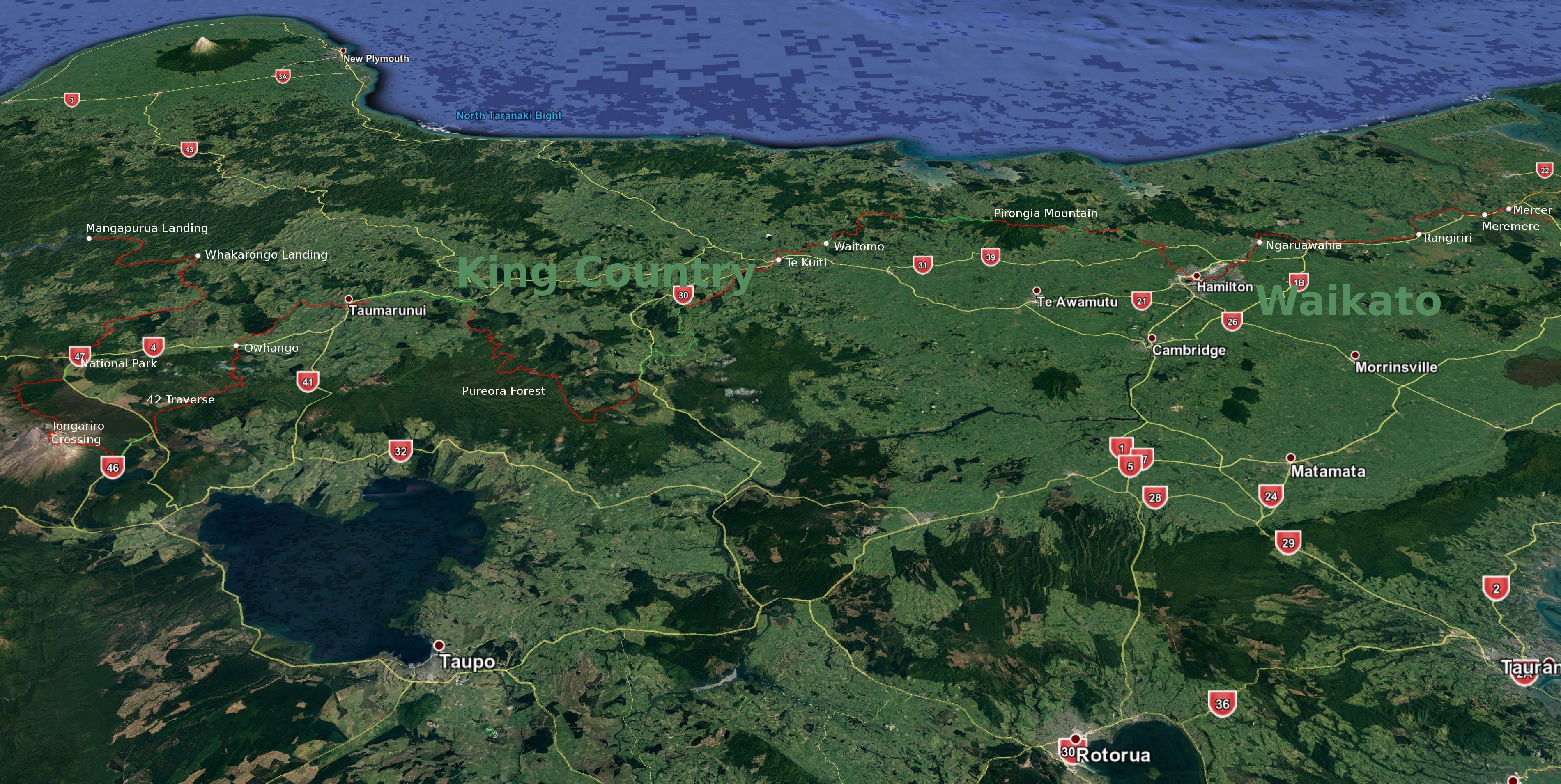
Beginings of the Whanganui River near Te Pōrere Redoubt 
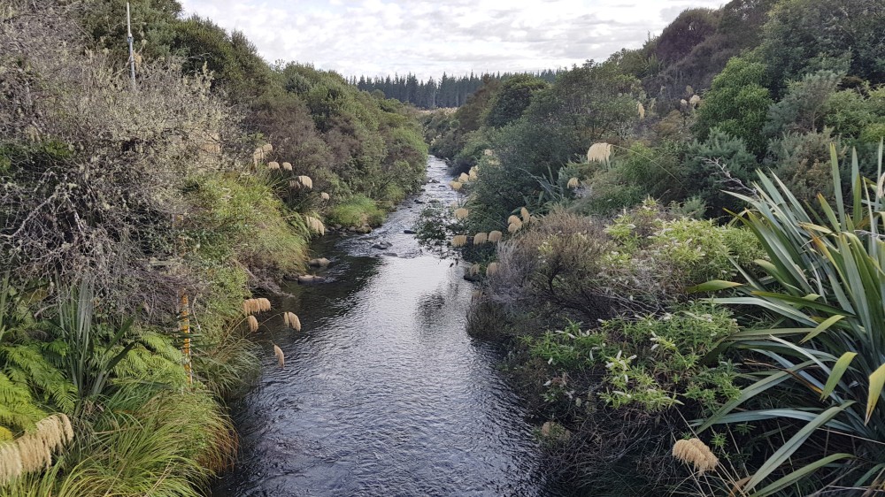
Te Pōrere Redoubt 
State of the Waione Coters track near Hillary Outdoor Pursuits Centre 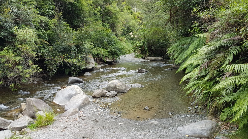
Mangatepopo Stream crossing on Waione Coters track 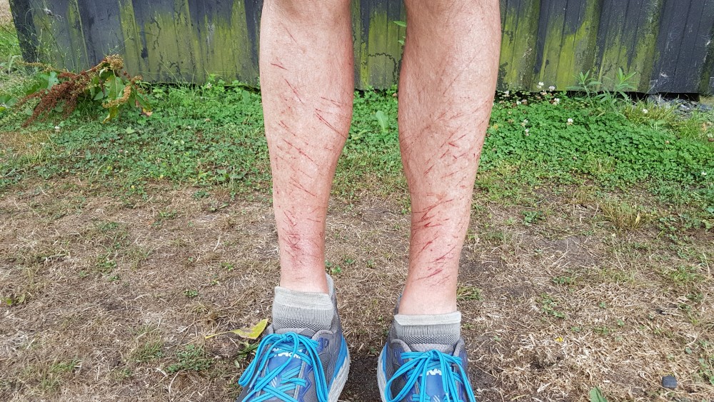
Gorse and blackberry scratches from Tongaririo camp to Ōwhango 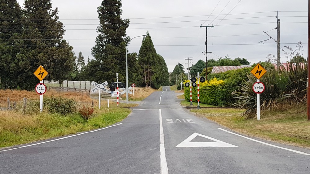
Kawautahi Rd, Ōwhango 
Typical King Country farmland, Hikumutu Rd 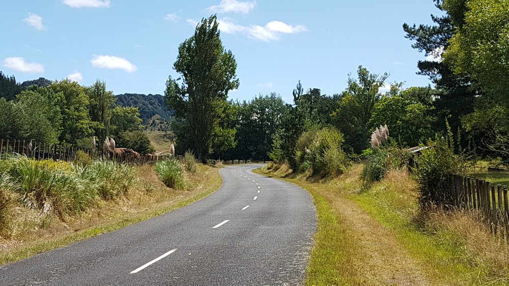
Ongarue Back Rd 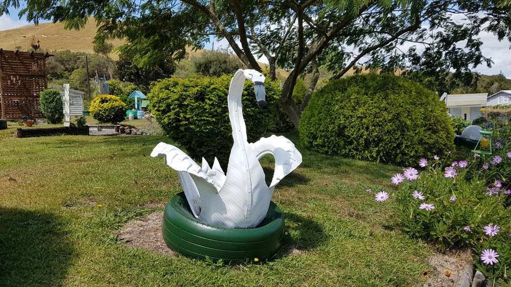
Tyre art, Ongarue Back Rd 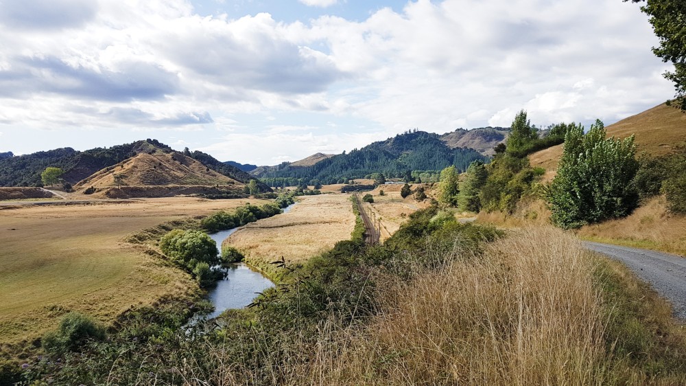
Gravel section of Ongarue Back Rd 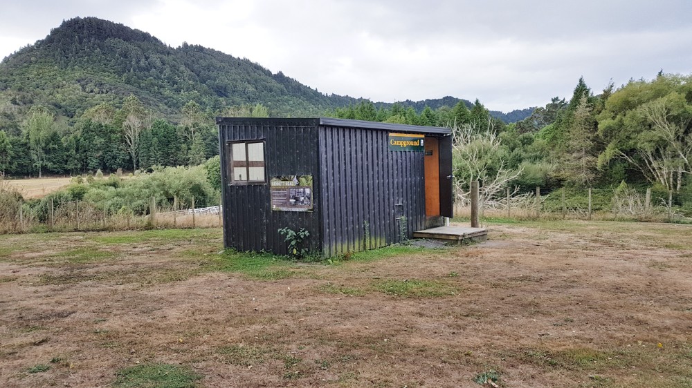
TA shelter at Ongarue campsite 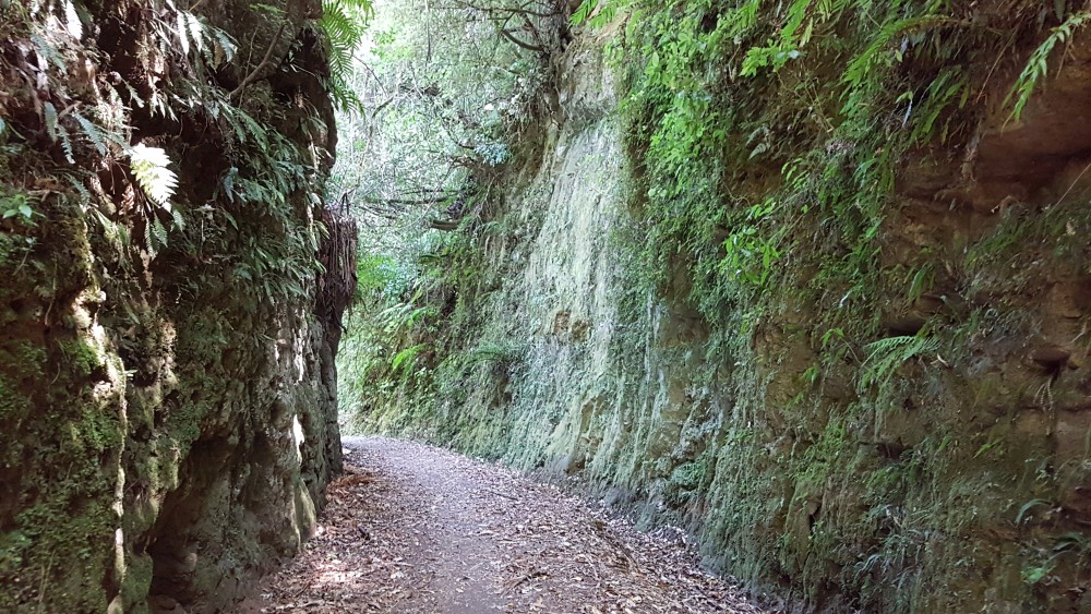
Timber Trail 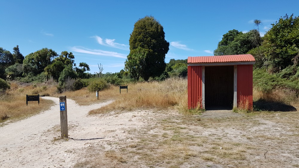
Shelter at Mystery Creek on Timber Trail 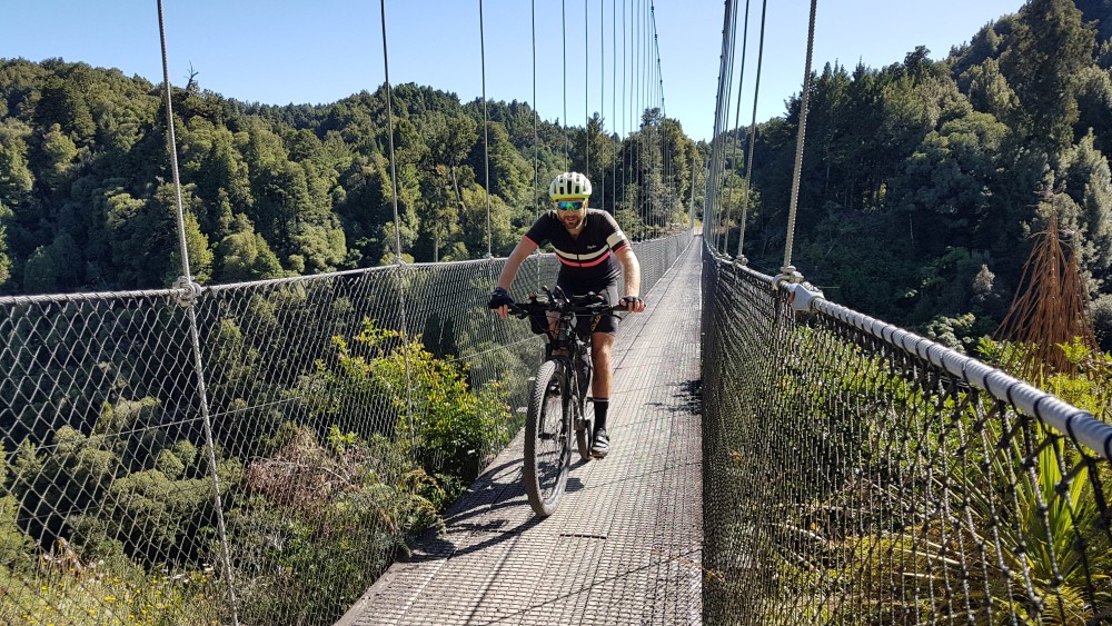
Maramataha suspension bridge on Timber Trail 
Shelter at Piropiro campsite, Timber Trail 
Mangaokewa North Rd shelter 
Track through blackberry, Mangaokewa North Rd shelter to Te Kūiti 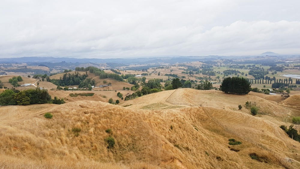
Above Brook Park Reserve, Te Kuiti 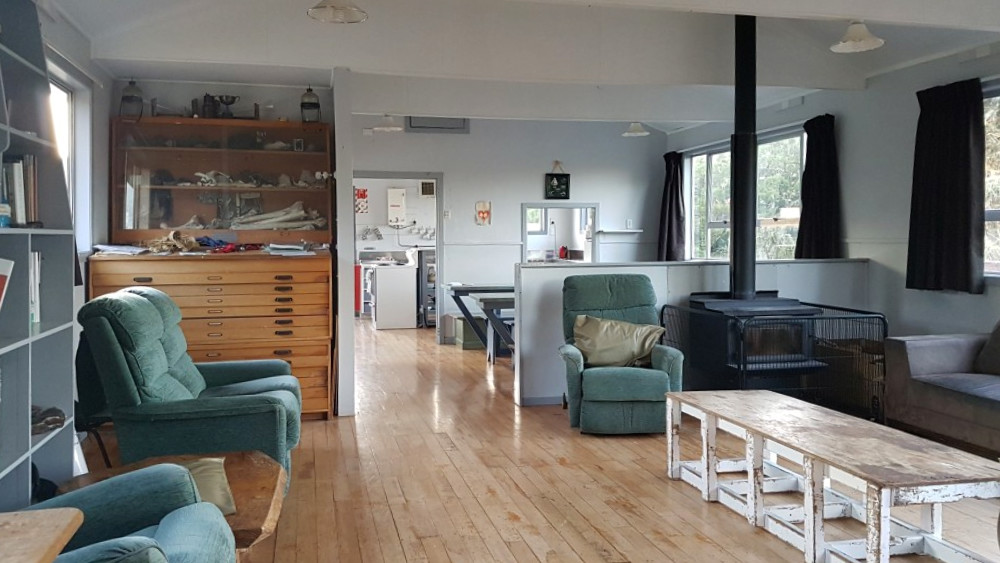
Hamilton Tomo Group hut, Waitomo 
From Pirongia Mountain towards Hamilton 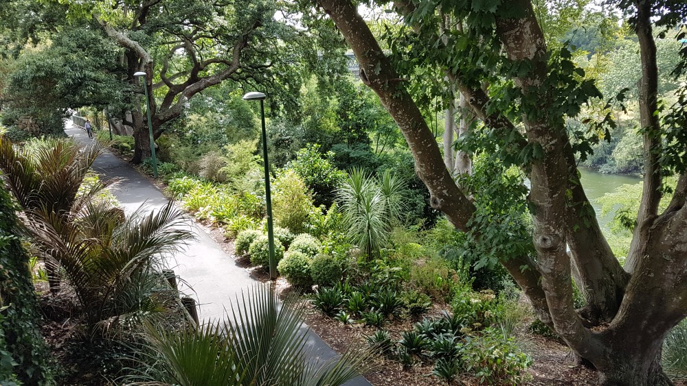
River Walk path, Hamilton 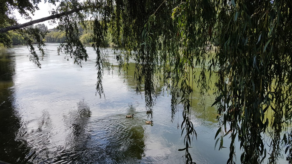
Waikato River, Hamilton 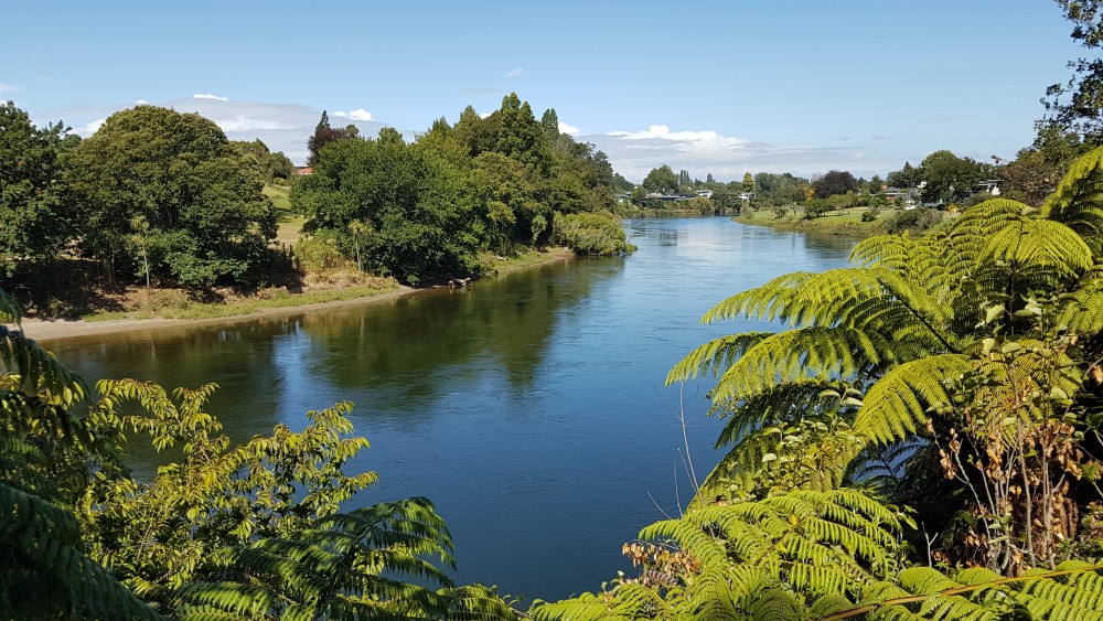
Waikato River, Hamilton 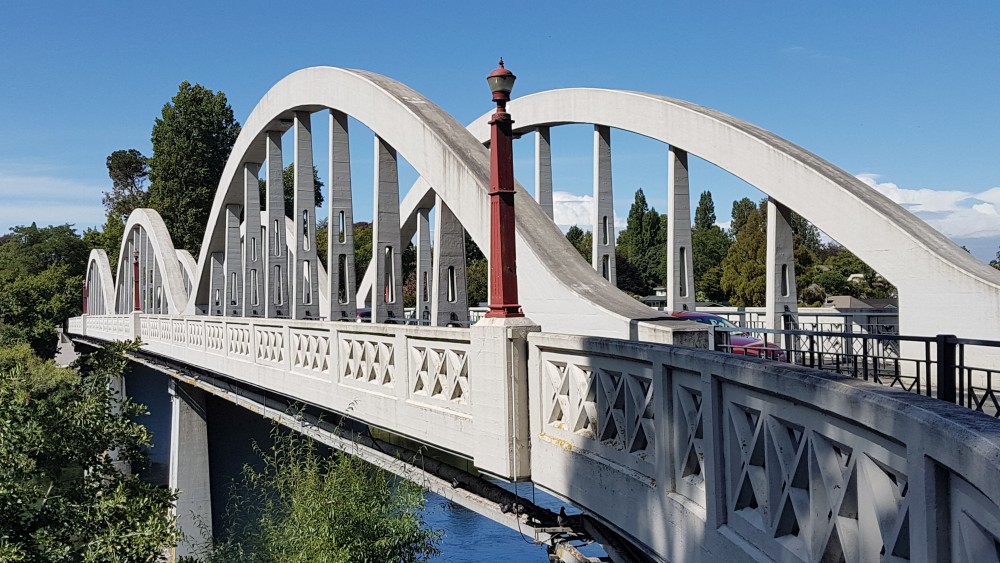
Fairfield Bridge, Hamilton 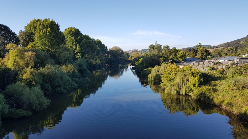
Waipa River, Ngaruawahia 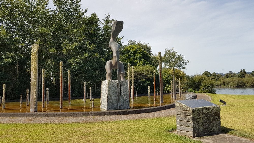
Te Ahurei o Waikato by Lyonel Grant, near Huntly Power Station 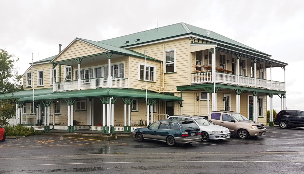
Rangiriri Hotel 
Rangiriri pie 
Best Te Araroa signage in the country – north of Rangiriri 
Stopbank north of Rangiriri by Churchill Rd East 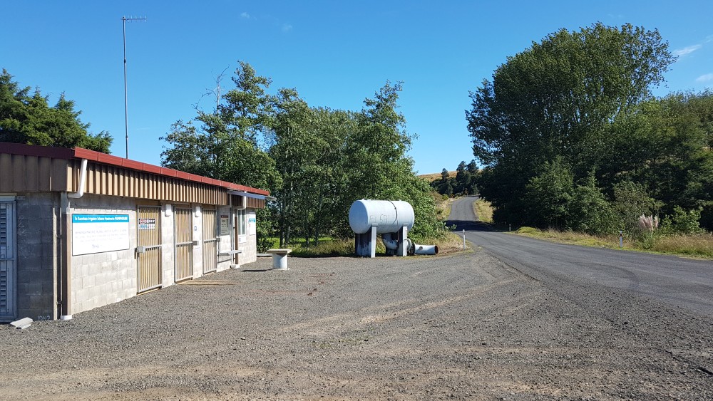
Pumphouse with drinking water on Churchill Rd, north of Rangiriri 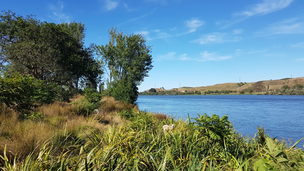
Waikato River, north of Rangiriri 
Trail on river side (right in photo) of farmland north of Rangiriri 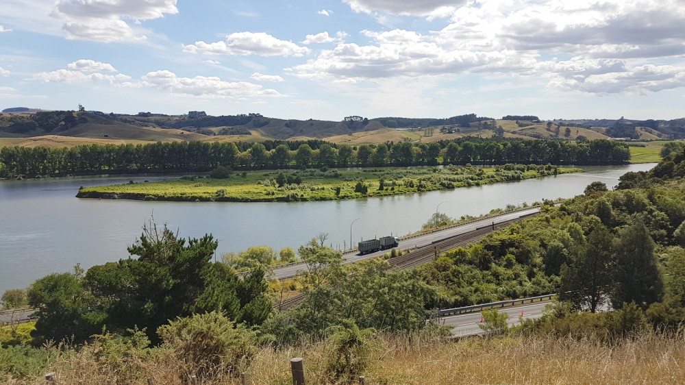
Waikato River and Motutawa Island from Whangamarino Redoubt, south of Mercer
Tongariro to Taumarunui: 66.5 km, 2 days
3D view Tongariro to Te Kūiti
22. Tongariro Family Holiday Park, SH 47 to Ōwhango: 10 hrs 45, 39.5 km (maps 55, 54, 53)
Walk south-west on SH47 about 3.5 km and turn right into Access Rd No. 3. The route formerly took you over to the turn-off to the historic Te Pōrere Redoubt about 1km from the holiday park (and is still marked as the Te Araroa Trail on NZ Topo maps). But the TA Trust decided that this culturally significant military fortification, where 37 defenders were killed in 1869, should be respected (plus people clambering over it causes physical damage). This also has the benefit that you avoid a track horribly overgrown with gorse that goes from the redoubt to Access Rd 3 and was part of the former TA route. (If you are curious to see what the Whanganui River looks like as a mere trickle not far from its origins on Mt Tongariro though, there is a bridge crossing it on the way to the redoubt. You cross it on SH47 as well, but I’m not sure how much you can see at that point).
Access Rd 3 services the Hillary Outdoor Pursuits Centre and you are unlikely to encounter traffic on it. After passing the Centre take the Waione Coters track off at right, and then the branch at left a short distance from the road. It is a 4WD track but extensively overgrown for much of its length, but thankfully not with gorse. TA walkers have written on the DoC sign that it took them 5 hours, not the 2 hrs 45 given by DoC. Yes, this is a rare occasion when DoC have given an underestimate of walking time. For me it was 3 hrs 15 mins.
After 10.5 km the track descends to cross the Mangatepopo Stream before sidling above the now enlarged Whanganui River. The crossing is calf-high at times of low water levels, but finding the track opposite is a little tricky. You cross on a slight diagonal downstream and then follow a small side section of the stream for a short distance before coming to a marker for the track uphill at left. There is a grassy bit here where people have obviously camped.
The track ends by joining up with the 42 Traverse Track (an old logging road) and crossing another (shallower) stream. Again, you will have to get your feet wet as there are no boulders for hopping across. About 20m or so after the crossing there is a camping spot in the bush. The 42 Traverse Track is said to be one of the best mountain bike trails in the North Island, so watch for cyclists (and hunters on quad bikes in the evening). You could even cycle it yourself, as there are operators who will drop you off at the start (at Kapoors Rd?, further south-west on SH47 from the holiday park) and carry your pack to Ōwhango.
About 2 km after joining the 42 Traverse Track there is a signposted detour marked in purple on the TA map at about grid 5681.7N due to a slip but detouring is no longer necessary. Check the Alerts and Trail Status to be sure.
As the track (really a road by now) gets near Ōwhango it passes a large grassy area before a pumice quarry and you could possibly camp here. Then there is the large picnic area at the Whakapapa River bridge that is part of the Ohinetonga Scenic Reserve. Following this you are presented with a long slog uphill to higher ground. The first road branching off is labelled ‘Main road’. It is actually Omaki Rd, not a road called Main Road, and the sign points to the main highway going through Ōwhango.
Ōwhango has no shops, but has an excellent café, the Blue Hill Café (open 8am to 2pm). There are also toilets in the centre of town. If you are not staying in Ōwhango, circumvent it by keeping on the road up from the scenic reserve as it becomes Onga St, then turning right into Omatane Rd at the south end of town to reach SH4.
- Owhango Adventures – aka Ōwhango Hotel. SH 4 at Omatane Rd. Is primarily a canoe hire and outdoor adventure operation but the former hotel building they use has a bar, café and accommodation that is available to people besides their adventure clients: $60/double or $30/person in two bedrooms and tent sites for TA walkers for about $10. 07 895 4854, 0800 222 663, 027 678 6461, info@owhangoadventures.co.nz (Confirmed correct Oct 2022)
23. Owhango to Taumarunui: 7 hrs, 26.5 km (maps 53, 52)
Walk down SH4 a short distance from Ōwhango and turn right into Kawautahi Rd, and then right again into Hikumutu Rd. You then stay on this all the way to the south side of Taumarunui. Traffic is extremely light and there is some shelter with tree plantings along the way. It is an easy and attractive bit of road walking. The road is unsealed except for the last 11 km or so. There is a community hall with toilets and water at Hikumutu, just before Makokomiko Rd, on gridline 5688N. As you approach Taumarunui cross a bridge over the Whanganui and walk alongside the Taumarunui Domain. Turn slightly left into Miriama St, then quickly right into Hikaia St to reach the main street through town. Supermarkets are at the west end of town, and the campground is about 4 km east. There are toilets in the middle of town and in the information centre (also approximately at the centre of town), which has free wifi too.
The only cheap places to stay in Taumarunui are the Taumarunui Holiday Park and Grandad’s Cottage. Both are unfortunately 4 km and 5.2 km (respectively) east of town. You may be able to be picked up if you ask nicely and they are not busy.
- Hikumutu Lodge – 874 Hikumutu Rd, RD 2, Hikumutu, Taumarunui, 3992. 16.5 km from Ōwhango on the TA trail; 10 km south of Taumarunui. Backpacker beds, camping and private rooms. Discounts for registered AT walkers. Kitchen, showers, etc, and will hold bounce boxes. 022 402 4639.
- Taumarunui Holiday Park – 100 State Highway 4, ph 0800 473 281; 07 895 9345. Has basic cabins (from $75 each) and camping sites.
- Grandad’s Cottage – 298 Miro St, 027 600 8998. No website. Shared facilities for 2-room cottages and camping. But is no longer offering short term accommodation. Maybe this will change?
- Forgotten World Motel – Usefully located at west end of main street, opposite New World supermarket. Hakiaha St, Taumarunui, 07 895 7181, freephone 0800 724 52278.
- Ruapehu Unique Stays – Tiny house, 7km south of Taumarunui, on the TA Trail, sleeps 3, plus others 2km off-trail, sleeping 2 or 4. ruapehuuniquestays@gmail.com, 020 438 3909.
- Taumarunui Canoe hire and Jet Boat Journeys – 292 Hikumutu Rd, 3 km from Taumarunui, on the TA Trail. If you want to flip-flop and paddle the Whanganui River from as far up-river as you can go, then these people would be worth contacting.
- Q Variety Store – 95 Hakiaha St. A very large cheap imports shop useful for replacing or repairing some gear, etc. The Kyle Grace Emporium is a smaller version a bit further west.
- Seriously Outdoors – 99 Hakiaha St, an outdoor supplies store, open 9am–5pm weekdays, 9am–1pm Sat. Closed Monday and Sunday.
Taumarunui to Te Kūiti via Pureora Forest: 161.5 km, 6–7 days
The Pureora Forest Park, north-west of Lake Taupō, between Te Kūiti and Taumarunui, was established in 1978 following tree-sitting protests against logging of native trees. It is known for its remaining giant rimu, mataī, miro, tōtara and tawa trees, seen especially at the northern end of the trail, as well as for the rare kōkako bird. The popularity of the Timber Trail means there are a number of operators offering shuttle services out of Taumarunui, Ongarue and other places to the trail ends.
In October 2017 the TA Trust rerouted the track to run along the mountain biker’s Timber Trail, which kind of rendered notes from my walk on the earlier route in 2016 redundant. The new route does mean less mud, an easier trail, and avoids the problem of a poor camping site at the end of a long road walk from Taumarunui (and shortens that road walk). But accommodation along the Timber Trail is only at camping sites (unless you stay at the Timber Trail Lodge or divert to Bogg Inn Hut near the end), you will be encountering a lot of cyclists, and you miss out on some good tramping. Also, with the route now changed there will be fewer TA people in the huts on the old route. So, if you want to do some bush tramping I would still consider the old route. As I have walked the Timber Trail as well I give both options here.
Old Route
Taumarunui to Mangakahu Valley Road end: 8 hrs, 32 km (old maps 47, 46, 45)
At the western end of Taumarunui, just after the McDonalds restaurant and before the bridge over the Ongarue River, turn north into Short St. Then go left into Golf Rd and continue through a round-about on it past the golf course to Taringamotu Rd. Turn right into this and left at its intersection with Simmons Rd to stay on the road as it soon passes through the small settlement of Taringamotu. At 10.5 km from Taumarunui turn left into Ngakonui-Ongarue Rd at the small settlement of Ngakonui, and right at its intersection with Piaua Rd 500m further on to remain on the same road. Then left at a further 2 km to stick with Ngakonui-Ongarue Rd at its intersection with Roberts Rd. Turn off to the right at the next intersection to get onto Mangakahu Rd. Towards the end it becomes a private farm road and you pass through several gates to reach the point where the road nominally ends and there is a signpost to the tramping track. The road end is more or less at a largish open area that could be camped upon, but the ground looks hard and there are no facilities.
Mangakahu Valley Road end to Hauhungaroa Hut (6 bunks): 3.5 hrs, 6 km (click and download old map 45)
A 4WD track continues on from the road end. It enters the Mangakahu Stream and goes up the stream bed a short distance before exiting to the right, but you can avoid getting wet feet by branching off at left before the 4WD track goes down to the water and then rejoining the track just after it exits the stream. It is a long climb up to Motere peak, through often muddy stretches. After sidling round the peak, the track continues along the ridge, with sections of up and down. The turn-off to the hut at left is well signposted.
- Hauhungaroa Hut – Standard 6-bunk DoC hut. This has been recently built and has double glazing and fly screens as well as a great view and sunny orientation. It is a nice place to stay.
Hauhungaroa Hut to Waihaha Hut (10 bunks): 7 hrs, 11.5 km (old maps 45, 44)
The route continues along the Hauhungaroa Range ridgeline, with alternating sections of level walking and up and down for 6.5 km, before steeply descending to follow a mostly flat route along the banks of the Waihaha River for another 6 km to the hut. There are two grassy areas very suitable for camping not far north of the descent off the Hauhungaroa Range. The first is about 500m from the bottom, on the 5711 horizontal gridline. The second, larger, and probably better, is 150m or so further north. There is also a pleasant flat section of river terrace in the bush amongst large trees about 1 km south of the Waihaha Hut that could also be used for camping.
- Waihaha Hut – Standard 10-bunk DoC hut. This is situated in a very large grassy clearing. In the weekend you may find you are sharing the hut with overnight trampers who have come in on the 3 hr Waihaha Track to the east.
Waihaha Hut to Bog Inn Hut (4 bunks): 8.5 hrs, 17 km (old map 44, current map 48)
The track meets the Mangatu Stream 1 hr 15 mins after leaving the hut. A large fallen log across the stream provides a reasonably safe way across it to avoid wet feet. There is a flat area near the stream that would be a nice spot to camp. This is just before you attempt a strenuous, near-vertical climb by using tree trunks and roots as hand holds up onto a ridge.
After about 4 km on the ridge the track descends to the left at an intersection. A point of interest when you get down on the flat is a swampy pond just off to the right of the track. About ten minutes further on is a small area in the bush with a circle of stones for a fireplace that would be suitable for camping. A 300m steep ascent takes the track to Weraroa peak and another ridge of about 5.5 km, and then it is downhill to Bog Inn Hut.
- Bog Inn Hut – Standard, 4-bunk DoC hut. This is a rustic affair, made from chainsawn and axe-split timbers in 1960 to house scientists studying the nearby bog. There is space in the forest beyond it for several tents.
Bog Inn Hut to Pureora: 5 hrs, 16.5 km (current map 48)
Leave Bog Inn on the track you arrived but watch for the intersection by a large tree for the track going uphill. It is not marked and you could easily find yourself on the way to Waihaha Hut again. The track then joins with the Timber Trail after 1 km. Eventually the track departs at right to steeply climb a muddy stretch to Mt Pureora (1165m). The top is bare, and offers 360-degree views taking in Lake Taupō to the south-east. (The lake is a collapsed volcano whose most recent eruption around 233 CE was the biggest the world has seen over the last 5,000 years).
After another section of sometimes muddy track the trail rejoins the Timber Trail on the other side and winds its way down through previously logged country before entering the final, flatter stretch of 3 km through a forest of huge, ancient trees. There is an interesting 5-minute diversion to view an historic caterpillar tractor used to bring split logs for fence posts out of the bush in the 1930s and 40s.
The track ends at the Ngaherenga picnic area with toilets and barbecues. You can camp a few hundred metres east at the DoC Ngaherenga Campsite for a small fee (pre-booking now required). See below under #27 for more on Pureora accommodation.
New Route
24. Taumarunui to Ongarue Campsite (Bennett Rd): 6 hrs, 25.5 km (maps 52, 51)
At the western end of Taumarunui, just after the McDonalds restaurant and before the bridge over the Ongarue River, turn north into Short St. Then go left into Golf Rd and continue through a round-about on it past the golf course. Continue past the high school and cemetery and the Taringamotu Rd turn-off on what becomes the Ongarue Back Rd and which follows the railway line along the Ongarue Stream. It has almost zero traffic. Stay right at two railway and road bridges across the river after 8 km when the road becomes unsealed (just follow the blue Mountains to Sea cycle signs). Stay right also after a further 13.5 km when the road branches over a bridge to the small settlement of Ongarue. At the Bennett Rd car park that marks the southern end of the Timber Trail there is a campsite specially constructed for TA walkers.
- Ongarue Campsite – Bennett Rd at 2235/2741 Ngakonui Ongarue Road (Bennett Rd is a short branch off Ngakonui Ongarue Rd, and just to be confusing there is another Bennett Rd in Ongarue nearby.) Camping with fully enclosed shelter (a hut really, but no bunks, though people do sleep on the floor), toilets and water. I believe that it is free.
25. The Timber Trail – Ongarue Campsite to Mystery Creek: 7 hrs 15, 28 km (maps 51, 50)
The trail is 80 km long from Bennett Rd car park to Pureora (or 84 km from Ongarue to Pureora) and you can tackle it in anything between two and four days. Three days is ideal, but you miss out staying at the middle, Piropiro, where there is an extensive and pleasant free campsite, as well as the nearby somewhat upmarket Timber Trail Lodge (where you can have a beer and a meal), and Camp Epic, also in the vicinity, which offers showers, flush toilets and cooking facilities. There are toilets and tiny shelters along the route and generally you can camp by these. They are unfortunately not marked on the TA or NZ Topo map, nor generally signposted with their name, though the shelters are obvious when you come to them and some are marked on the maps in the DoC Timber Trail brochure. They are: Brunton’s Camp (at 8 km from Bennett Rd campsite), No. 10 Camp (17 km), Mystery Creek (28 km), Piropiro (42 km), Harrison’s Creek (54 km) and, not a shelter but an historic tramping hut, Bogg Inn (off trail a little, 64 km).
The Timber Trail is a mostly well-graded, wide track, frequented by cyclists (invariably going north to south), and usefully marked every km (from north to south). Keep your ears open to avoid being bowled by a cyclist coming down a steep track on a blind corner. The trail is based on a bush railway for the first 35 km, so fairly gentle in its inclines, but there are steeper up and downs after this point. The first section is a bit of an uphill slog nevertheless, taking you to the Ongarue Spiral and a little beyond that, Brunton’s Camp. Given that the walk from Taumarunui to Bennett Rd is not too long you could always keep going the extra two hours to Brunton’s in the same day, and thus make Piropiro the day following, but then you have two short days to get to Pureora and there is not really anywhere to stay after Pureora for a long distance. Brunton’s is not a particularly wonderful spot and has no water, but you can get water before at the stream at Ongarue Spiral. It has a shelter, and like all the shelters features two benches within, but these are narrow and about 1.75m long, so not good for sleeping on if you are large. At Mystery Creek (which is at about grid ref 1812.6E; 5717.5N) there is stream water at the bridge just after the campsite.
26. The Timber Trail: Mystery Creek to Harrison’s Creek: 7 hrs, 26 km (maps 49, 48)
A notable point along this section is the 141m long Maramataha suspension bridge, an engineering marvel of our time. The other is Piropiro. Here you first pass Camp Epic. If you wish to stay you need to book in advance: you can pitch your own tent or glamp it and stay in theirs (022 023 7958 paul@epiccycleadventures.com). Then there is Piropiro campsite, a little way off trail to the left, with a large expanse of grass, several large shelters (but earth floors and no benches, so not so good for sleeping in), toilets, a water tap and three apple trees. And finally, up the hill from the trail, the Timber Trail Lodge. You can get a cup of tea if you make it yourself from the large selection of leaf teas for just $2, or buy a cold drink. There are evening meals but you can’t automatically expect to dine if you are not staying, since the lodge is geared towards package tours that include meals, cycles, and shuttle. You can stay without being on a package, but rates are very substantial (cheapest option $430 for 2 people, or $345 for one), though include meals (0800 885 6343, stay@timbertraillodge.co.nz). (Confirmed correct Oct 2024)
About 45 minutes after Piropiro there is a lovely spot by a very accessible stream with sheltered places you could camp, though unfortunately there is no toilet or shelter. Harrison’s Creek (at about grid ref 1824.2E; 5724.8N) isn’t bad though, and better than Mystery Creek. It is marked with the tiny word ‘shelter’ on the TA/NZ Topo map. It has easier access to its creek, enabling you to have a wash if you wish.
27. The Timber Trail: Harrison’s Creek to Pureora: 6.5 hrs, 25.5 km (map 48)
You pass the turn-off to the rustic Bog Inn (4 bunks, but room for several tents in the hut surrounds and not boggy!) after about 2 hrs. It is an historic hut with its own rough-hewn charm set in the bush about 800m off-trail. You will need a DoC hut ticket, Backcountry Hut Pass or TA Trail Pass to stay here. At the 15 km mark after Bog Inn new toilets are currently being planned. Then it is a slog uphill to the highest point on the Timber Trail. If you want to climb some more there is a 1. 5 hr diversion to the top of Mt Pureora for views of Lake Taupō, Mt Ruapehu and the Kaimanawa Ranges. The track is fairly rough but is being improved in 2024/25 summer. Down from the highest point on the trail itself you come into open country at around the 8 km mark, where there is a shelter and toilets (but not really room for camping, and the first water source on this section of the trail is at the twin bridges a little further downhill.) The trail ends with a few km of wonderful, mature bush (the bit that they didn’t log). You emerge at a picnic area. About 500m or so to the right is the Ngaherenga Campsite. There is nothing much else at Pureora – no shops or petrol station. And the DoC field station is not a visitor centre.
- DoC Ngaherenga Campsite – Pureora. Tent sites $10 as at Sept 2025, or covered by the TA TRail Pass, but pre-booking required. The campsite has sheltered spots, a toilet and a water tap.
- Pureora Cabins – A few hundred metres further on from the campsite, in Pureora ‘village’. The cabins are mostly multi-bed and apparently intended for groups but the website does say you can get a bunk in a shared room for $40 (and a tent site for $10). Note that there is no-one on-site, so you need to organise this in advance and that cellphone reception is only available on the Spark network in Pureora. 021 064 3178, pureoracabins@gmail.com (Confirmed correct Oct 2022)
To Te Kūiti and points north
28. Pureora to Mangaokewa North Rd shelter: 9 hrs, 36.5 km (maps 48, 47, 46, 45)
You begin 36.5 km of back-country road walking by heading west along the road from Pureora on Maraeroa Rd and after 3.5 km turning left into the fairly busy SH30. After 7.5 km turn right into the unsealed Mangaokewa Rd (with very little traffic). Keep left at all the turn-offs, including Allen Rd at the right after 9 km, and Waipā Rd after another 3 km. The road turns south for 2 km at Waipā Rd. It then turns west for 8.5 km before going steeply uphill on a sealed section. Mangaokewa North Rd branches off at right as the road turns on the hill. Turn right into this road. After about 3.5 km this becomes the Mangaokewa River Trail at a gate. About 200m before this at right is a campsite set up specifically for TA walkers by some wonderfully good-hearted farmers Sam and Laura.
There really isn’t anywhere to camp from Pureora to this point, and no water. If you don’t want to walk all the way, the only accommodation option might be found by hitching on SH30 from the Mangaokewa Rd turn-off to Bennydale, 8 to 10 km off-trail:
- Mangaokewa North shelter campsite – Between map gridlines 5743 and 5744N. There is a brightly painted shelter with running water in a sink, a clothesline, a toilet and a picnic table. The shelter has a dusty dirt floor, so you can’t sleep in it (unless you sleep on the picnic table in the shelter). There is an honesty box for the $5 fee (bring cash). I’d suggest giving more than a paltry $5 for this private initiative.
29. Mangaokewa North Rd shelter to Te Kūiti: 6.5 hrs, 19.5 km (maps 45, 44)
This section can be closed for lambing from July to the end of October, so check under Alerts and Trail Status on the official TA site at this time of year.
The distance from the shelter to Te Kūiti looks short on paper, but it is a slow and notoriously difficult track and the whole section between Pureora and Te Kūiti could be worth giving a miss. At least that was the situation when I walked the section in 2021. A hiker in 2025 says that there has been a large amount of work done in clearing the track and implies that it was pretty straight forward for her (and traversed quicker than my 6.5 hours.) So long as it is regularly maintained then you can probably ignore of my comments about its difficulties.
You begin by passing through farmland then a pine and eucalyptus forest. The track is overgrown with blackberry, but it is not too bad compared with what is to come. Then you follow a rough and poorly marked track along a stream. After a little over an hour the orange markers change to yellow and lead uphill to a farm track where the going is easier. Soon you are back down near the stream again though and in blackberry alley leading up to the area where you pass beneath overhead transmission lines 6.5km from the shelter. You mightn’t think there is a track through here, but the GPS will say otherwise. PVC pants and parka would be the ideal gear to get through here without your clothes torn and body scratched. Maybe somebody could buy a dozen sets and leave them in Te Kūiti for Sobos to drop them off at the shelter and Nobos to return them? Or make arm and leg protectors out of heavy fabric for similar use. Apparently the track is regularly cleared, but stuff grows back fast. Your difficulties are compounded by poor marking of the track throughout and many parts up steep, crumbling hillsides damaged by cattle. I wouldn’t want to do it when the ground is boggy.
You come out onto farmland after the transmission lines but there are still a few difficulties to follow. You can cross a farm bridge a bit further along and then re-cross the stream on a log to save a bit of hillside scrambling and blackberry. Don’t camp in the following section, particularly from grid 5748.7 to 5760.6N, as pest control with firearms at night is sometimes undertaken. After about 40 minutes the track goes uphill and meets a 4WD track going steeply up. Before the track becomes thoroughly overgrown with gorse there is a large, inverted orange triangle (oriented sideways for SoBos) that marks a difficult-to-see track off at the side going steeply downhill through bush. You now come to a lovely spot amongst a grove of redwood trees beside the stream. A while later you encounter a swing bridge. As of Sept 2024, the landowners are allowing camping by the bridge.
You can cross the swing bridge or stay on the same side, as the two tracks either side of the stream pass through the Mangaokewa Reserve and meet up at the Waiteti Viaduct car park by virtue of another bridge there. But apparently the true left bank track (the western side) is better maintained through to the reserve, so just stay with the bank you are on and cross a bridge at the reserve.
The track continues going up and down alongside the stream and seems to peter out when the bush opens up. Head uphill to find a farm track running about 20m above the stream if you have lost the track. The track comes out at a bridge back over the stream. There is a high, locked gate on the other side, but a stile before the gate shows the way along a path that skirts the lime works, a timber processing plant and a gravel depot before coming out on Waitete Rd (SH30). Turn right to head 1.5 km into town. There are public toilets as you enter Te Kūiti, plus some in the centre of the main street and more at the north-western end.
- Camping by swing bridge and picnic table on Mangaokewa River Track – see above.
- Campgrounds – There don’t appear to be any in Te Kuiti. The Te Kuiti Holiday Park and the KiwiCamp are the same place and are simply a gravel lot for campervans by Brook Park. Calling a parking lot a ‘Holiday Park’ is an extreme case of marketing vs reality.
- Sue Sands – Sue is a treasure and well informed about the trail. She is no longer offering accommodation but can help with gear repairs, receiving mail, etc. Text 021 104 9707. (Confirmed correct Oct 2024)
- Te Kuiti Camp & Cabin – aka Garnett and Brandon Family Camp and Cabin. Behind family home, 10 mins walk from town centre. Cabin has shower and toilet, $50 per person cash; bunk bed $30, camping has outdoor hot shower and Portaloo $25/pp. Outdoor kitchen area for both. Text Simone at 021 036 5114. (Confirmed correct Oct 2024)
- Steve Joyce – Trail angel in Te Kuiti with beds, tent sites, showers, washing, internet, meals. $20. 027 435 8087. (Confirmed correct, Oct 2025)
- There are several motels and a New World supermarket in town but few eating options besides a string of takeaways and the upmarket eatery in the old railway station. The sizeable New World is probably your best option for food. There is a Supervalue supermarket further north-west on the main road as well.
- Te Kūiti i-Site Visitor Information Centre – Rora St, Te Kūiti, 07 878 8077.
- DOC Maniapoto Area Office – 78 Taupiri Street, Te Kūiti, 07 878 1050.
Te Kūiti to Hamilton via Pirongia Mountain: 123 km, 4–5 days
There are no supermarkets between Te Kūiti and Hamilton and the only resupply options are the village store in Waitomo and a petrol station at Whatawhata (which is less than a day away from Hamilton). There are cafés and eateries at Waitomo and Whatawhata. You could hitch-hike off-trail just before Pirongia Mountain to Otorohanga to the south or the larger town of Te Awamutu to the east for food, but this seems more trouble than it is worth.
3D view Te Kūiti to Hamilton
30. Te Kūiti to Waitomo: 6.5 hrs, 17.5 km (maps 44, 43)
This is another slow track that is poorly marked at times, so it helps to have your GPS on. You leave town and head into the Brook Park Reserve which has noted tree collections including black walnuts, Pinus radiata tree crops, rhododendrons, and native trees such as kauri and rimu. There is a flash-looking café (Boscoe Café) by the entrance. (A path along the Mangakokewa Stream runs through town and exits by the café, so this is an alternative method of reaching here.) As with so many public parks, there is a maze of paths here. I don’t know if TA signs have been put on them yet, but I got completely confused. Basically, head uphill and skirt around Pehitawa Mast Hill. The park is a pleasant enough place, but if you want to save time get out your mapping app and use GPS.
The track then meanders over sometimes steep farmland, generally going downhill and curving around to head north but rarely in a straight line for long. The marking points are mostly stiles. Sometimes they have simply a white post, other times orange triangles. Check the angle the orange triangle on your side points as the next stile may not be in the same direction you’ve just been walking. The farmland may be closed for lambing from 1 July to September each year. (During lambing you can go round the farmland by leaving town on Sommerville Rd, then going left on Te Kumi Station Rd over to the main highway, walking up that a short distance, and turning left into Oparure Rd. But check the Alerts and Trail Status page on the official TA website.)
You end up on a road and a short distance north-east on this near the top of a hill the track continues off at left at a stile. From the fence follow markers down a ridge line to Pehitawa Forest (Queen Elizabeth II Trust-covenanted land with a fine remnant stand of kahikatea trees). The trail then crosses a suspension bridge over the Mangapu River followed by a stile at the right and a farm bridge over a stream. You then scramble up the following steep hillside between an area of felled pine plantation on the left and regenerating bush on the right. This is tricky, as markers give out a little way up, so head up to the top fence corner around the bush, then turn left along a fence line above the area of pine plantation to reach a stile. Follow the fence line along regenerating bush to a spot where a gate was formerly installed. Head downhill through gorse and mānuka on the Pehitawa Track, including a section once known to TA walkers as the ‘Te Kūiti tunnel of gorse’. It is clearer these days but the gorse is working towards a comeback. This track can be slippery when wet. You exit at a small gate onto farmland.
Over the farmland you again enter a potentially muddy bush section up a steep hill. Down on the other side you emerge onto farmland through another small gate. Around here are some enormous boulders thought to have been thrown out by a volcanic eruption 60 km away. Across this farmland and up a hill yet again and you end at the tar-sealed Fullerton Rd. Cross this to take a track to Hotel Access Rd and Waitomo Village. Go right on this down to the main road and left to the general store. There are cafés and restaurants in Waitomo, plus a motor camp, a visitor centre, and the famous Waitomo Glowworm Caves. The caves are expensive but worth a visit (07 878 8227; 0800 456 922 freephone). You can also do black water rafting.
- Juno Hall, Waitomo – YHA, 600 Waitomo Caves Road, 1 km east of the village, 07 878 7649.
- Waitomo Village Chalets (aka Kiwi Paka) – Hotel Access Rd, offers a variety of levels of accommodation, including a backpacker lodge. 20% discount and half-priced Continental breakfast for TA walkers. 07 878 3395, 022 621 5143.
- Waitomo Top 10 Holiday Park – 12 Te Anga Rd, close to the village, 0508 498 666 (freephone); 07 878 7639.
- Waitomo Homestead Cabins – 584 Main South Road, about 800m north of Waitomo village. Twin cabins from $120/night. 07 873 7397.
- Waitomo Caves Hotel – School Access Rd, but this has been closed for some years and remains so (Sept 2023). If you are interested in the paranormal, or conversely would like to avoid such things, then you should know that the hotel has a reputation for being haunted. Could be worth checking out.
- Hamilton Tomo Group – 155 Te Anga Rd, 1.5km north-west of Waitomo Village. This is a friendly caving club hut with plenty of bunk rooms and space to camp. Hot showers, drying room for wet gear, well-equipped kitchen and large communal sitting room with wood burner and large deck. $25pp/night for bunk bed or camping – both include shower/kitchen. Book in advance on the website and you will receive instructions on how to get into the hut. Remember that this is volunteer run, so don’t expect an instant reply. Club caving trips are held 1st Saturday of each month. Email ahead if you’d like to join one. Some equipment can be hired.
- Waitomo Village Store – 10 Waitomo Caves Rd, open 7 days, 7am to 7pm. The groceries are not really enough for resupplying but you can have a drink and something to eat here. Click here and here to see photos of what was on the shelves in 2020.
31. Waitomo to Pirongia Forest Park (#1): 10 hrs, 33 km (maps 43, 42)
The section from Waitomo through to the top of Mt Pirongia is problematic in that there isn’t really any accommodation aside from two trail angels with tent sites at 32 km and 34 km of tough walking from Waitomo, so you will definitely need a tent, and you may need to find a spot to camp yourself. Route finding on parts is tricky too, so I would advise using a GPS mapping app on your phone and remembering to charge it up in Waitomo.
Head north-west out of Waitomo Village on Te Anga Rd (SH 37), passing the entrance to Waitomo Caves and going through the roundabout and past the Hamilton Tomo Group premises. Turn right onto Ngatapuwae Rd. This then becomes an old logging track, the Waitomo Forest Access Track, through scrub and regenerating bush.
Waitomo Forest Access Track to Māhoe Rd: 5 hrs 45, 15 km
This includes some easy and some steep sections of tramping track, 4WD track, and farmland. Don’t underestimate how long the 15 km might take. Also, please respect track closure during lambing: 1 August to 1 October each year. Leave gates open or closed as you find them and give way to farming operations. NO camping or fires on private land.
After about 20 mins the track branches to the right, but if you miss this just take the next right and the track joins up again. In fact, there are various splits but just try and follow the orange markers or use your GPS to stay on the right one. There is a crossing of the Moakurarua Stream after about 2hrs 15 mins (8.5 km). This should be less than knee-deep in normal flows but can rise higher after rain, when you should wait for the waters to recede. A bit further on you come to a grassy patch at the bottom of a downhill stretch. The track seems to lead off to the left and across the small Kopua Stream but do not go this way. Go straight ahead and you will find a track behind some obscuring bushes. This follows the stream for a while and then turns right into a stiff climb uphill.
On exiting mature forest you walk 1.5 km along a fence line through cut scrub, then over two stiles and 700m along a graded track that climbs very steeply. Pay close attention as you near the top. A tree above the track has a large orange marker indicating a short, narrow track uphill off to the right through trees. If you have your head down as you plod uphill you will never see it. This track takes you onto open country and the loading area of a grass airstrip, which you need to cross. In the unlikely event of it being in use, attract the attention of the site manager and wait for their OK to cross, as this is a high-risk area. Then don’t go through the gate on the other side but downhill at left along a fence line that goes straight up and down over hills for about 1 km to the stile to Māhoe Rd. Another danger in this area is pest control with firearms at night: from grid ref 5768.5N (that’s 2 km before the airstrip) to 5773.2 N, 8km further north on the Māhoe Track before you get to Gayne Rd. So not a good idea to camp along here.
Māhoe Rd to Pirongia Forest Park (#1): 2 hrs 45, 9 km
Head north (right) on the gravel Māhoe Road 500m past a disused quarry and woolshed near the north end of the road where a DOC sign reads “Ōmarama Scenic Reserve”. The trail now follows old timber trails over farmland and through bush. There are orange markers but not many, and the trail branches at several points. It is reminiscent of the Timber Trail between Ongarue and Pureora in parts, but is often extremely overgrown, broken up and very muddy, even in dry weather – though some improvements may have been undertaken since I walked through here. There is water at two places and it would be best to top up here as there is none all the way through to Pirongia Mountain except at trail angel Jo’s on Kaimango Rd and presumably the Putaki Campsite (see below).
Pirongia Forest Park #1 traverse: 1 hr, 5 km
As the track nears its end it divides. The more obvious branch at left takes you to Kaimango Rd, while the TA route used to go right to Honikiwi Rd on an overgrown track. Ignore that track and take the left branch, and turn right onto Kaimango and keep going north on it. This goes through the DoC-administered Pirongia Forest Park. I am calling this park Pirongia Forest Park #1, as there are confusingly two Pirongia Forest Parks, the isolated patch we come to now, and the park that covers Pirongia Mountain later. Kaimango Rd goes right through the forest, with generally steep sides of bush above at left and below at right.
You might be wondering where to camp along this section by now. One option is on the previous bit of the former timber trail. Or through the forest park just before the highest point there is a 4WD track off at left that could be used. In general, it is hard to get into the bush from the road and the ground would not be level, though it does begin to flatten out at right near the end. Note that there is no water through here. The other option is the two trail angels:
- Casey’s place – 238 Kaimango Rd, which is about grid line 5781N, just after the end of the forest park. Even if you don’t stay, she does offer water. 027 213 0043. You can find her on the Trail Angels Facebook page (posted Aug 2024).
- Putaki Campsite – Mahoe Rd. This is what the TA notes say, and add that is at km 856. But this km point on the 2025/26 map would be on Kaimango Rd, just before the intersection with Kawhia Rd, at about grid ref 5772.4N. I suspect they used the 2024/25 map, where this km point would indeed be on Mahoe Rd, at about grid ref 5782N. Help me someone! This is why I use grid refs rather than km points, as the latter change every year. Best to check the TA Trail app, when it gets updated for 2025/26. Anyway, campsite with shelter and toilet, usefully provided by Te Araroa Waikato Trust with support from NZ Carbon Farming.
- Jo’s Funny Farm – 60 Kaimango Rd. Jo has been operating as a trail angel for a long time here. There is a sign on her gate. Camping and indoor accommodation, shower and meals (vegetarian available). The spot is just before Kaimango Rd meets Kāwhia Rd (see below) at a place marked as Te Rauamoa on the map, 34 km from Waitomo. Text Jo at 022 013 5713 or ph 07 871 0601. (Confirmed Oct 2024)
32. Pirongia Forest Park #1 to Pāhautea Hut (20 bunks): 6 hrs, 18 km (maps 42, 41)
End of Pirongia Forest Park #1 to start of Hihikiwi track (Omanawa Stream): 3 hrs, 12.5 km
Continue on Kaimango Rd. It has almost no traffic but this changes when you get to the sealed Kāwhia Rd (SH 31) at Te Rauamoa. Turn left into it and walk for 2.7 km until you come to the unsealed Te Rauamoa Rd on the right as the main road turns west. Continue on Te Rauamoa Rd for 5.5 km to an intersection with Pekanui Rd on the right and Okupata Rd on the left. Go through the intersection in the same direction north on Pirongia West Rd for 2 km to the Omanawa Stream.
If you want to go off-trail to resupply you could hitch east then south on Kāwhia Rd (SH31) to Otorohanga, which has a Woolworths supermarket. The larger town of Te Awamutu is due east but once you have to depart from Kāwhia Rd there is no direct route to the centre. Another option, not so much for resupply, though it does have a general store, is to head west on the Kāwhia Rd to Kāwhia itself, a pleasant sea-side settlement.
Omanawa Stream to Pāhautea Hut: 3 hrs, 5.5 km
Climb a fairly steep spur up the Hihikiwi Track to Hihikiwi peak (905 m). It is fairly tough going, with many roots to clamber over and muddy patches to circumvent. The Pirongia Traverse is notoriously muddy, so be prepared for deep mud after rain or in winter. The final section is over long stretches of boardwalk to Pāhautea Hut.
You could always push on past Pāhautea Hut to the pleasant Kaniwhaniwha campsite on the other side of the mountain and stay there. Then you could make Hamilton in a single longish (38.5 km) but manageable day and skip staying at Whatawhata.
- Pāhautea Hut – Standard 20-bunk DoC hut with bunks in two rooms. The hut is new and the whole development is quite fancy, with a cooking shelter for campers, a special boot cleaning station, three toilets, including one functioning as a male urinal, and the old hut that is reserved for DoC staff but which might be open if the main hut is crowded. The tent sites are all on specially prepared pads in the bush off a boardwalk and are free but still need to be booked, as does the hut. Note that fires are not permitted. You can use the DoC Backcountry Hut Pass or TA Trail Pass to stay in the hut, but you still have to book.
33. Pāhautea Hut to Whatawhata: 9 hrs 15, 32 km (maps 41, 40)
Pāhautea Hut to Kaniwhaniwha campsite: 3 hrs 15, 8.5 km
Head east from the hut to Pirongia Mountain peak (959m) and take the track that is signposted as the Tirohanga Track. Then split off it at left after a short distance onto the Tahuanui Track that follows a ridge downhill to the Kaniwhaniwha campsite. The going is initially similar to the hike up the other side, with a steep, narrow track and much clambering over tree roots, but it then becomes gentler and flatter for a long distance near the bottom. There is less mud on this side too.
- Kaniwhaniwha campsite – This is very nice, with a huge, mown grass area, sheltered margins, spots you could camp under trees in bad weather, toilets, water tap, and a place to swim. It is probably pretty popular in the holiday season. It is free to stay.
Kaniwhaniwha campsite to Whatawhata: 6 hrs, 24 km
The walk to the Kaniwhaniwha car park begins on the Nikau Walk and takes you to Limeworks Loop Rd. Walk west (left) and then north on this road, turning left before a bridge over another bridge onto Fillery Rd. Just over the bridge the Karamu Walkway South begins at right. There is the Karamu Homestead Airbnb and bunkhouse accommodation further along Limeworks Loops Rd (see below).
The next section is closed for lambing from 1 August to 10 November. During this time, cross the first bridge mentioned above to walk east on Limeworks Loop Rd and then left on Te Pahu Rd until it joins Old Mountain Rd.
If no closure, go along the Karamu Walkway around the limeworks then over a stile and across farmland to join up with a farm track. The route along the walkway is roughly marked with white poles but at least a third of these are lying dead on the ground and others are spaced far apart, so wayfinding can be tricky. Then turn left across a field and head uphill to the bush margin and a 4WD drive that proceeds up what is a ridiculously steep section for a vehicle. Then you cross farmland and go up another very steep climb to a ridge at left. Marker poles are absent near the top, but just go straight down the other side and you will find the next pole down near the bottom. Then go north 3 km to Old Mountain Rd. The track splits as you near the road and you want to depart the Karamu Walkway here by staying right to save extra walking on the Old Mountain Rd.
Turn right into Old Mountain Rd and walk 5 km to the very busy Te Pahu Rd. Cross the road to a track that takes you towards the river and a riverside track by the Waipā River. When I walked this bit in 2019 the riverside track was poorly marked and massively overgrown to the point of being useless so I just followed the farmland fence. I believe it has been cleared since. You exit onto the road in order to cross the Paratawa Stream on the road bridge. The track begins again after a few hundred metres on the other side of the bridge and is much more navigable from this point on. Near the end the track may become a bit overgrown again, but it is entirely usable, and you end up in what feels like someone’s backyard. Don’t worry, just stay hard right and walk along the property margin on the river side. In a dozen or two metres you exit at the New Beginnings Pentecostal Church at about where Te Pahu Rd joins up with SH23 (Whatawhata Rd). Go north on it about 1km, over the Waipā River (cross the road first to be on the pedestrian side of the bridge) to Whatawhata. There is a petrol station (Whatawhata Service Centre), tavern (The Backyard Gastro Pub) and the Village Café, and that is about the sum of the settlement. No water unless you buy it.
- Karamu Homestead – 966 Limeworks Loop Rd. Continue on Limeworks Loop Rd past the TA route turn-off on Fillery Rd for 900m. Two Airbnbs plus campsites and a bunkhouse. $30 for either campsite or bunkhouse and covers cooked breakfast, coffee, hot showers and free wifi. All money goes towards further improvements for TA hikers. Stewart Best 027 272 7010. (Confirmed correct Oct 2025)
- The Village Café – 1 Rothwell Lane, Whatawhata. Besides being a place to eat they also offer tent sites. 07 829 8892; 021 829 809.
- K Valley Shepherd’s Hut – Eight km north-west of Whatawhata in the Karakariki Valley. Pick-up available. Warm shower, kitchenette, long drop and phone charging. Hut sleeps two, and there is plenty of space for tents. Koha appreciated. Pick-up point is junction of Te Pahu Rd and SH 23, about 1.1 km before Whatawhata. Anita and Keith, 021 0805 1626, k.a.voogt@hotmail.com (Confirmed correct Oct 2024)
- Backyard Gastro Pub – (aka Backyard Bar and Eatery) 1333 Horotiu Rd, Whatawhata (SH39/SH23 intersection). They are no longer offering camping sites, but there is a range of food and drink available in the pub.
34. Whatawhata to Hamilton / Kirikiriroa: 4 hrs, 15 km (maps 40, 39)
At Whatawhata village turn right into Kakaramea Rd (SH39). Then turn left into Walsh Rd. This turns 90 degrees right after 1km, and at its end a 2 km track heads off east over farmland at left. At its end is O’Dea Rd. This joins with Howden Rd, and from this you turn right into Taitua Rd to end up at the Taitua Arboretum car park. There are toilets here and a drinking water tap on the outside of the toilet building. Hamilton’s Taitua Arboretum is a collection of mature trees on 20 hectares of open pasture, lakes and woodland gardens linked by a network of walking tracks and bridges. The park also features great views and wonderful bird life. Open 7 days from 8am to half an hour before dusk.
Continue on in the same direction as Taitua Rd on a gravel cycle and walking path, following signs to Tills Lookout. The path ends at a short road and you turn left from that into Wallace Rd before picking up the (now concreted) pedestrian/cycle path again at right to Tills Lookout. Turn left off that when you get to a high point (before the actual lookout) to reach Melva St and join up with the busy Whatawhata Rd. Turn right into Whatawhata Rd and walk about 1.2 km to a roundabout. (Just before the roundabout there is a shopping centre on the right with a Woolworths supermarket and a Binn Inn store.) Take the Killarney Rd exit going east. Just over the rail line is the clearly marked (and again concreted) Western Rail Trail going north. (If you need to take a train north towards Auckland (departing 4.30pm) or south towards Wellington (10.15 am) exit a short distance on the Trail to the Hamilton Railway Station).
The trail ends at Norris Ward Park. Exit at the corner of Tristram and Ward streets, cross over Tristam and walk down Ward to its end and turn right into Worley Place, then left through Garden Place, between the two halves of the Centre Place shopping complex to Victoria St, the main street of Hamilton (known as Kirikiriroa in Māori). Turn left and head north for about 1 km to reach the backpacker accommodation area. If you are not stopping, cross Victoria St and do a slight dog-leg to go down a pedestrian way between the BNZ and Forsyth Barr buildings to Te Awa (aka River Walk or River Path, a very pleasant 8 km combined walk-cycle way) along the river that ends at Pukete Rd. Actually, even if you are planning to stay in the backpacker area of Hamilton you could still take the River Walk and pop back up to Victoria St at Rostrevor St (or before that at London St, which has toilets on the corner with Victoria St).
- Backpackers Central – 846 Victoria St, at the northern end of the CBD and 5 mins from Pak’nSave and Woolworths supermarkets. Price includes a make-your-own breakfast. 07 839 1928.
- Eagles Nest backpackers – 937 Victoria St, slightly further north than Backpackers Central. 07 838 2704.
- Microtel Lodge – 140 Ulster St, slightly further north than Eagles Nest Backpackers and near Mill St Pak’nSave supermarket, with small single rooms sharing facilities with one other bedroom at $49, plus doubles, dorm beds, and cheap studio rooms, 027 957 1848.
- YWCA Hostel – Cnr Clarence & Pembroke Sts, about 700m south of the TA trail where it meets Ward St. Pak’nSave supermarket nearby, but further from centre of town than other accommodations above. $50. 027 756 4402.
- Hamilton City Holiday Park – 14 Ruakura Rd, Claudelands, about 2 km east of city centre. Camping, cabins & self-contained units, 07 855 8255.
- Liam & Hannah – Trail angels located about grid 5818N on the river. Camping, showers, washing machine and covered areas to escape rain. No donation required. 027 208 8447. (Confirmed correct Oct 2024)
- i-Site Visitor Information Centre – 5 Garden Place, Hamilton, 07 839 3580.
- DOC Waikato Area Office – 5 Northway St, Te Rapa, 07 838 3363.
- Hamilton Transport Centre – cnr Bryce and Anglesea Sts, with toilets, showers, luggage lockers, café, toilets. BusIt goes between Huntly and Hamilton (0800 800 402), Dalroy Express to Auckland, New Plymouth and Hawera (0508 465 622), plus Intercity and Naked Bus for national services.
- Hamilton City Centre buses go every 10 minutes Monday – Friday: 7am-6pm Mon-Fri and 9am-1pm Sat–Sun. $1.34 with Bee Card, $5 cash.
- Supermarkets: Pak’nSave (Clarence St, and 17 Mill St); Woolworths (Cnr Anglesea & Liverpool Sts, approx behind Pak’nSave); Wellmart Asian (27C Vialou St); New Save Asian (130-136 Tristram St); Binn Inn (shop 34, 47 Whatawhata Rd, Dinsdale; and 21 Braid Rd, St Andrews, on your way north on the River Walk before the golf course).
- Trek’n’Travel – 221 Victoria St. Outdoor supplies. Has a register book for TA hikers and very knowledgeable staff. There are Macpac and Kathmandu stores in Hamilton as well.
- Te Huia train – This train goes to Auckland (Strand station, bottom of Parnell) at 6:05am and 2:05pm weekdays, plus 9.30am on Thurs and Fri, 7:35 am and 9am Saturdays and 2.45pm Sundays. 0800 205 305.
Hamilton to Mercer – River Walking: 70 km, 3–4 days
The rest of the trail in the Waikato is mostly along the banks of the Waikato River. This is a dangerous river, running swift and deep, and swimming is NOT recommended. Water erosion may undermine the bank near the river edge and the track may become impassable when the river is in flood.
3D view Hamilton to Mercer
35. Hamilton to Ngāruawāhia – Te Awa (The River): 5 hrs, 20.5 km (maps 39, 38)
To start out of Hamilton, locate the River Walk as above and stay on it until its end at Pukete Rd. There are toilets and drinking water taps at some points along the way. Then keep going in the same direction along Pukete Rd until a path branches off at right along the river. Follow this until it curves around to join up with Pukete Rd again. Then turn right down Meadow View Rd to the river. A large Fonterra milk processing plant will be at your left when this road turns directly to the river near its end. Just after passing under the Waikato Expressway bridge you cross the river on the Horotiu Bridge and follow the river on its other bank before re-crossing at the spectacular new green pedestrian/cycle Perry Bridge over to the margin of the Ngāruawāhia Golf Course.
Continue north-west along the riverbank. As you near the rail bridge you will pass the Tūrangawaewae Marae across the river. This is the official residence and reception centre of the head of the Kīngitanga (Māori King Movement), making Ngāruawāhia a significant place for Māori. The marae is open only once a year, during the annual canoe regatta, held on the nearest Saturday to 17 March. Taupiri Mountain, which watches over Ngāruawāhia, is sacred and contains the Waikato’s most significant Māori burial ground. It is about 6 km north-west of the township on the true right bank of the river by SH1. You can walk to the summit for views of the region but it is not on your route, since you progress north on the other side of the river.
If you continue around the river on the edge of Ngāruawāhia you will pass under the road, and then rail bridge, to come to the junction of two great rivers, the Waikato and Waipā, which once served as important canoe routes. Before this there is a pathway directly up to the River Bed Motel though.
- RiverBed Motel – 13 Market St, Ngāruawāhia, 07 824 8360. The nice people who run this place used to allow you to pitch a tent on the tiny lawn but it sounds like they don’t do this anymore. Studio unit $140 (Sept 2025).
- Kandoit Earthship – Waingaro Rd, Ngāruawāhia, about 400m from the Waingaro River bridge. Off-grid eco retreat built from car tyres and other recycled material to create NZ’s first ‘Earthship’ standard home. $86 on Airbnb as at Oct 2024. Tent sites also. 027 271 3400.
-
New World Supermarket – 7 Galileo St, Ngāruawāhia
36. Ngāruawāhia to Huntly via the Hakarimata Walkway: 6.5 hrs, 19 km (maps 38, 37)
Turn at the junction of the rivers to go south a short distance on the Waipā before crossing Waingaro Rd bridge. Go right on the other side on Hakarimata Rd and a short distance on you will see prominent signs at left for the Hakarimata Track. The track is steep, hilly and arduous but the bush and views are worth it. The DoC estimate for walking its 12km length is given as 6 to 7 hours. I did it in 4 hrs 30 mins, with not many rest stops (but excluding lunch).
The track actually starts at left on Brownlee Rd with a sign indicating a walk to the Waterworks. There are toilets about here. Don’t, instead, keep going straight ahead uphill on the road, as that just takes you to water reservoirs. The summit track is extremely popular on the weekend with runners and walkers. It is mostly steps (about 1500) and takes about 45 mins. The summit has a lookout tower and is 374m high. From there you head north along the ridge on a fairly standard tramping track with many roots across the path, and ups and downs, so the going is relatively slow. Near the end, the track becomes more groomed and you can take the Kauri Loop Track to the west to a grove of large kauri trees and an old pā (Māori fortified village) site, though this is a detour. The track ends in more steps to Parker Rd. There are toilets here, but no drinking water.
Turn left from the northern end of Parker Rd into Hakarimata Rd, which then turns into Riverview Rd along the bank of the Waikato River again. When it turns left away from the river a little it becomes Harris St at an intersection with Rotowaro Rd and Tainui Bridge Rd. You can head over the bridge into Huntly for food or accommodation. There is a very large Woolworths over the bridge but the camping ground is a further 1 km further into Huntly. In my stated distances from Ngāruawāhia to Huntly and Huntly to Rangiriri I have factored in one km to the Woolworths, though if you are going straight through and don’t need a big stock up in Huntly then you could consider the Ngāruawāhia to Rangiriri distance as 34.5 km. Also, there are a couple of dairies on the route just north of the Huntly bridge if you only want a drink or ice block. The first is at Bridge St on the right; the second is the Riverlea Dairy on the left on about gridline 5842 N, just before Hetherington Rd.
You may like to factor in a bus trip. There are buses from Hamilton, through Ngāruawāhia and on to Huntly. You could leave your gear at Ngāruawāhia say, walk to Huntly, bus back, stay overnight, then bus to Huntly the next day to walk the next section. Or do it in two steps from Hamilton. If you can be bothered. And there is also a once-a-day morning bus to Mercer. Check out the Northern Connector timetables on the Hamilton Bus-It site.
- Huntly i-Site Visitor Information – 156 Great South Rd, Huntly, 07 828 6406
- Huntly Camping Grounds (aka Lake Hakanoa Motor Caravan Park) – 5 Taihua St, Huntly, about 1–2 km north of the road bridge, 07 828 8363, 027 497 8925. 15 tent sites, 42 power sites, 4 onsite caravans, 3 cabins. (Confirmed correct Oct 2022)
- The Essex Arms – 151 Main St, Huntly, just north of the rail bridge, private rooms and possibly backpackers accommodation, 07 828 7179.
- Manor Views – 24 Upland Rd, Huntly, rooms from $145, plus honeymoon suites. Note that ‘taxes and fees’ bump up the room rate by a very considerable amount. 07 828 0171; 021 959 562.
- Fred’s 4 Four Square – Gordon Rd, Huntly.
- Woolworths Supermarket – 16/18 Tumate Mahuta Drive, Huntly.
- Te Huia train – The train from Hamilton to Auckland stops here. It takes 2 hrs 10 mins to The Strand station in Auckland, though you may want to get off at Puhinui and switch to a local line.
37. Huntly to Rangiriri: 4.5 hrs, 17 km (maps 37, 36)
Continuing on the other side of the river from Huntly, keep going north on Harris St. Keep right when it forks into Hetherington and Te Ōhāki Rds to stay on the river side of the huge Huntly Power Station. The trail passes through bush in a sculpture park for 200m in front of the power station then continues on Te Ōhāki Rd.
The trail ducks over the stopbanks off the road for 500m after Te Ohaaki Marae before rejoining the road for a similar distance and then departing at right again along a stopbank. The stopbank sections can have long grass, which makes for slow, and sometimes wet, walking. The sticky seed heads of Paspalum grass can also be unpleasant to walk through in autumn. The first stopbank is not marked as the trail route but starts opposite a row of houses on the left. After 1.5km the trail goes to the river side of the Huntly Golf Course. Walkers are welcome to have refreshments at the clubhouse when it is open on the weekends. The water in taps outside the clubhouse is not treated for drinking.
About 1.4 km before Maurea Marae there’s a monument to the Ngāti ti Naho chief, Te Wheoro, who embodied the extraordinary stresses of colonial rule on Waikato Māori as they argued strategies to preserve tribal identity. Te Wheoro sided at first with the Crown and was against the idea of a Māori king. In the years following the 1863 British military invasion of the Waikato he served as an intermediary for the government’s negotiation with Tāwhiao, the Māori King. But as a Māori MP over the next two decades, Te Wheoro witnessed government decisions he saw as racist and finally became an implacable critic of the Native Land Court. He came to believe local self-government was right for Māori and in 1884, in company with Tāwhiao, he travelled to England to unsuccessfully petition Queen Victoria for redress of Māori land seizures.
The track ends at a stile. Cross the bridge here over the river to Rangiriri. There is nothing much in Rangiriri (no shops), but it was the site of a major battle in 1863 during the NZ Wars. You can visit the site of Te Wheoro’s Redoubt just uphill from the hotel. There is a cemetery with graves of the British soldiers killed opposite the hotel and a drinking fountain outside this. A public toilet is situated at the intersection of Rangiriri and Murphy roads, along from the hotel, on the same side of Rangiriri Rd, past the café.
- Rangiriri Hotel – 8 Talbot Street, Rangiriri (pub, bar, food & accommodation), 07 826 3467. $90 for single, $130/$140 queen/king bed, shared bathroom, $170 ensuite (Oct 2025). You can also pitch a tent outdoors for $20. Shower is $10 extra. Food is typical pub fare.
- Fixate Café – 12 Rangiriri Rd, next to the Rangiriri Hotel, open 7am to 2pm Tues to Sun, closed Mon.
38. Rangiriri to Mercer, 8.5 hrs, 26 km (maps 36, 35)
Walk down Kumete Rd from the Rangiriri Bridge, past a boat ramp and a massive TA sign. You are on Churchill Rd East and it is unsealed with very light traffic to the point where Plantation Rd joins it. It is then sealed. The next section goes for 2km on the stopbank then 2 km on the road, and a further 3 km on stopbank. Young bulls are sometimes grazed in these sections, so walking on the road is an option if you prefer to avoid them. Also, the grass can be long, wet and tiring to walk through.
Just before Churchill Rd begins to go uphill and turn east there is a pumphouse at right with clearly signposted drinking water (approx grid ref 1782.7/5859.3). The trail departs from the road at left a little further on at a point that is easy to miss. It goes over an extremely overgrown boardwalk across a swamp. Though a sign says you are entering private property, generally you remain on the river side of the fence. A confusing bit is where you head uphill and the track alongside the fence just ends in gorse. Pay attention to the marker post at the top, and follow where the roughly painted arrow is pointing downhill. You will pick up further markers here.
Whangamarino Wetlands Track, 5.5km
Turn left back to the river along a stream after passing two dirt racetracks at Dragway Rd. The trail here is very difficult as it is totally overgrown, with many holes and logs beneath the weeds. It is safer if you wish to avoid a broken leg, and certainly a lot faster, to walk on the farm side of the fence and negotiate the many electric fences. Sorry Mr farmer if you didn’t give permission for this.
(An alternative to all this that gets you to Meremere is to follow the State Highway 1 from Rangiriri. If you look carefully at the map you will see that there are minor roads that hug most of it. Start out on Te Wharepu Rd, then Wayside Rd, and Whangamarino Rd. The latter takes you on a detour around SH1, before coming back to run alongside it and becoming Foster Rd. You depart again to the east when this turns away from the highway and follow Springhill Rd into Meremere (or you could continue from Whangamarino to Springhill directly, though this is a little longer).)
You then walk next to the main highway (there is a barrier) until you turn right to go under two highway bridges and a rail line to the Whangamarino floodgate and over the Oram Rd bridge.
Whangamarino Redoubt Track, 2.5km
This is a very scenic route but the track is basic, hilly and can be slippery. You begin near the Whangamarino Redoubt (an historic fortification from the NZ Wars). Follow the markers through bush and over farmland. From the high points there are great views of the Waikato River and the Whangamarino wetland, the second largest bog and swamp complex in the North Island. You eventually go along a fence line with orange markers to join Skeet Rd. At the end of Skeet Rd turn left into Koheroa Rd and over the motorway and then right to the Service Centre, with a motel, petrol station, McDonalds, an Irish pub, and a café.
- InterCity buses may stop on request, but you would need to check as it isn’t a scheduled stop. (Curiously, the smaller settlement of Rangiriri is a stop you can book online.) On the other side of the motorway is the train station but no trains currently stop here. That includes the Te Huia commuter train service between Auckland and Hamilton.
- Kellyville Road Accommodation – Kellyville Rd, Mercer, off Koheroa Rd, about 1.8 km off-trail to the east. A 1930s bungalow on rural land with 2 twin guest rooms. 021 124 8338, sofiaandreen@xtra.co.nz or book on Airbnb (current Oct 2024).
- Mercer Motel – 2 Roose Rd, Mercer, 09 233 6555, info@mercermotel.co.nz. Has motel units plus campsites and showers/toilets for Te Araroa walkers. There also seem to be very small cabins. When I was there in early 2021 it was hard to raise anybody on the phone number above, let alone have them return a message. There was an honesty box for the camping fee by the office. It seems to be fine to set your tent up on the lawn, but someone may need to unlock the toilets/showers for you.
- Skekinah Farm Stay Backpackers (BBH) – 122 Pungapunga Rd, Pukekawa. This is not within easy walking distance of Mercer, but apparently they can pick you up and drop you off and it is a nice place in the country to stay. 09 233 4464; 021 058 0283.
– Always check the Trail Status pages of the official Te Araroa website for recent changes or alerts on the trail.
– To download this page see instructions on the Home page.
– Make a donation to support this site.
Last updated 3 November 2025.
