
 Click 3D map to enlarge; click again to zoom
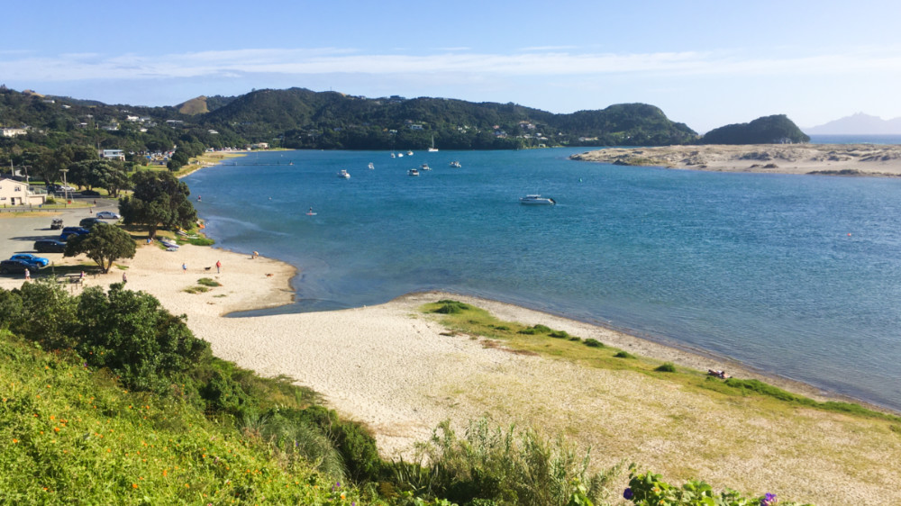
Mangawhai Heads 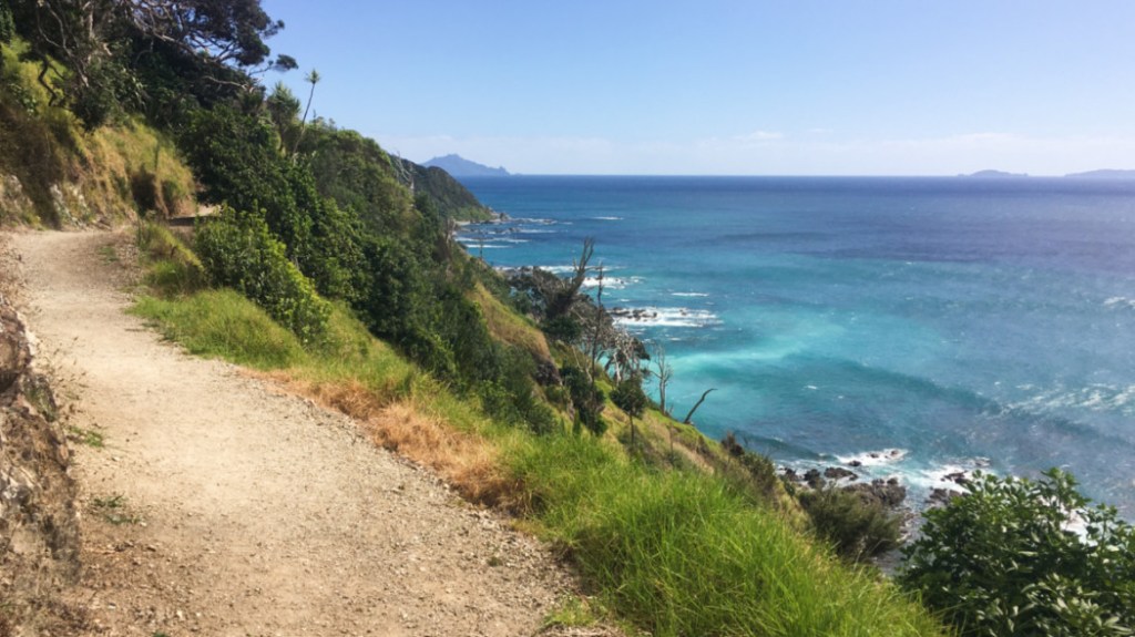
Mangawhai Walkway 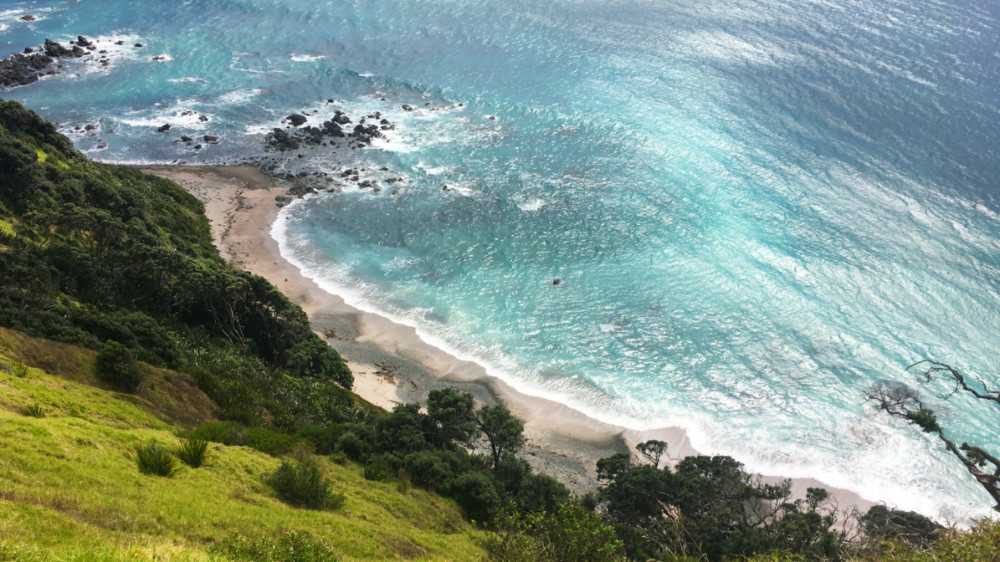
Looking down from Mangawhai Walkway 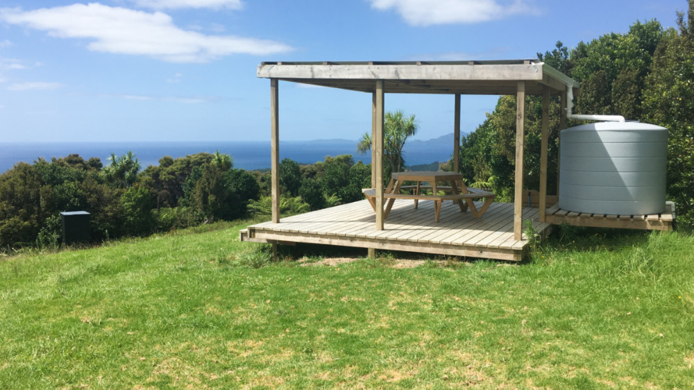
Campsite, Brynderwyn Walkway 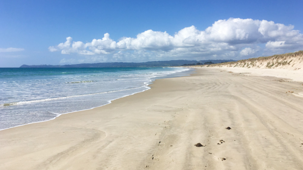
Bream Bay 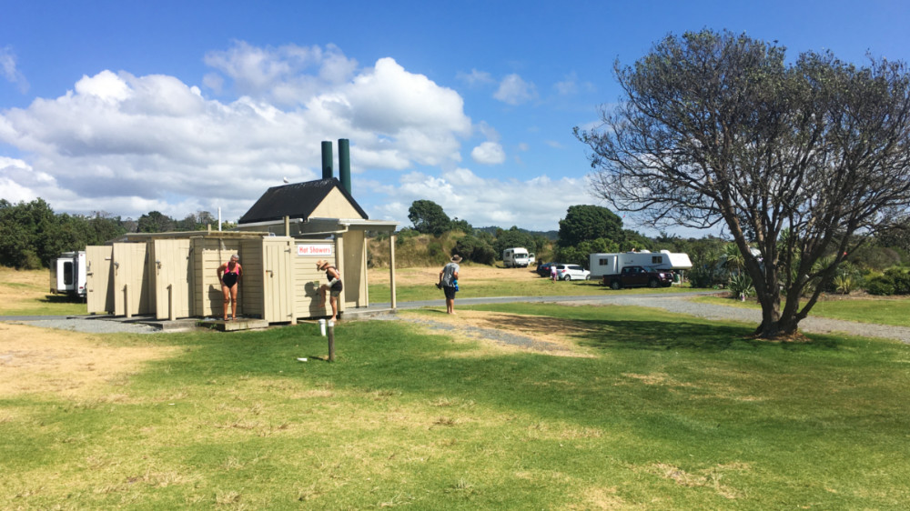
Ureti Beach camp ground 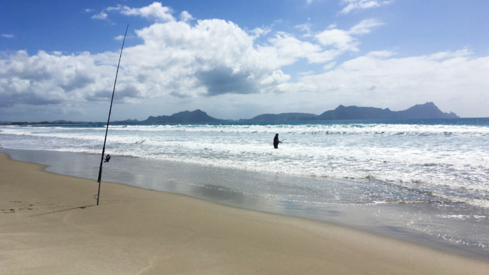
Bream Bay fishing 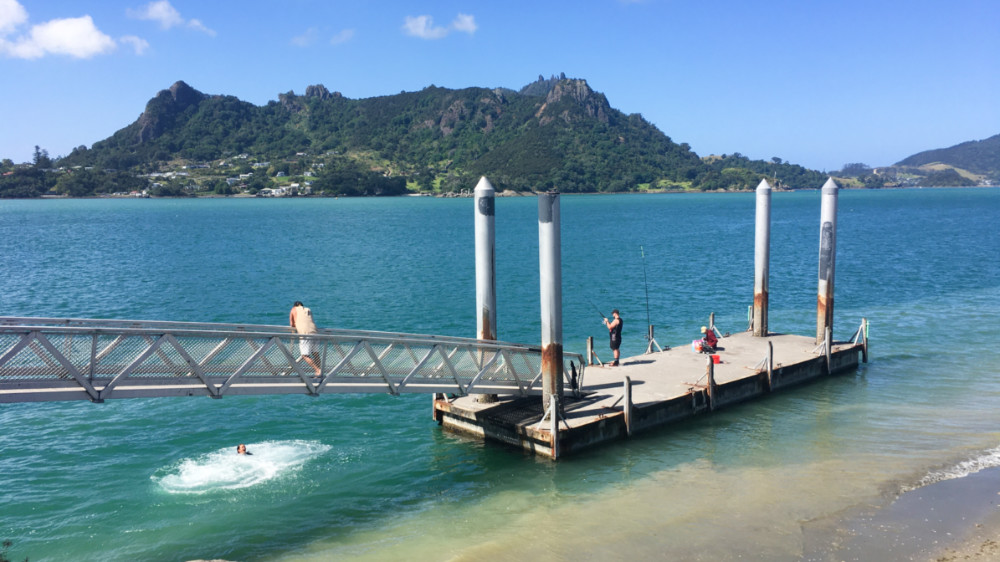
Floating pontoon, Marsden Point – pick-up location for harbour crossing 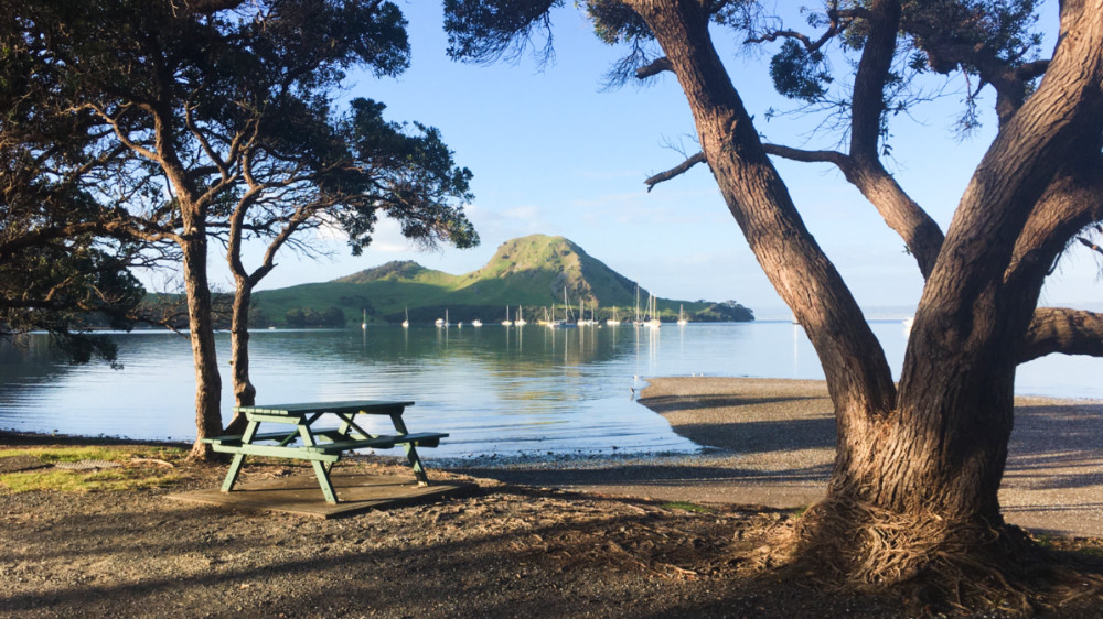
Mt Lion from Urquharts Bay, Whangarei Heads 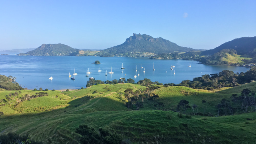
Whangarei Heads from lower slopes of Mt Lion 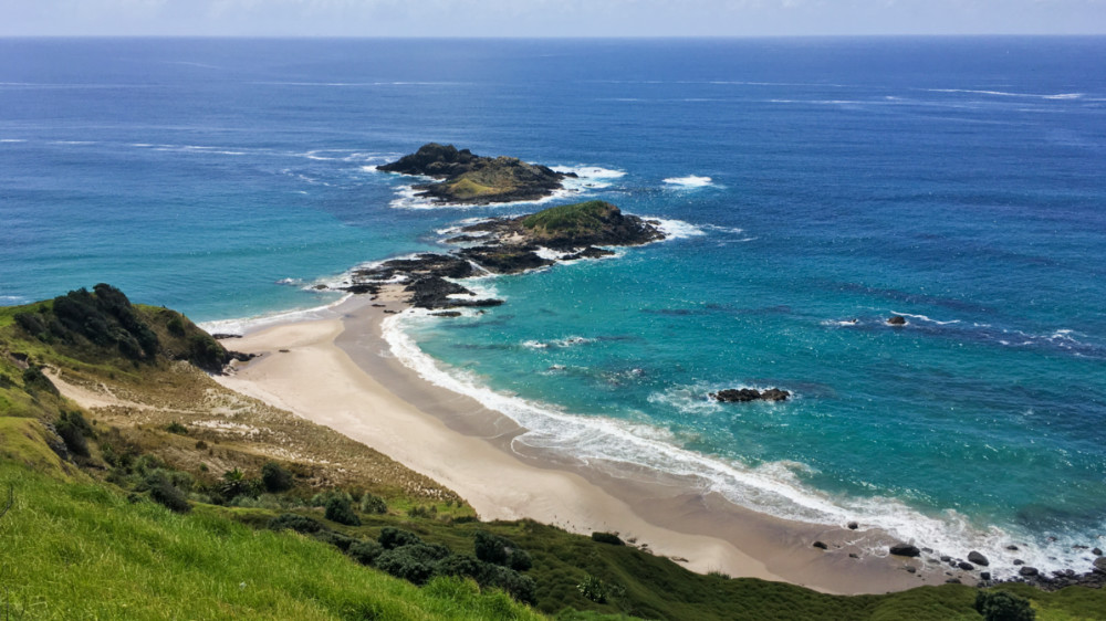
Tarakanahi Island, North end of Te Whara Track 
North end of Ocean Beach 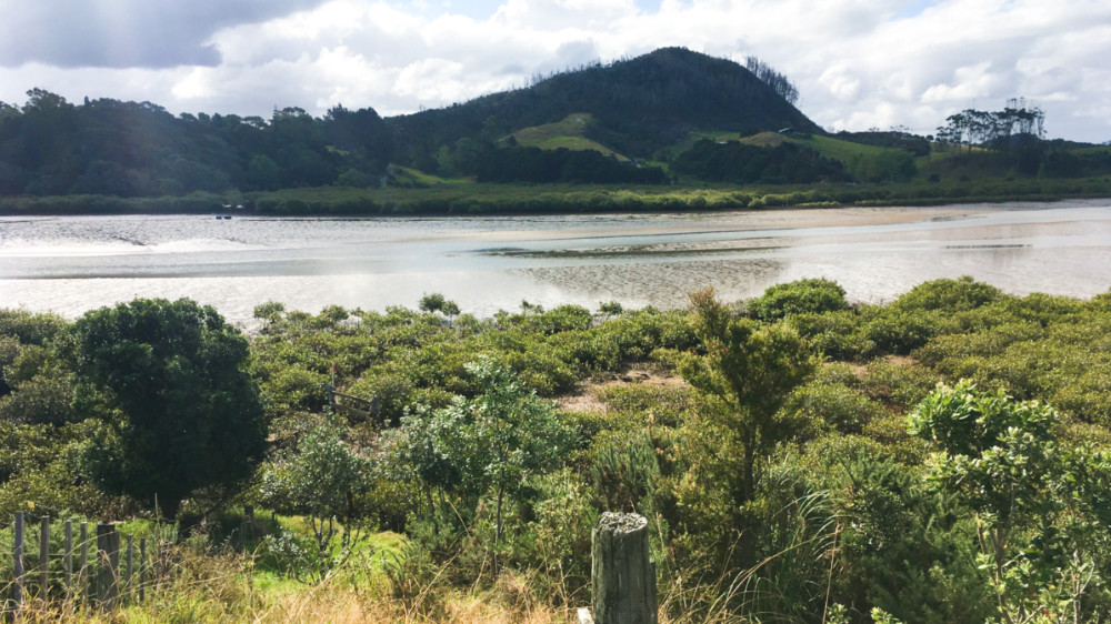
Start point for crossing Taiharuru Estuary 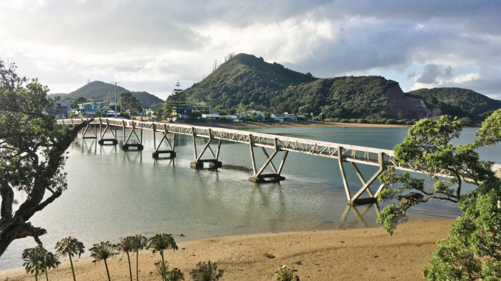
Pataua River footbridge 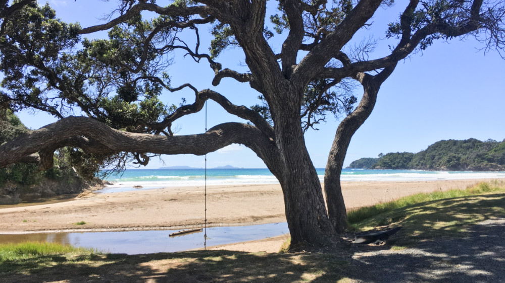
Start of Whananaki Coastal Track, McAuslin Rd, Sandy Bay 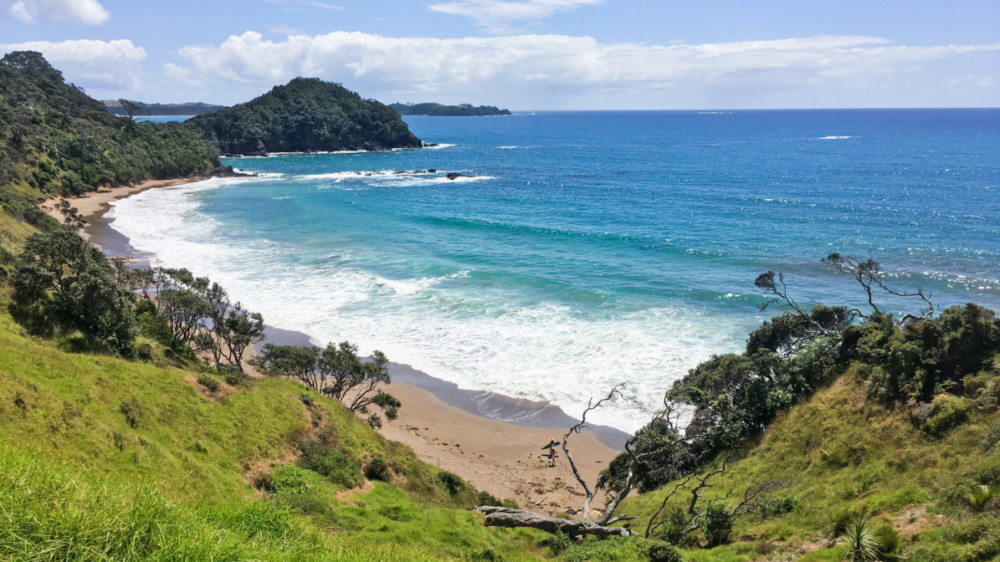
Whananaki Coastal Track 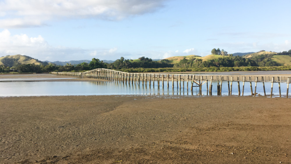
Footbridge, Whananaki – claimed longest in Southern Hemisphere 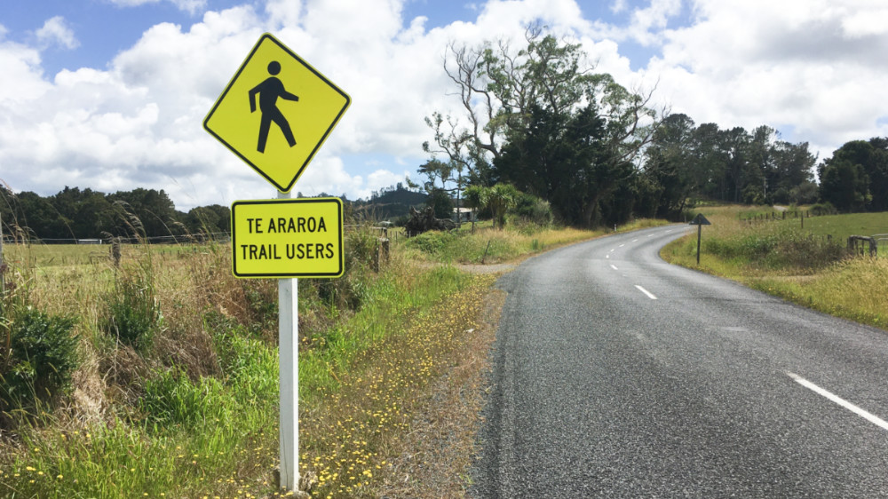
Whananaki North Road 
At start of Helena Track 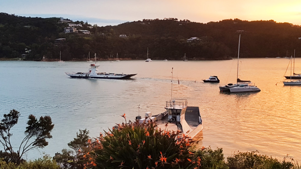
Car ferry to Opua 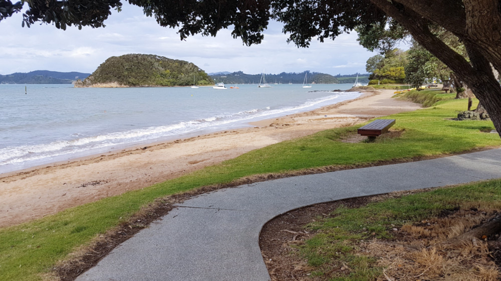
Paihia 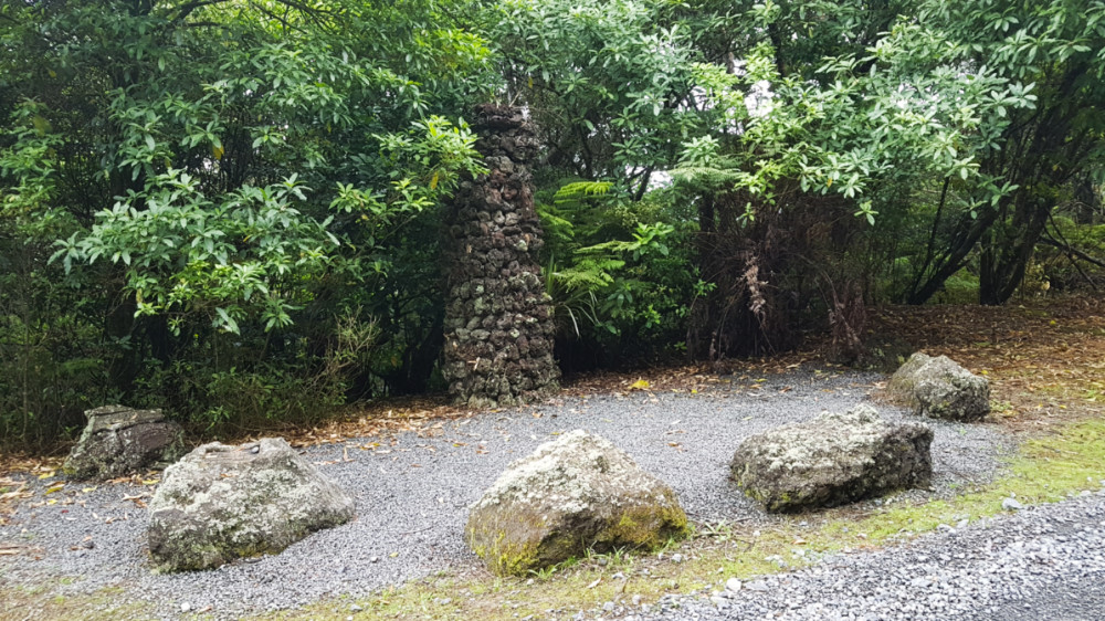
Site where the first part of the Te Araroa Trail was opened in 1995 – Kerikeri-Waitangi section 
Kemp House, Kerikeri 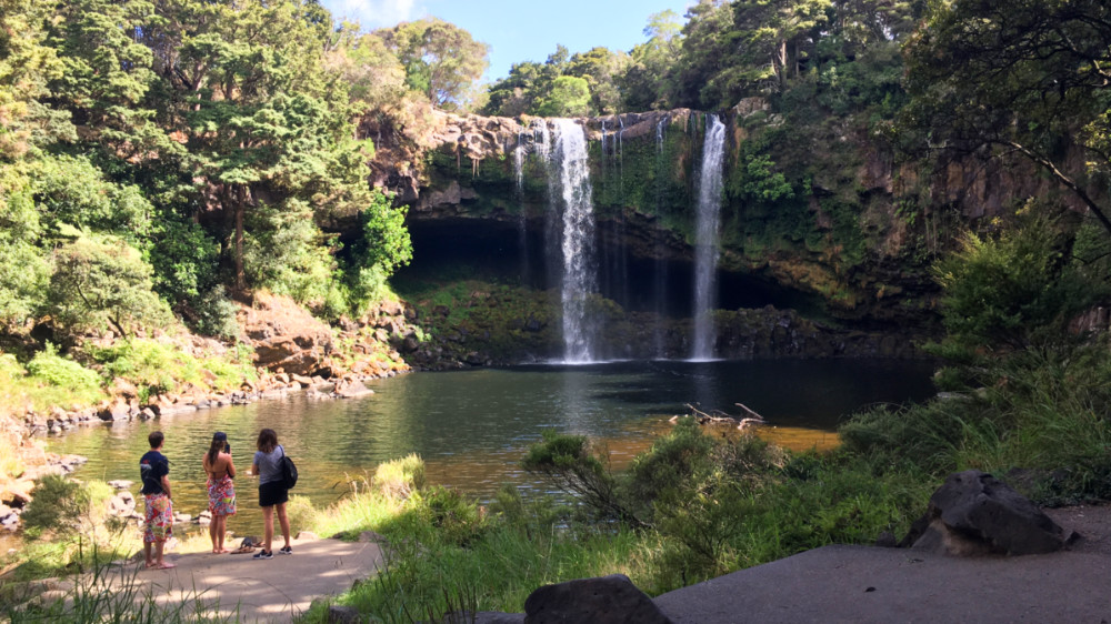
Rainbow Falls, Kerikeri 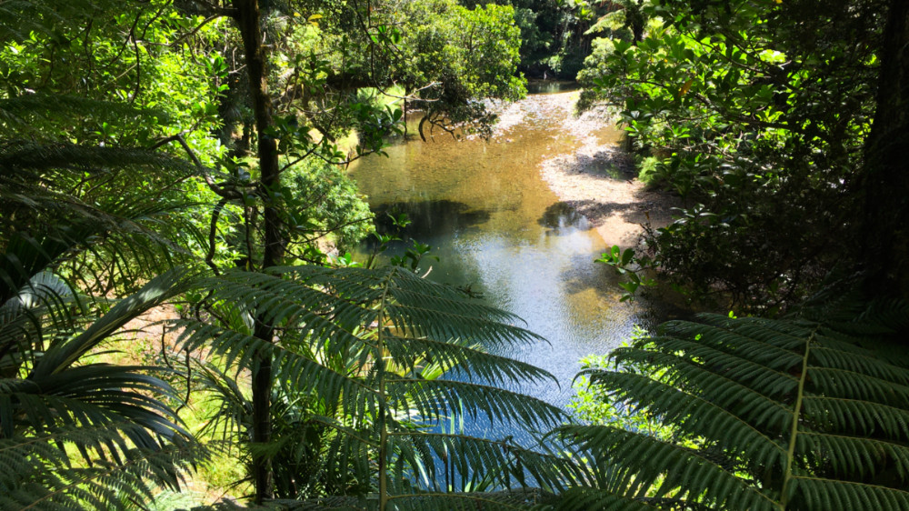
Waipapa River, Puketī Forest 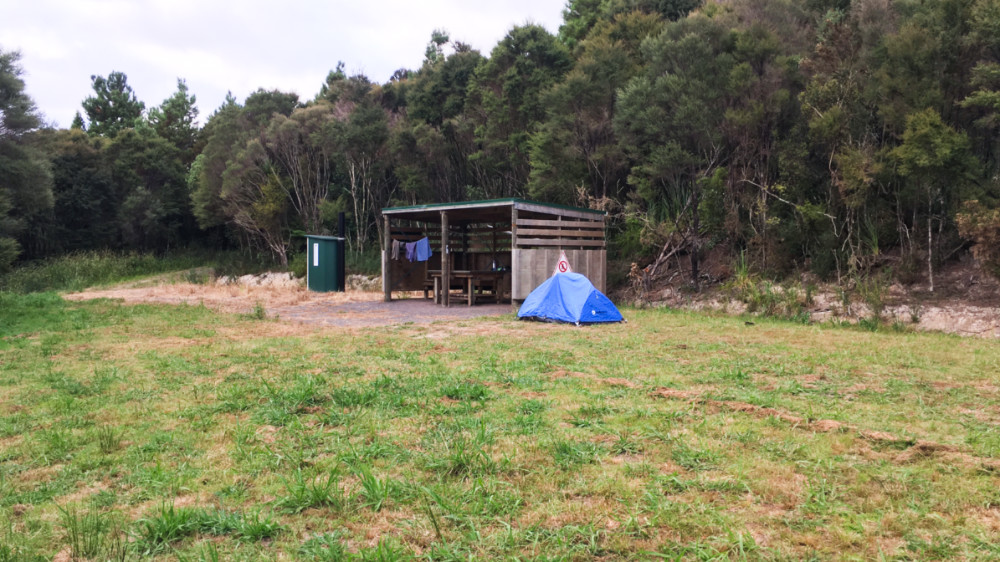
Blackbridge Rd camp, Ōmahuta Forest 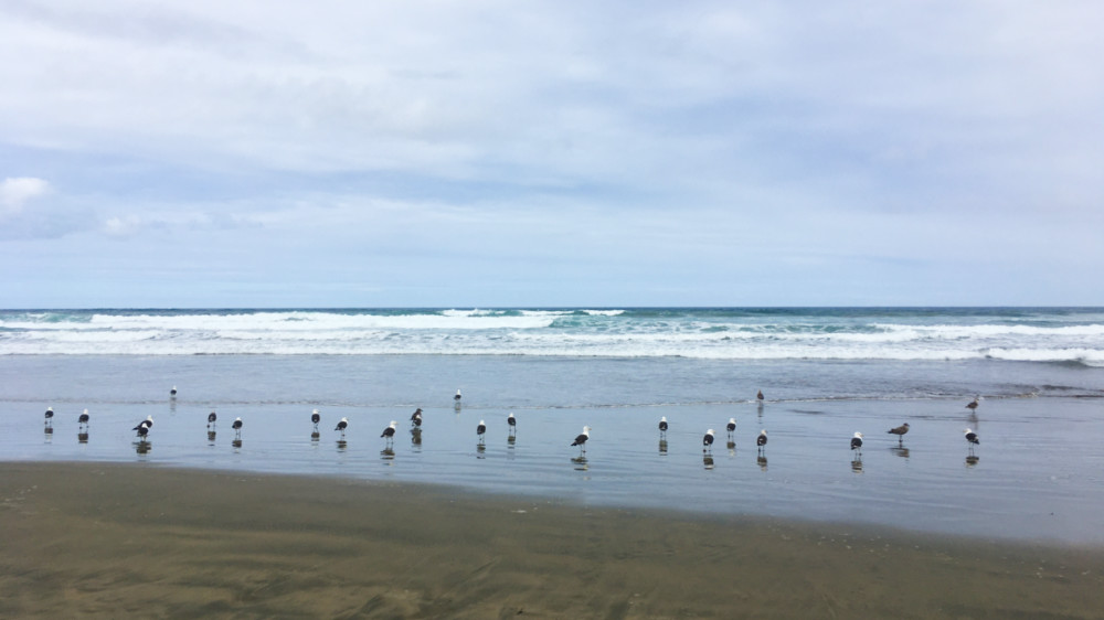
Birds, Ninety Mile Beach 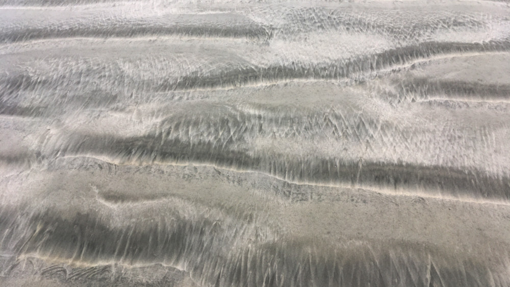
Wave patterns on sand, Ninety Mile Beach 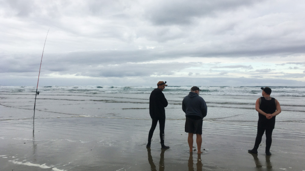
Fishermen, Ninety Mile Beach 
Ninety Mile Beach looking south from Scott Point area 
Twilight Camp 
Te Werahi Beach and Cape Maria van Diemen 
Cape Reinga lighthouse
3D view westwards: Mangawhai to Ōpua
48. Mangawhai Heads to Camp Waipū Cove: 25 km (maps 25, 24)
Mangawhai–Bream Tail Walkway: 2 hrs, 7 km (map 25)
From the carpark at the beach at Mangawhai Heads (end of Wintle St) get onto DoC’s Mangawhai Walkway along the cliffs. You do this by going onto the beach, NOT up the Goldsmith Track to the top of the nearby hill (though there is a great view from there.) The walkway departs from the beach. It involves a bit of a climb at first but is a very pleasant track and graded at tourist level. It is a bit like the Escarpment Track between Pukerua Bay and Paekākāriki in Wellington but not as high and nowhere near as hard. It comes out on a tarmac driveway. You cross over and go down a kauri bush gully on a well-benched zig-zaging track. Then after a marshy area follow a spur on pasture land uphill to a subdivision driveway which becomes Bream Tail Rd. After 1.8 km on this you are at its junction with Cove Rd.
A TA hiker has told me that an alternative to the Brynderwyn Walkway described below, and which is especially useful when the weather is bad, is not to turn left into Cove Rd but to go on a new cycle/walkway at right near the Cove Rd / Bream Tail Rd junction that leads to Langs Beach. From here you can walk on the Waipū Coastal Walkway to Waipū Cove. The route would be shorter and easier too.
Brynderwyn Walkway – Cullen Rd: 4.5 hrs, 13.5 km (map 24)
Head left, south-east, up Cove Rd, then exit right onto a short bush walk to Tarata Pl. Go uphill on this very steep road. (There has been a lot of track development work in the area for mountain bikers and there are numerous temporary signs about alternative routes but if you follow them you end up in a huge mountain bike park with tracks going in every direction and no clear way forward on your route to Cullen Rd. Better to stick to the official route.) From the end of the road head west on the Langsview Track (aka Brynderwyn Walkway). At the high points of 297m and 276m there are great views in every direction. Just after the 297m high point, after the Forest Tanekaha Track joins Langsview Track, there is a DoC shelter, toilet, water and campsite. It is a great spot, though doesn’t have a lot of flat ground. I’m guessing it is at about grid ref 6007.4 N, 1738.8 E.
Turn right into Cullen Rd, a 4WD track that eventually becomes a sealed road and walk 7.5 km on it to where it meets Cove Rd at Waipū Cove (the settlement, not the actual cove on the coast). Note that there can be forestry operations on Cullen Rd on weekdays and sometimes Saturday. Wear a high-visibility jacket or pack cover if you have one and don’t wear headphones. Observe signage and any instructions. Cullen Rd starts pleasantly, in bush, but soon becomes an exposed hell on a hot day. When the pine tress grow it may be a nicer walk, but for now it is pretty bleak. At least it is all downhill though.
- Waipu Hotel – 4 South Rd, Waipū. Cheap rooms ($50 and $70) and camping (possibly this is for campervans though – you will need to check). 09 432 0306, 022 184 6776. As at Feb 2024 the rooms are all occupied by long term guests.
- Camp Waipu Cove – 869 Cove Rd, Waipū, about 1200m south of where Cullen Rd meets Cove Rd. Cabins and camping. Mention you are walking Te Araroa Trail for a generous 20% discount on campsites (but not cabins). The camp ground is huge, so you have to walk a long way down its length to find the entrance. There is a dairy and takeaway store 100m further on from the entrance, and at 100m further on again, the Cove Cafe at 910 Cove Rd. 09 432 0410.
49. Camp Waipū Cove to Whangārei Heads (at Taurikura): 8.5 hrs plus time waiting for water crossing, 34 km (maps 24, 23)
Bream Bay Walk
Continue north alongside Cove Rd for 6.5 km to Waipū on the Waipū Cycleway and Walkway that begins in Waipū Cove. There is a section of about 1 km in the middle where the walkway is not yet completed and you need to walk on Cove Rd. There are a few takeaways, restaurants, cafés and a Four Square store in Waipū. The flash-looking café as you come into the settlement is good. Turn right at the settlement into Nova Scotia Drive and then right again into Uretiti Rd and one final right turn into Tip Rd to take you to the beach. Then it is 5.5 km north along the beach to Ruakākā. You pass the DoC Uretiti Beach camping ground on the way (behind the dunes).
At the end of the beach you can cross the Ruakākā River mouth at low tide from the rock/concrete wall (at the northernmost end of the Ruakākā Beach Holiday Park) but it is dangerous to do so at other times. Check the NIWA tide tables for Bream Bay. Up to 2hrs either side of low tide is do-able. You can try a kayak crossing by contacting Simon Ellison (Ruakākā Kayaking, ph 09 432 8668 or 021 233 6748 – and he would prefer a call than a text), who can assist with a kayak crossing. Please arrange a day in advance, and a koha (donation) is requested. (Confirmed correct Nov 2022). Note that there is a wildlife sanctuary on the opposite side of the river, with many migrant and wading birds, so please do not walk inside the fenced-off nesting areas. The other option if the tide is not low is to cross the bridge at the southern end of the camp ground to walk north on Marsden Point Rd and then cross to the beach at Peter Snell Rd just before the Ruakākā shopping complex (where there are a couple of decent sized supermarkets). There is a footpath along most of Marsden Point Rd to the shopping centre.
The trail heads north along the beach to Marsden Point. There is a track in the dunes just past the power station if wind on the beach is getting you down, and one further inland as well (Ruakākā Pipeline Rd Track) that starts from Sime Rd. On a hot, windless day you will be cooler on the beach though.
Go round Marsden Point to the wharf area. Where the map shows a sharp right turn onto a wharf there are some toilets. The floating pontoon for pickup by boat to cross the harbour entrance is directly north of here, as per the map. And Cafe North is west of the toilets nearby at 12 Ralph Trimmer Drive, though possibly the entrance is on Port Marsden Highway. If you don’t have a boat pick up organised from the wharf you can keep going to the Marsden Cove Marina at 48 Rauiri Drive where you may be able to get a boat to take you to the other side (see under the next section below). The marina has a café, telephone and toilets. It’s a little complicated wending your way through this heavy industrial area and you might be better off giving Marsden Point a miss altogether if you want to go to the marina. Cut across to it via Rama Rd and then Marsden Bay Rd. There is a beach track into Rama Rd just before you get to Marsden Point Beach car park.
Marsden Point was the site of NZ’s only oil refinery, but it has now switched from refining to being a fuel import terminal.
There don’t seem to be any scheduled bus services between Marsden Point and Whangārei (36 km), nor on the other side to Whangarei Heads (27 km), which is a pity as Whangārei offers full-scale supermarkets for resupply and if you could get there by land and then around the other side to the heads then you avoid the boat crossing. Whangārei Coastal Commuter (see listing below) can take you from Marsden Point to Whangārei for $80, and from Whangārei to Whangārei Heads for $50 to $70 depending where you want to be dropped off. (Prices Nov 2022) You can also get a bus with BusLink from Ruakākā to Whangārei on Thursdays at 10:10am (Sept 2025).
To cross the harbour entrance by sea to Whangārei Heads you can try Blair Jones or Peter (listed below) or try the marina already mentioned. If you do go over in a boat, make sure you are wearing a life jacket (and likewise for any other boat rides on the trail – too many people drown every year in NZ in boating accidents). If you get dropped off at McLeods Bay you can walk round to Reotahi Bay by taking Stuart Rd. This becomes a track which goes to the end of Darch Point Rd. Turn right off this on Matuku St and from here a track goes to a driveway on Norfolk Rd. Go to the end of this road to a playground and onto another track that takes you to Reotahi Beach Rd.
From Reotahi Bay a track goes around to Little Munro Bay. Once there, head inland up the very steep Bay View Rd and then turn right into Whangārei Heads Rd. Stay on this around the bays.
- Uretiti Beach DOC Campsite – located between beach and SH 1, 5km north of Waipū. Campsites, toilets, water, showers ($2 coin operated if you want it hot). Camp office on-site. Covered by the DoC Campsite Pass and the Trail Pass. Bookings required. Please register at camp office on arrival, even though booked. 09 432 1051.
- Ruakaka Reserve Motor Camp – 21 Ruakākā Beach Rd, located on the beachfront/estuary. Tent sites and cabins. This looks like a very nice campground. 09 432 7590.
- Ruakaka Beach Front Motel – 115 Ruakākā Beach Rd. The cheapest unit is $179 as at Sept 2024. 09 432 7166.
- Blair Jones – water taxi across the Whangārei Harbour to Reotahi. Pick-up point at the floating pontoon shown on the TA map where the yellow route changes to blue (to the east of a large pile of wood chips) to Reotahi Beach on the other side. The charge is $100 for up to 5 people. Weekdays only. 021 114 7466, text msg the day before preferred over a phone call. (Confirmed correct Feb 2024)
- Peter – also does water taxi and would like 24 hrs notice, 0274 172 440. He runs from the same pontoon as Blair to Reotahi Beach. (Confirmed correct Oct 2022)
- Whangārei Coastal Commuter – can take you to Tutukaka and Ngunguru, both settlements well north of Whangārei that are on the TA, but this is really only useful if you want to skip the section from Whangārei Heads or need to bail out when you are up there. 021 901 408. (Confirmed correct Oct 2022)
- Buslink – A bus service goes to the airport, which is on your way to Whangārei Heads. But there doesn’t appear to be a service to the Heads itself. There is also a service to and from Ruakākā, Waipū and Mangawhai Heads on Thursdays.
- The Cell Block – 91 Cameron St, Whangārei. Very central hostel. Is a former cell prison cell block! 022 355 0557, thecellblockwhangarei@gmail.com. There is a Whangārei YHA but it is a very long way from town.
- YWCA – 21 Rust Ave, Whangārei. Fairly central. 09 438 2926. ywcawhg@xtra.co.nz.
- Reotahi Reserve, Whangārei Heads – Camping by TA walkers for one night is permitted provided you put your tent in the grass area over the fence at left and away from the toilets.
- Thistle Do – 25 Beach Rd, Reotahi, Whangārei Heads. Discounted rates for TA hikers. Bach and tent sites. 09 434 0006, 027 356 6526.
- WHY (Whangarei Heads Yoga) Retreat – 16 Reotahi Rd, Mcleod Bay, Whangārei Heads. 15% discount and one free yoga class to to TA hikers. 09 434 0604.
- Camp Manaia – 26 McDonald Rd, McGregors Bay, Whangārei Heads. It is Baptist run, so no alcohol allowed on site. Four campsites, ablutions and kitchen, minimum per site $30 (as at Sept 2025). campmanaia@gmail.com, 09 438 3948, 020 410 76038.
- Robert & Megan – 2363 Whangārei Heads Rd. Cabin with twin beds ($20 ea) and space for 4 tents ($15 ea). Or camp in garage in bad weather. Cooking and clothes washing facilities plus shared bathroom. 09 434 0996, 022 641 9786 (Meg), rob@thenzartist.co.nz. (Confirmed Oct 2025)
- Taurikura Peninsula Seaview Cabin and Camp – Taurikura Peninsula. Cabin with double bed, kitchen and bathroom and tent sites (latter are expensive as they require access to the vacant cabin for a toilet and shower). 09 434 0150, 022 161 2285 (Brenda). (Confirmed correct Feb 2024)
- Erik, McKenzie Bay – 2426 Whangārei Heads Road. Cabin with double bed, $70 (Sept 2025), and two tent sites at $20 ea. Shower, toilet, kitchen in house. 027 379 9776. Needs 24 hrs notice in advance. (New listing 2025/26)
50. Whangārei Heads (at Taurikura) to Pataua (Treasure Island campground): 10 hrs hrs, 27 km (map 22)
Crossing the Whangārei Heads is a crucial section and if you have to wait around some hours for a boat or make your way by land to Whangārei itself then this affects how all the following sections are ‘chunked’. I have assumed your next day after Waipū Cove starts at Taurikura, at the north side of Whangarei Heads, but you might simply be passing through here from Ruakaka or Whangārei. The chunking for the entire Northland section is simply the way it worked for me (though I started at Mangawhai Village, not Mangawhai Heads).
Bream Head (Te Whara) Track: 7.5 km, 4 hrs (map 22)
Take the right fork when you get to Ocean Beach Rd to follow the beach along Urquharts Bay Rd, and stay on it to the carpark at its end. There are toilets here. A track then continues and it divides shortly into one that goes to a gun emplacement and the other, on the left, towards Smugglers Bay. Take the latter, then walk up the steep track on 1194 steps to continue along the ridge to Mt Lion (Matariki) on Te Whara Track. This is a stiff climb. The rock formations and occasional views all along the ridge are spectacular. You pass a track down to Peach Cove Hut, a DoC hut that you need to book in order to get a code for the lock. It is all conservation land along the trail but camping is prohibited. A following junction is with the track to Ocean Beach Rd, but go right (uphill) to stay on the Te Whara Track. It remains a well formed track, but there are some sections with a lot of tree roots. There is a side track to visit the summit base that is worth the one or two minute detour, but you would need to be very sure footed and have a good head for heights (and be prepared to fall to your death) to climb right to the top of the peak. After the Bream Head/Te Whara summit the track turns north on the Te Whara Track to Ocean Beach. You pass the remains of a WWII naval radar station (with a picnic table). At the end of Ocean Beach Rd is a small car park with toilets and an outdoor cold shower. There is a by-law prohibiting camping here.
- Peach Cove Hut – Serviced 8-bunk DoC hut. Bookings are required, as this hut is locked. You get a code number for the lock when your booking is confirmed. The official TA notes (2023-24) imply that you can camp here but DoC says no, you can’t. Backcountry passes can’t be used here in the summer season, nor TA Trail Passes. 09 470 3300.
- Bream Head Getaway – 310 Ocean Beach Rd, Whangārei Heads, about 800m south-west of Ocean Beach car park. Healthy and wholesome food packs for sale as you pass through. 021 550 249 (Melissa), grassroots63@outlook.com
- Te Whara camp – 22 Ranui Rd, off Ocean Beach Rd, close to the beach at the southern end of Ocean Beach. Camp sites with open sided shelter, table, long drop toilet and hot showers. $20 pp, cash only. Hosts Rupert and Wendy Newbold. Please txt 021 121 5362. (Confirmed correct Oct 2025)
Ocean Beach Walk: 9 km, 3 hr (map 22)
Walk north along the beach. You first have to climb up sand on the side of a promontory to get to the next beach. There is a short bit of track at the top to the leftthat leads to a spot that makes it easier to get down the other side. The dunes along the beach are a wildlife sanctuary, so avoid entering here. No dogs are allowed due to nesting birds. It would be best to walk at low tide so you don’t need to go near the dunes. Check the NIWA tide tables.
- Jaggers camp – Camp for koha/donation. Look out for sign on the top of a dune after a section with vehicle tracks down to the beach. It has the faded word ‘Camp’ and a TA sign on it. It is located about 400m inland at about map grid 6036 N. Please call ahead to book. Water, toilets, showers (cold), camping, caravan, cabin. 021 243 1347. Bring cash to pay the koha. (Confirmed correct Oct 2025)
Near the end of Ocean Beach is a stream/occasional estuary that changes shape a lot. Sometimes if the tide is high you’re best to wait for it to drop a little before crossing. On the other side find some clay steps up to the gravel Kauri Mountain Rd. Leave the gate at the edge of farmland as you find it and follow the road uphill to the right. At the top by a car park turn right onto the Kauri Mountain Track.
Speaking of kauri, this might be a good place to repeat a paragraph from the Auckland pages in case you haven’t read it, as you will be encountering kauri a number of times in this region: Kauri die-back disease has recently been spreading amongst kauri trees in the Auckland and Northland regions. It is a soil-borne fungus that attacks the roots and lower trunk of the trees and eventually kills them. There is no known cure and it is spreading like wildfire, killing an iconic species of native New Zealand tree, possibly sending it to extinction. Many other types of vegetation are dependent on the kauri, so there is a risk that we won’t just lose the trees but whole forests. The disease is mainly being spread by humans. It is crucial that you don’t walk anywhere near the roots of these trees as you are likely to pick up the fungus on your footwear and spread it further. The roots can be very close to the surface and extend a very long way from the tree. So use boardwalks where provided and clean your footwear using wash stations (and don’t forget to wash your poles). Just spraying anti-fungus solution on your shoes isn’t enough. You have to get all the soil off them in the first instance, as that’s where the spores will be. And then you have to be careful you are not just washing the soil to some place where it can infect further trees.
Kauri Mountain Track: 35 mins, 3 km (map 22)
From the Kauri Mountain trig descend down the other side to a long driveway that passes private homes. Use the stiles and leave gates open or closed as you find them.
Taiharuru Estuary Route: 2 hrs, 7 km (map 22)
The drive exits at a point where Harambee Rd and Te Whara Way meet. Turn hard left into Harambee, then right at the bottom of the hill into Taiharuru Rd. After a mangrove-filled inlet you go uphill and on the crest of this hill opposite house number 504 is a driveway off at left. Stick to the route along here that follows a fence line down to a signposted start point for crossing the estuary.
At the water’s edge, providing the tide is low, you walk out on the estuary to the point at right and then around it. There are two white marker poles with orange triangles showing the shallowest point across from where you begin. After crossing the channel here remain in the estuary and walk north-west, staying well out from the mangroves. The mud can be deep in places, especially in the mangrove at the beginning, where it is a smelly black beneath the top layer of grey/brown mud. Take your shoes off before you start – that black will stain them forever, and you might lift your foot to find the shoe is buried in the mud. Poke ahead with your poles – which will also scare off any stingrays, as will splashing the water, though they are harmless. You will definitely need your poles to traverse the estuary, as the mud is often slippery. To plan for the tide check the usual NIWA site and cross within 2.5 hrs either side of of low tide. Head for the distant power lines (marked on the TA map as a line with circles) after you have rounded the point. Come ashore at a council reserve after you can see down the estuary at right and out to sea. Hop on the road (Pataua South Rd) and head north. Wash your poles in fresh water as soon as you can to prevent salt water corrosion if they are aluminium ones.
An alternative to walking the Taiharuru Estuary is to walk around the estuary. It is only an extra 2km. To take this, skip the Kauri Mountain Track and continue on the Kauri Mountain Rd, then turn left into Taiharuru Rd, then right into Patua South Rd. It would be less scenic and involve road walking, but may not take any more time than the estuary route.
- Treasure Island campground – 60 Mahanga Rd, Pataua South, about 500m east of the trail at Pataua. 09 436 2390, 021 0266 8021. Discount for TA walkers. Not usually open in winter months, and the basic supply shop is only open for 6 weeks over the peak summer period, with takeaways offered until 6pm weekdays and 7pm weekends. This does not seem to be a highly popular campground and you may find no-one around (neither campers nor management). Note that the showers in the two-story toilet/shower and kitchen block require a 50c piece to yield hot water.
- Ra Puawai B&B – 27 Mahanga Rd, Pataua South, before you get to Treasure Island campground. ‘A genuine Kiwi 60’s bach on the beach.’ Large deck for relaxing and taking in the stunning views. Three bedrooms, sleeping 4. Full kitchen including coffee machine, coffee and basic supplies. Wifi, spa, kayaks, paddle boards, and dinghy. On Airbnb and expensive, but a discount can be made to TA walkers who make a phone booking. 021 115 4969, ldprendiville@gmail.com.
- There are no shops in Pataua North or Pataua South.
51. Pataua (Treasure Island campground) to Ngunguru: 8.5 hrs, 33 km (map 21)
The standard route for getting to Ngunguru used to involve the assistance of James at Nikau Bay Camp and Cabins. But the camp is now closed to TA walkers annually from January to September, and that includes James ferrying you across the Ngunguru River! So for NoBos hitting this area at the beginning of the year you will have to schedule in walking an extra 5 km, with 10 km on a busy and dangerous stretch of road. This is very unfortunate. I have checked with James (Feb 2024), as I thought maybe he could still ferry people over the estuary, or that someone from Ngunguru could do so, but he is adamant that his camp is closed to TA walkers from 3 January to 15 September. Note also that the NZ Topo map (used as the base for the TA map), has the TA Trail in a dotted line crossing the estuary of the Horahora River and making for a shortcut to James’ camp. This is no longer the route (I think either landowner permission was withdrawn or the river crossing judged dangerous.)
Cross the footbridge over the next estuary (Pataua River) and walk 13 km along the Pataua North Rd. It is not really an option to walk north on the beach from Pataua because it is private land between the beach and the road. Traffic is light-to-moderate. You climb one fairly big hill and then, before the top of a second, exit at right off the road onto an old logging track through a gate. This is the Mackerel Forest Track, marked in black on the TA map. It passes through private forest and may be subject to occasional closures due to forestry operations. Open daylight hours only and no camping or fires. The track is overgrown but easy enough to walk on. The track goes up and around a pine-covered hill and then steeply down. Take the right branch at the bottom of a long descent to follow the Tākehe River, crossing it at a shallow ford to take you onto the true left bank. You then join and cross the Waitangi River at a point where it is also shallow before climbing up on Mackerel Rd (a forest road) through pine forest to join Ngunguru Ford Rd. Turn left onto it. You are now on the section marked in purple on the TA map as a bypass. It is a bypass if you are hiking January to September in this area. But if James at Nikau Bay Camp and Cabins will take you, then turn right when you exit Mackerel Rd instead and walk the 8 km to his camp.
Otherwise, on the bypass, after about 3.5 km on Ngunguru Ford Rd going west you turn right to join the main road to Ngunguru. This is a very busy road with fast traffic, making it one of the most dangerous sections of road walking on the whole TA trail in my view. You can potentially cut about 7 km of this road, and about 9 km in general, by going up Waipoka Rd. My understanding is that at the end of this you can cross over to Old Kaiatea Rd and rejoin the trail at the junction of Te Toiroa and Kaiatea roads, thus cutting out Ngunguru entirely, though you need to have enough food to skip this settlement. As for accommodation, you could stay at Sam’s Bush Retreat (see below).
If you want to visit Whangārei, its not so far from the junction of Ngunguru Ford Rd and Ngunguru Rd. Just keep going west on Ngunguru Rd and it is about 13 km to the northern suburb of Tikipunga, with a campground and a Woolworths supermarket. You could always take the Coastal Commuter bus (see below) one direction or the other perhaps.
Ngunguru
(‘Ngunguru’ may look unpronounceable at first, but break it into Māori syllables: ngu (rhymes with new, but with the ‘n’ combined with a ‘g’, as in sing), followed by another ngu, then -ru (as in roo): ngu-ngu-ru. The syllables are equally stressed. You may well hear people say nu-nu-ru (with the stress in the middle), but that is mangling a language.)
Note: If the sea conditions are good, an alternative is to sea kayak from Ngunguru to Pataua North with Pacific Coast Kayaks. They offer a trip from Ngunguru to Pataua or Taiharuru, with a lunch stop at Goat Island (lunch provided). This is a guided trip as there are a few hazards such as a bar crossing at Pataua. They do not hire kayaks out to solo paddlers. Pacific Coast Kayaks will carry hikers’ packs to the finish point where hikers can resume their journey. As there is additional mileage involved and a driver has to do a pickup, the cost is more than a usual day trip. It is therefore cheaper if you join up with other hikers so that the transport costs can be shared.
- Whangarei Coastal Commuter – Service on request from Whangārei to Tutukaka and Ngunguru, 021 901 408 (Confirmed correct Oct 2022)
- The Secret Spot Campsite – Coalhill Lane, Kiripaka, off Ngunguru Rd, 9 km before Ngunguru (22 km from Pataua) on the TA bypass. Sheltered campsites by a river and under native trees. Hot shower, toilet, fresh water, outdoor kitchen with gas cookers. $25 pp. Bookings essential: text 027 7097 111 (Anna), korucreek@gmail.com. (New listing 2025/26)
- Nikau Bay Camp and Cabins – 999 Ngunguru Ford Rd, Ngunguru. James Johnston is your host at this spot on the southern shore of the Ngunguru Estuary. The camp has cabins, tent sites, and showers/cooking facilities. 021 0242 1632 (texting preferred and is on WhatsApp), or ngunguru@live.com. James can help you get across the estuary if you give him at least a day’s notice. Closed entirely May to mid-September, and to TA walkers from about 3 January apparently.
- Sam’s Bush Retreat – 109 Waipoka Rd, 1.2 km off Ngunguru Rd. Campsite for a koha, discount for TA hikers on indoor accom. This is handy if you are taking the road route, and is on the route for the shortcut that skips Ngunguru I’ve mentioned in the road route section above, but Sam’s is 8-9 km off-trail otherwise. 021 069 0937, samiitracey@gmail.com. (Confirmed correct Oct 2025)
- DonnaMaree Austin, trail angel – Ngunguru. Located 5 mins from the dairy and takeaways. Monday to Thurs only, and indoor accommodation only, for maximum of 3. Can provide meals. Koha. sassyangelkiwi@yahoo.com, 021 142 2385. (Confirmed correct Feb 2024)
- Self-contained unit – Chloe Place, Ngunguru. $100/night. 021 137 5378 Ali & Graham. (New listing 2025/26)
- Accommodation is limited in Ngunguru. so one option is to ask if there is anything on the Tutukaka and Ngunguru Community Facebook page the day or two before you arrive.
- There are a couple of cafés, takeaway shops and a small Four Square grocery store on Ngunguru Rd.
52. Ngunguru to Whananaki: 6 hrs, 25 km (map 20)
Ngunguru to Sandy Bay: 4 hrs, 16.5 km (map 20)
In the middle of Ngunguru turn left after the shops into Waiotoi Rd. Walk along this for about 2.8 km. It becomes Pukenui Rd at a branch left, then a track called the Old Coach Road that follows a ridge to drop you onto Te Toiroa Rd. The Old Coach Rd is very easy walking and takes about 25 minutes. After you have headed west on this a bit you turn right into Kaiatea Rd, and then right again into Matapōuri Rd to reach the coast. This now leaves you about 3 km north of Matapōuri. All the above roads have very light traffic on them. The coastal road from Ngunguru to Matapōuri looks shorter, but presumably is busier and less safe for walking.
Whananaki Coastal Track: 2.5 hrs, 7.5 km (map 20)
You could still walk the 3 km east to Matapōuri, a very nice place by various accounts (especially Whale Bay). There is a store and a camping ground here. Otherwise, turn left over a bridge onto McAuslin Rd. Stay on this until a ‘T’ intersection, where the Whananaki Walkway departs past a gate in more or less the direction you have been travelling. There is limited beach access along the McAuslin Rd/Whananaki Walkway (only at Sheltered Bay) and the track is a 4WD road with very limited shade. You can divert to the Capitaine Bougainville Memorial on the north point of Oruaea Bay (25 mins return – hide your pack on the Walkway). There are great views from here along the coast.
The walkway ends as a well-graded farm track/driveway lined with pōhutukawa trees, going over a stile and behind private baches. You exit past Pitokuhu Point onto Pukekawa Rd back from the next beach. Continue on this to cross the spit to the southern shore of Whananaki Inlet and walk west along the water’s edge to the footbridge and cross over what is claimed to be the longest footbridge in the Southern Hemisphere. If the tide is high on the above-mentioned shore you should detour beforehand by taking the road going west from Whananaki South as property owners have strung an electric fence wire along their frontages to the water. Over the bridge a short way to Whananaki North Rd on the right are public toilets, and further on are the Whananaki Holiday Camp and a store.
- Tui Cabin – 2km up Clements Rd, Matapōuri Bay (just past #152). Two double bedrooms, gas cooker, fireplace, showers. 5km or so off-trail now that Clements Rd is not on the trail. ‘More like a tramping hut than anything… Primarily catering for Te Araroa hikers.’ Changing hands at present (Nov 2025), but may keep going. 027 378 3046; bobgilbert@xtra.co.nz
- Sandy Bay camping – 27 McAuslin Rd, beachfront lawn for tent sites. Indoor shower and toilet. $10 koha pp. Owners live onsite. 021 986 518 (Ian), 021 896 518 (Aly). (New listing 2025/26)
- Whananaki Holiday Park – Whananaki North Rd, Whananaki. Has cabins, tourist flats, tent sites and the Naki’d Inn hut specially for TA walkers (that’s ‘knackered inn’, if you didn’t get it) – sleeps two, but there is another, larger hut as well. There is a small store outside the campground but it sells little suitable for hiking and you can forget about fresh fruit and vegetables. 09 433 8896.
- Motutara Farm – This is basic campground with cold water showers and pit toilets about 2 km off-trail from Whananaki Holiday Park further round the coast. 42 Rockell Rd, 09 433 8252, 020 4033 8252. And further again is the DoC Otamure Bay campsite, where it looks like you might be able to join up to the Onekainga–Morepork Track, or even just keep going around the coast to join up with the trail at Helena Bay, depending whether some of the roads are private or not.
53. Whananaki to Helena Bay: 9.5 hrs and 30 km via the bypass around the Onekainga-Morepork Track (maps 20, 19)
Whananaki to Helena Ridge Track: 5.5 hrs, 21 km (maps 20, 19)
Leave Whananaki by the marked walking trail from the footbridge. This is a pleasant section, though long grass may get your shoes wet in the morning. At a stile over a collapsed fence just continue along the fence line. You exit onto Whananaki North Rd, which has fairly light traffic (about 20 cars per 30 mins mid-morning). The Onekainga-Morepork Track that used to be the TA route turns off at right after about 2km, but even if it has signage saying that it is open, it is closed as a route all the way through to Kaiikanui Rd.
After about 12.5 km turn hard right into the unsealed Pigs Head. It is easy to miss this turnoff, so pay attention. It then turns right to become Kaiikanui Rd. Traffic is extremely light on these two roads, and there is shade for much of the way. Kaiikanui Rd wends slowly upwards to the ridge.
Helena Ridge Track: 3.5 hrs, 9 km (map 19)
The turn-off to the track is a farm drive and is marked but is easy to miss on a long straight section of road. Turn right at the orange marker to avoid going up to the house and continue on a pleasant farm track amongst trees to a stile and a footwear spray station about 1 km from the road. The track begins below the station through manuka and is horribly overgrown to start with. It is better to walk the fence line above on open ground and descend to the track when the fence enters bush, a bit before a campsite where the landowner has provided a water tank (which may be empty in dry conditions) and free camping (no toilet though). You pass along the Helena Ridge Track with agreement from a number of landowners so please respect this and do not camp anywhere else on it.
A bit further on there is more potential confusion as the orange marker is on a fence post on the farm side of the fence, while there appear to be tracks in the bush below. But ignore these, as they are cattle tracks – the orange marker does indicate the correct route. The track then crosses farmland track and alternates between pasture, farm track and native bush. You may encounter some gates with electrified wires – just use the insulated grips to open and close the gap. In an open area the track turns from westerly to north along a ridgeline and then enters regenerating bush down the long ridge in a very pleasant walk. The track ends at a cleaning station and stile beneath a ‘High Chaparral’ sign on Webb Rd at Ngawai Bay.
There is an alternative to the Helena Ridge Track that takes you to the Waikahoa Bay DoC camp site in the Mimiwhangata Coastal Park (map grid 1727.5 E, 6077 N). Stay on Kaiikanui Rd going north-east, then right into Mimiwhangata Rd for 4.5 km and then a further 1 km over the hill to the campground. To rejoin the trail, retrace your steps to the road intersection and turn right into Webb Rd and stay on it to Ngawai Bay (a smaller bay within Helena Bay). The DoC Back Country Hut pass does not apply at the campground and bookings are essential in peak season.
- Kōmanawa Farmstay – 361 Kaiikanui Rd, at approx grid ref 6071.6N, 18 km north Whananaki. Camping spots, hot showers, bathrooms, water, charging station. Up driveway past some houses to red woolshed. Scan QR code on door. $25/night (at Sept 2025), cash or internet transfer. Bookings essential on WhatsApp Community, https://t.ly/5cFuz and notify a day in advance to confirm availability.
- LXM Artist Studio – Helena Bay about a km from the intersection of Webb and Russell roads (approx map grid ref 1722.5 E, 6077.5 N). Has a caravan that sleeps three and space for about 10 tents. Phone ahead 022 045 4391 (Alex) or 0274 339 016 (Dave) after 3pm to be picked up. lxmartist73@gmail.com. (Confirmed correct Feb 2024).
54. Helena Bay to ‘The Farm’: 4.5 hrs, 17.6 km (map 18)
As of 2020/21, the Russell Forest track has become off-limits entirely. You now need to road walk towards Russell, and either go all the way to this township or take one of two other options before you get there, as detailed below. It is 44.3 km from Helena Bay to Russell but you can stop at The Farm, 17.6 km from Helena Bay. It is 26.7 km from The Farm to Russell and from there you can take a ferry to Paihia.
Stay on Webb Rd heading north into Te Mimiha Bay and turn right into Russell Rd. The road has moderate-to-low traffic (15 cars in 30 minutes mid-morning on Saturday).
- Whangaruru Beachfront Camp – Ohawini Rd, Oakura Nth, between Ohawini Bay and Oakura Bay, about 3 km off trail (approx map grid 1721.7 E, 6084.2 N) and 9.5 km north of Helena Bay. TA walkers discount of winter rates for summer, e.g. campsite $17 pp, cabins $60 to $75. 09 433 6806, 022 604 8972. There is a takeaway store in Oakura Bay, 11am – 6.45pm, closed Tues and Wed.
- Oakura Bay Fish, Dive and Cruise – 207 Oakura Beach Rd, Oakura Bay, about 2 km off trail at approx grid 6083.5N. Scroll down their website to find their accommodation section: caravans from $25pp and tent sites from $15. Potential for drop off next morning. Ngawai and Justin, 09 433 6877, 0800 625 872, 0274 625 872.
- Tammy – 2999 Russell Rd, about 11 km north of Helena Bay. Tent sites ($15), ablution block with hot showers. No cooking facilities. 027 240 4121. (Confirmed correct Nov 2025)
- The Farm – 3632 Russell Rd, 09 553 3266 (map grid ref approx 6089 N). Cabins, dorms, tents, campsites. This is a long string of buildings, with family and workers housed to the right and guests at the left (north end). There is a relaxed, hippy vibe to the place. There is no reception or anything – just try and find someone who looks like they live or work there. 17.5 km north of Helena Bay. They operate a shuttle at peak times to Helena Bay to save TA hikers road walking.
55. ‘The Farm’ to Paihia via Okiato & Opua 32 km, Russell, 27 km; or Waikare, 20 km (maps 17, 16)
Now you can either turn off the Russell Rd onto Waikare Rd to take the kayaking option to Ōpua or Paihia; turn off Russell Rd onto Aucks Rd to Okaito to take the ferry to Ōpua and then walk 1.5 hrs to Paihia; or continue on to Russell and take another ferry over to Paihia.
1. Via the Waikare canoe trip
Take a left turn at Waikare Rd on the way to Russell on the Russell–Whakapapa Rd and walk 5.7 km to Waikare Inlet and the Waikare Landing. You will need to have organised with Moana Kayaks, phone 09 402 6078 or 021 159 2185 to have a kayak delivered. It’s better to travel in a group or two or three as this will reduce costs. The paddle from Waikare to Paihia takes 3-4hr depending on weather conditions, tide and fitness levels, and should only be done by persons with some experience and navigation ability. Going with an outgoing tide is presumably best. I understand that there isn’t enough water in the inlet to paddle when it is low tide, so an hour or two after high tide might be best. Minimum is two people at $100pp, three $90pp, etc to $70/pp for six. Includes kayak hire, pack transport, kayak pickup, dry bags, maps, full safety equipment. There is another kayak hire place in Paihia that may be worth checking out: Coastal Kayakers. The TA map show the kayak trip ending in Ōpua but you may as well keep going to Paihia.
- Sheryl Wikaire – Has information on Waikare amenities as well as tent sites (koha/donation) available for walkers at 228D Waikare Valley Rd, at about gridline 6087N, about 1.8 km south of the landing (not as shown on Google maps). Sheryl’s place is ‘off grid’: composting toilet available on request and kauri die-back cleaning facilities for your use. 027 309 3476; peter1.sheryl@gmail.com.
- Aroha – Forest cabin and space for tents on Waikare Valley Rd, about 2.3 km south of Waikare Inlet kayak landing, near exit of former TA route on Russell Forest track. Off-grid. $18pp. Pickups available from Russell waterfront Four Square or Waikare Inlet, $10 one way for groups or individuals. Booking a day or more in advance required. 021 0243 4349 (Aroha) (Confirmed correct Nov 2025)
2. Via Opua
Continue for 10 km after the Waikare Rd turn-off, and go left into Aucks Rd for 4.5 km to reach Okiato (total 21.5 km). A more relaxing route for part of this road walk is to take the Okiato to Russell Walkway that goes around cliffs and through wetland and bush from Aucks Rd, just after its junction with the Russell–Whakapara Rd, and finishes at Pipiroa Rd near the ferry. It is longer than walking Aucks Rd, but more enjoyable. Only the last stage (‘Stage One’) of this is shown on the NZ Topo map, a short section off Aucks Rd as you near Okiato. Stage two and three are on the north-west side of Aucks Rd. Take the vehicle ferry over the Veronica Channel to Ōpua. Ferries go every 10 minutes from 6 am to 9.50 pm, and only cost $1 for foot passengers, so have some cash ready.
- Opua Seaview Motel – 24 Franklin St. Prices are regular motel level but 10% discount for TA walkers. 09 402 7632, 0800 666 835, 021 164 6834.
Ōpua to Paihia: 6km, 1.5 hrs (map 16)
Walk along the signed track from Ōpua north to Haumai Bay. Then, after you cross the estuary on the roadway, you can follow the coast to Paihia Beach if the tide is low. Walking around the beaches and rocks is possible until about 2 to 3 hrs before high tide. Otherwise, continue on SH11 as it changes from Paihia Rd to Seaview Rd. There are toilets at the southern end of Paihia Beach.
3. Via Russell
The walkway mentioned above continues as stage 4 from the intersection of Aucks Rd and Russell–Whakapara Rd into Russell itself. You may have to search for it though – I didn’t read my own notes and just continued on the road! Never saw it. But I did make the mistake of taking a walkway off to the right before the road goes uphill – this goes way above Russell and round to its back. (A nice enough track but it takes much longer than the road and involves more uphill walking.)
There is plenty of history at Russell, once called Kororāreka and known as the ‘hell-hole of the Pacific’ for its drunken sailors and vice in the early 1800s. It couldn’t be more genteel and gentrified today. The Bay of Islands Ferry goes on the hour over to Paihia, from 9am to 9pm, plus some services outside those hours. Buy tickets at the ferry wharf ($16 one-way). There also seems to be another service on a smaller boat, ‘The Happy Ferry’, leaving at 20 mins past the hour 9am to 5pm, $10 one way.
- Russell Outback Eco Retreat – 17 Pararoa Bay Rd, near corner of Russell–Whakapara Rd and Paroa Bay Rd, 11 km from Okaito. Self-contained cabin that sleeps 6. Book in advance. 021 558 514 (Clair). Also on Airbnb.
- Russell–Orongo Bay Holiday Park – Wairoro Park, 5960 Russell-Whakapara Rd, 4km before Russell (map grid 6095 N), 09 403 7704.
- Wainui Lodge – 92D Te Wahapu Rd, Russell. Again, before Russell, but on other side of Orongo Bay from the holiday park, about 600m off the Russell-Whakapara Rd, so better suited if you are heading to Okiato and Opua. Seems to have two lodges ($120 for cheapest) and a ‘hostel’ with two bedrooms (sleeping 5 in total), but it is a bit unclear on the website. 09 403 8278, 021 0887 1130.
- Russell Top 10 Holiday Park – 1 James St, Russell, centrally located. 0800 148 671, 09 403 7826, 9am to 5pm.
Paihia
The Russell, Paihia and Waitangi area is super touristed and there are many accommodation options available, including a number of backpacker hostels. Paihia is a bit like a very small version of Queenstown or Wanaka and consists mainly of places to stay and eat, but despite all the accommodations it can get booked right out in summer. Once there were a dozen or so hostels here, but following Covid there are only about four, so this will make cheap accommodation especially tight. There is a smallish Countdown (1 km or so north-west of Paihia’s centre on the main road to Kerikeri (SH11, Puketona Rd) and a more central Four Square supermarket (Williams Rd) in Paihia; and two Four Squares in Russell, with the one in York St plenty good enough for resupply. Larger supermarkets are at your next stop, Kerikeri.
- i-SITE Visitor Information Centres – The Wharf, Marsden Rd, Paihia, 09 402 7345. For further information on Paihia and Russell go to www.paihianz.co.nz and www.russellinfo.co.nz
- Paihia Top Ten Holiday Park – 1290 SH 11, Paihia, 09 402 7678. You reach this before Haumai Bay and Paihia when coming from Ōpua. Note that the online prices for small tent sites on the website (if you can get the booking function to work) are for two people. The price for a one-person tent is not listed but is considerably less.
- Bay of Islands Lodge – Corner of Kings & MacMurray Rds, Paihia, 029 043 02059. This was previously the YHA in Paihia. Discount for TA walkers.
- Centabay Lodge – 27 Selwyn Rd, Paihia. Discounts to seniors with Super Gold card! Like Haka Lodge, close to shops at centre of Paihia. 09 402 7466; 0800 402 746.
- Haka Lodge – 76 Marsden Rd, Paihia. 09 952 4340.
- Peppertree Lodge – 15 Kings Rd, about 400m south of shops. 09 402 6122, 0800 473 7737.
- Waitangi Holiday Park – 1 Tahuna Rd, Waitangi, 0800 55 6660 or 09 402 7866, info@waitangiholidaypark.co.nz
- Salt Air – 0800 472 582 or 09 402 8338, info@saltair.co.nz Scenic and charter flights from Paihia or Kerikeri.
- Buslink – Scroll down for Mid North timetable. Paihia to Kerikeri: Tues, Thurs at 11am (same bus departs 10.50 from Ōpua); return trip departs 2pm Kerikeri (Sept 2025).
- InterCity – Bus services Paihia to Kerikeri daily 11:41am, 5:10pm, 9:45 pm (except Sat for latter) with the 11:41 going on to Kaitaia Mon, Wed, Fri, Sun. And south to Auckland via Whangarei daily 7:45am, 10:15am, 1:35pm, except no 10:15 on Sat. (Sept 2025).
3D view westwards: Ōpua to Cape Reinga
56. Paihia to Kerikeri: 6 hrs, 25 km (map 15)
From Paihia follow Marsden Rd north to Waitangi Bridge. From the bridge continue on the road past the Waitangi Treaty Grounds. The grounds are open daily from 9am to 6pm in January and February, and to 5pm for the rest of the year. Daily guided tours, hangi and Māori cultural performances are available. Surprisingly, for an estate that was gifted to the nation, the entire grounds are fenced off and you can only enter through the visitor centre for $50, or about half that price if you are a NZ resident. You could perhaps hop over the fence in a secluded spot if you just want to visit the grounds and skip the buildings. Note, though, that a little further up the road is a monument that claims to be sited approximately where the treaty was signed (not actually in the Treaty Grounds!)
On 6 February 1840, New Zealand’s founding document was signed at Waitangi between Lieutenant-Governor Hobson, representing of the British Crown and Māori chiefs. The manicured lawns and the solemn kaitiakitanga that surround the place indicate the importance now placed on the treaty. The Treaty Grounds (including the colonial Treaty House) and 1000 acres of land were gifted to the nation in 1932 by the former Governor General, Lord Charles Bledisloe. As a British aristocrat, he perhaps saw more clearly than Pākehā New Zealanders then did of what the Treaty of Waitangi meant to Māori, and the nation. Te Whare Runanga (the carved meeting house) was opened on 6 February 1940, one hundred years after the signing. It stands facing the Treaty House, the two buildings together symbolising the partnership agreed between Māori and the British Crown, on which today’s Aotearoa New Zealand is founded. Whare Waka Café is located within the Treaty Grounds.
From the Treaty Grounds proceed on Tau Henare Drive past the golf course. The drive becomes the gravelled Haruru Falls Rd. Go west along this and turn right into Te Puke Rd. There is a track off here soon after the junction to the top of Mt Bledisloe (105m), which gives a good view of the area.
At the junction with Skyline Rd up Te Puke Rd a few metres is an inconspicuous plaque on a circle of boulders and a cairn now becoming enveloped by bushes that was made from local volcanic rock by Kerikeri sculptor Chris Booth. They mark the 7 February 1995 opening by the then prime minister Jim Bolger of the Kerikeri–Waitangi route, the very first Te Araroa track! There was a brochure produced for the track, which included a sketch of the proposed route for the whole North Island (and which has pretty much been realised as envisaged, except for a bit that detoured to the Waitakere Ranges near Auckland).
Waitangi Forest Track: 14.5 km, 3 hrs
Te Puke Rd becomes Te Wairoa Rd. It joins the Skyline Rd (turn right) and then forks a bit further on to the left (with Bedford to the right). Just go all the way on Te Wairoa down to Kerikeri Inlet Rd. The route from Haruru Falls Rd to Kerikeri Inlet Rd is all forestry road, and offers both shade and shelter from wind.
The Waitangi Forest is a commercial forest, and forestry operations, including logging and log truck transport, are present in the forest most months of the year. It is important to stick to the route to avoid entering active logging work. Heed all the signs and do not enter areas that are marked as closed. If you encounter a road closed sign or banner across the road, it means you have left the designated walkway and are on the wrong route.
Cross the bridge over the Okura River (or tidal inlet really) and stay on Kerikeri Inlet Rd through the outskirts of Kerikeri. Turn right into Pā Rd. Near the end, just before a large house with a pagoda-like tower on it (the former Pagoda Lodge) is a narrow track off at left. The track takes you down into a gully and over a bridge and onto the historic reserve that includes the site of Kororipo Pā. This pā served as a coastal village, a trading post and a fortified base for war parties. You then want to be on the Kororipo Pā Track (marked with TA signs), which takes you to Kerikeri Rd and at its end the historic Stone Store at the water’s edge. You will probably want to continue down Kerikeri Rd to the centre of Kerikeri (with a large New World supermarket at 99 Kerikeri Rd as you enter town and Countdown at 1 Fairway Drive at the other end), but the route for the next section is across the large foot bridge near Kemp House and the Stone Store over the Kerikeri River to the reserve on the other side to the Kerikeri Walkway.
The Kerikeri Basin is where Māori welcomed missionaries in 1819 to establish a Church Mission Settlement. This established the framework for New Zealand’s bi-cultural society. Kerikeri is both a beautiful place in the Bay of Islands, and one of New Zealand’s most historic sites. Kemp House was built in 1821-22 and is the oldest European building in NZ. There is a café inside.
Accommodation in Kerikeri can be tight. There are two backpackers, but seasonal workers can be in the hostel beds, so sort out your Kerikeri accommodation well ahead. You may have to stealth camp. Or perhaps taking the Intercity bus (1.10 pm) back to Paihia to stay there would be an option. But this would cut down your walking the next day severely, as the first bus from Paihia doesn’t arrive in Kerikeri until about lunchtime. Maybe, if there are several of you, booking a shuttle with Kerikeri Taxis so you can choose your own time could be an option.
- Hone Heke Lodge – (aka Kerikeri Flashpackers), 65 Hone Heke Rd, Kerikeri. The place seems to have won a swag of awards – see their website. But it now also seems to be largely occupied by seasonal workers, though its website says they have limited beds for TA walkers. Book well ahead. 09 407 8170; 0800 407 817 freephone.
- KeriCentral Hostel – 25 Cobham Rd. Closer to town than Hone Heke. 09 407 3542, 027 800 8067.
- Relax-a-Lodge – 1574 Springfield Rd, Kerikeri. This is somewhat out of town on SH10 (cnr with Blue Gum Lane) at south-west and doesn’t have shared rooms. Cheapest rooms are $63 for a single and $81 double, min 2 nights stay (Nov 2022). Maybe they can pick you up? 09 407 6989.
- Alderton Drive – At north end of town, close to trail and. Two tent sites and single or queen bed. Shower, toilet, free wifi, recharge outlets, etc. $10 for tent, $25 indoors (at Sept 2025). 021 897 197 (Aly Craig).
- Rainbow Falls NZMCA Park – 60 Rainbow Falls Road, Kerikeri. This is for motorised campers, and has very little internet presence, but you may be able to pitch a tent. It is right opposite the waterfalls on the TA trail. 09 298 5466.
- Department of Conservation (DoC) – Bay of Islands area office, 34 Landing Rd, Kerikeri, across the reserve where the Kerikeri Walkway starts, 09 407 0300, bayofislandsbooking@doc.govt.nz
- InterCity – Buses depart several times a day for Auckland and once a day for Kaitaia. 09 583 5780.
- Buslink – Scroll down for Mid North timetable. Kerikeri to Paihia, Tues, Thurs, 2pm (Sept 2025).
- Kerikeri Taxi Shuttles and Tours – 021 225 5120.
- Air New Zealand flies from Kerikeri to Auckland, 4 to 5 flights a day.
57. Kerikeri to Puketī Hut: 7.5 hrs, 27 km (maps 14, 13)
Kerikeri River Track: 2 hrs, 7 km
Follow the path inland along the northern bank of the Kerikeri River on the Kerikeri Walkway that starts at right straight after the bridge by Kemp House. You will pass the remains of a powerhouse built as part of a hydro-electric scheme that operated from 1930 to 1967, and past the 27m high Rainbow Falls that tumble over basalt lava fields which flowed into the river valley during long past volcanic eruptions. The track comes out onto a large grassy area. Turn left and continue following the river. You end at a drive, and go across it on a track that leads to a roadside rest area by SH10 with a gazebo and picnic table.
SH10 to Puketī Hut: 5.5 hrs, 21 km.
Parts of the next section can be closed for farming operations from time to time. Check the Alerts and Trail Status page on the official TA site:
The standard route when you get to SH10 is to cross it under a bridge and then go over a swing bridge to walk along the outside of the fence line beside the river. There is a sign about crossing farm land, but in practice you stay mostly outside the fence line, crossing only short patches of the farm. There are electric fences along the route: use the plastic handles to open electrified gates and replace them as they were. Move gently but steadily around cattle to avoid spooking them. The track can be overgrown but it had been sprayed with weedkiller when I went through. Someone had also spray-painted tree roots and rocks on the track with fluorescent paint in a diligent effort to keep you safe. You go up a valley of tree ferns then through a pine forest before coming out at the northen-most end of Mangakaretu Rd. Follow this road south-west (more or less) about 5 km until a track over farmland goes off at right after number 706. It is a fenced corridor between paddocks containing bulls for a section – don’t wear bright clothing or stray off the route. You then follow a stream in a QEII reserve (with a spot by a waterfall for a rest) to Wairere Rd (the crazy root painter has been through here too). Turn right and head north on the road for 2 km, then turn left and walk about 1 km to Puketī Hut and campsite.
If the track from Mangakaretu to Wairere road is closed keep going in a southerly direction on Mangakaretu Rd to Puketōtara Rd. Turn right into this, then right again into Wairare Rd.
- Puketī Hut and campsite – Serviced 18-bunk Doc hut. The hut has electricity, gas and cold showers. You have to book it in advance to get a combination code for the door lock. Book on 09 407-0300 or online $25. Online is preferable as there is a $10 surcharge for booking by phone, at a DoC centre, or by email. A backcountry hut pass can’t be used in the summer season but the Trail Pass can be used to get a 20% discount. The campsite is fully covered by the Trail Pass though, or can be booked online for $10, or $8 cash paid into an honesty box on-site. Remember to bring the right change if you plan to use the honesty box.
The Northland Forests: 4-5 days, 98 km, (maps 13, 12, 11, 10, 9)
Puketī–Ōmahuta Forest Track: 2 days 30 km (maps 13, 12, 11)
Puketī–Ōmahuta Forest Track is a challenging, wet route using river canyons that are subject to flash floods. You need good equipment and navigation skills. Only go in dry weather. Note that there are some beehives en route, and poison and trapping for possums, rats and mustelids occurs within this forest. Goat control operations using contract hunters also takes place.
For forest hygiene and visitor safety reasons it is requested that camping in Puketī and Ōmahuta Forests is restricted to the sites recommended by DoC – those being Blackbridge Rd and Puketī Forest HQ (eastern edge of Puketī Forest). These sites have been identified for camping as they are away from kauri, therefore reducing the risk of spreading kauri die-back disease, and will be poison exclusion zones for possum control operations. Plan using only these two sites.
58. Puketī Hut to Blackbridge Rd campsite: 8 hrs, 20 km (maps 13, 12)
Take the 4WD Pirau Ridge Road (aka Pukatea Ridge Track) that comes in towards the Puketī Forest campsite at left for 9 km. Be alert for vehicles and mountain bikers. After about 9 km watch out for the turn-off at left up some stairs onto a tramping track. This turn-off is is not marked on any maps. I walked right past it by continuing on the road. But there is an easily missed DoC sign on the right that says ‘Forest Pools via Lower Waipapa River Track’ with a TA sign on it. You are not going to Forest Pools, but you do want to get to the Lower Waipapa River. (The official NoBo notes talk about Takapau and Walnut tracks, but these do not appear on any maps and the former is scrubbed off the DoC sign.) After 3 km on a tramping track, with occasional relief of a gravel pathway and steps (for the sake of kauri trees), this descends steeply down stairs to the Waipapa River. There is an open piece of ground at right in the forest about 30m before the river where people have camped I believe. It is about 3 hrs 45 mins from Puketī campsite to here.
There is an easy river crossing then a well marked but rough and very slippery track after rain follows the river. You could instead wade along the river between shoals, but there is a deep section near the end (you could probably scramble up to the track from here though). A short, muddy descent then takes you down to cross the river at the junction with the Lower Waipapa River Track. You will see a large orange triangle marking where to cross the river – downstream a little where it is much shallower, just above some small rapids. Don’t bother taking off your shoes though, they are soon going to get very wet.
A track leads up a few metres on the other side and then down to the Mangapukahukahu Stream, which you also ford. You then walk up the stream bed for about 3 km. This is very slow and tedious going – about 1.5 hours. It is through a gorge that is subject to flash floods after heavy rain. DO NOT attempt this route in such conditions. Then a clearly marked track through pampas grass, followed by pines and finally eucalypts goes off left uphill. It becomes a 4WD track and leads to the start of Blackbridge Rd (a 4WD road). A new campsite has been built for TA hikers at the start of Blackbridge Rd, and is marked on the TA map (but not on the TA App or Far Out as of Feb 2024), around grid ref 1660E, 6100.5N, with a shelter and a water tank. It may be worth topping up here for water as it can be scarce over the next section. Past hikers said that this is a better place to stay than Apple Dam, which is now closed due to kauri dieback disease anyway.
Wet weather by-pass option 1 (road walking south of the forest): Starting from Puketī Forest Hut area, head south on Waiare Rd, then turn right into Puketī Rd for 9 km. It joins SH1 at Waihou Valley. Stay on SH1 going west and north-west for 22 km. When you get to the Omahuta Rd turn-off at right you can just keep going on SH1 north to Mangamuka, as the standard trail route comes down Ōmahuta Rd onto this section of SH1.
Wet weather by-pass option 2 (36 km Puketi Hut to Blackbridge Rd campsite): This is marked purple on the TA map and the TA Trail app: Continue up Waiare Rd from the Puketī Forest Hut area. Go left on Pupuke Mangapa Rd. This goes a long way west. When it branches, take the left one. This crosses the Mangapa River after about 1.5 km and becomes Jacksons Rd. Take the next left, Kauri Pā Rd and then left again onto Blackbridge Rd for about 3 km. If you can’t get to the Blackbridge Rd campsite, there is a potential camping spot by Louies Stream, about 24 km from Puketi Hut.
59. Blackbridge Rd campsite to Makene Road campsite: 6.5 hrs, 23 km (maps 11, 10)
To continue, keep on Blackbridge Rd and then left onto Kauri Pā Rd to head west. It becomes Kauri Sanctuary Rd, and you past occasional beehives tucked into the forest (just button up your clothes and walk gently past) and an airstrip on your right. At a junction the road becomes Ōmahuta Forest Rd where you turn right. 700m further on is Ōmahuta. Stay on the road where there is a big DoC sign for Ōmahuta Forest going off at left.
Walk 5km south-west down Ōmahuta Rd to the junction with SH1. Turn right and pass over Mangamuka Bridge before Mangamuka settlement (where there is a dairy with takeaways: see below). There are public toilets outside the dairy but they don’t have water for washing your hands. Your best bet for water may be the cemetery or the school. Turn left at Makene Rd, 12km from Ōmahuta.
- Mangamuka Bridge Dairy – SH 1 Mangamuka Bridge, takeaways available. Mon–Fri 7am–6pm (hours and days can vary, so don’t rely on this). 09 401 9184. Map grid approx 1649.5 E, 6100.7 N. They serve huge ice creams – you may find a double scoop too large; and are reputably generous with the burgers as well. It costs $1 to charge your phone, but it is probably a good idea to do so, as there is no power at the Makene Rd campsite.
- Mākene Rd – at start of Raetea Forest, camping spot with toilet, river, picnic table. There is a stream where you can wash but you should probably treat the water before drinking it. Stay by koha (bring cash for the donations box). A caravan can be booked: trishterran@gmail.com, 021 024 90415. (Confirmed correct Feb 2024)
60. Mākene Road campsite to Takahue via Raetea Forest Track: 10 hrs, 21.5 km, (maps 10, 9)
This is a tough section, mostly consisting of a track strewn with tree roots and, where these are not present, with mud. There is also little reliable water, so carry plenty. And start early. The DoC sign says 9 hrs on the track to Takahue Saddle Rd, which is about right, or a slight underestimate, but some people report taking 11 hours. The track leaves the road about 1.5 km to the left, up a driveway beside a house. Dogs may bark but won’t hurt you. The owners are used to walkers passing through and a greeting and/or thank you will go down well.
The track goes up a ridge to the peak of Umaumakaroro (447m). Actually, I think it goes slightly to the right of the ridge. I found orange track markers pointing in all directions at one point on the farmland above the house, so I went straight up up the ridge, but there were no markers here and I was soon in dense bush, bush-bashing my way to the top. After the trig, I then stumbled across the actual track coming round the northern side of the peak. So the proper route is to the right of the ridge as you go up, and stays to the right of the peak. There has been a route correction on the maps to deal with this, so if you follow the TA App you should be right. The track then goes more or less west, first to the peak of Kumetewhiwhia (638m) and then to Raetea (744m). These are some of the highest peaks in Northland, so expect cloud and rain. There are blue poles marking every km of the track – a nice touch. Keep going straight when a track branches off at left after Umaumakaroro and take the left fork about 1.3 km after Kumetewhiwhia. There is apparently a small area of ground near Raetea peak where some people camp – it’s by the transmitter that’s on a spur from the peak. A few hundred metres after Raetea take the right track marked ‘Takahue and Broadwood’ downhill (I presume it is the branch going straight ahead here that goes to the transmitter.) You eventually reach a junction of three 4WD roads. Take the right-hand one with the orange markers. After about 30 mins you pass a campsite set up for TA walkers (see below). It has no toilet, but there is a cold water enclosed shower. Continue down to a junction with Warner Rd and along Takahue Saddle Rd, which follows the Takahue River and leads you to the tiny settlement of Takahue.
- Mangamuka Gorge Walkway campsite is a marked spot about 1.5 km before you get to Warner Rd. The toilet is no longer maintained, so you will need to dig a hole, but there is an enclosed (but non-functioning?) shower. Also, the site had a lot of Paspalum dilatatum grass with its high, sticky seed heads when I was there in March. (approx 1634.0 E 6102.9 N). Note, there is NO CAMPING allowed at Warner Rd by the river.
- Takahue Marae (Old School Grounds) – NW corner of Takahue crossroads. It doesn’t look like a marae, just a house and some run-down buildings, but if you look carefully you can see the old school house near the road (quite a small one) and the toilet block (still functioning, but now with hot showers). Tenting, toilets and water are available, $10 koha appreciated. There is a labelled box for this on one of the utility sheds. Call in at the house to let them know you are here. Ph Karen Murray 021 0754 246 if any questions. (Confirmed correct Feb 2024)
- Abhay and Jaya’s – 271 Takahue Saddle Rd, Takahue. (You pass their place at about the point where Warner Road meets Takahue Saddle Rd – look for the sign ‘Krishna Sanctuary’.) Tent sites (pay with koha), share cabin $35, and private cabin $90 single or $120 twin. Latter includes hot shower, but otherwise pay $5. Also, vegan / vegetarian meal, 1 to 4pm, book in advance, koha c.$10. What’sApp 022 060 5862, krishnacef@gmail.com or Facebook message.
- Tramp Inn – 1479 Diggers Valley Rd. This private hut is about where a track to an airstrip is marked on the Topo map near the start of the Herekino Forest Track (west of Raetea Forest). It is a 7 km detour off the current trail. However, you could avoid retracing those 7 km by taking the Waiotehue Rd west of Takahue and then using the track marked on the NZ Topo/TA map to get to Diggers Valley Rd. Then you can go out to meet up with the Takahue Road again. I’d guess the loop is about 12 km in total, as against 4.5 km if you stick to the trail from Takahue to the point where DV Rd joins it, plus the 14 km to Tramp Inn and back. Pay $10 in an honesty box. 14 bunks and tent sites. 027 503 7026, info@adventurenorth.nz (Alan and Hayley Tubbs). (Confirmed correct Nov 2025)
- Peter Griffiths of Takahue (on the west side of Raetea Forest) – Can provide a drop-off and pick up service for a small fee and has some backpacker accommodation available. Contact him well in advance on 09 408 3685 as he seems to be hard to get hold of (or maybe that number is evenings only). (Confirmed correct, Nov 2022)
61. Takahue to Kaitaia 4 hrs, (17 km) and Ahipara Holiday Park (another 3.5 hrs, 14 km) (maps 8, 7)
Some years back the trail went through the Herekino Forest to Ahipara, but this is closed due to kauri die-back disease. So the alternative is to continue on north on Takahue Rd. Just before the 4th bridge turn left into Ruaroa Rd and when you get to SH1 hitch or arrange a lift the 6 km to Kaitaia (the road is very busy and high speed, so quite dangerous for walking (40 cars per 15 mins at 11am on a Friday). Closure of the Herekino Forest is actually useful as it means you can resupply at Kaitaia (Ahipara is pretty hopeless on that score). From Kaitaia it is 14 km road walking or hitch hiking to Ahipara or you can take a limited service bus (see below). This road is less dangerous than the Kaitaia one. There is at least a footpath the first 2.5 km, and several slow speed zones where there are schools and marae in the middle of the route.
A key location in Kaitaia is the Te Ahu Centre on the corner of Matthews Ave and South Rd at the south end of town that you pass as you arrive. It includes the i-Site. Here you can fill in a TA intentions book, for your safety on the 90 Mile Beach, as well as find out about transport to Cape Reinga if you haven’t already got that sorted. There are computers, cafés and a library with free wifi in the centre.
Slightly north of Pak’nSave is Mitre Ten hardware, a Hunting & Fishing store and The Warehouse. Riders Sports Depot is at 73 Commerce St, in the middle of town. You can buy a limited range of free-dried tramping meals and camping gas there. Kaitaia has a fair number of greasy takeaway joints and mediocre cafés, but also, apparently, the best café in New Zealand! That’s the Peekaboo Backyard Eatery at 5 Bank St, at left off Commerce St, a short way into town. I didn’t know about it when I was there, so I can’t vouch for it, but it won the top hospitality business, as well as best café and sustainability champion awards in 2025. (Some doubt has been cast on this award though. See this Spinoff article.) Otherwise, the library café might be the best of a poor bunch, and for a restaurant, Turkish Kebabs and Pizzas at 28 Commerce St seems good and Happy Bowl at 14 Commerce St could have healthier options than all the rest. There isn’t much to Ahipara: only the very small superette, a takeaway store nearby, and North Drift Cafe (closes 2pm) as you come into the settlement, so you will need to resupply in Kaitaia.
- Beachcomber Lodge & Backpacker – 235 Commerce St, Kaitaia, has private rooms, dorms, a kitchen and luggage storage. Check-in at the Wayfarer Motel next door. 09 408 1275.
- Rayanne King – Sleepout with accommodation for 4 people ($25 ea), fully self contained. Camping also. About 30 mins walk from Te Ahu Centre but can pick up and drop off for a donation. 027 330 2776, rayanneking4@gmail.com. (Confirmed correct Feb 2024)
- Pak’nSave – 111 North St, Kaitaia. This is the only supermarket in town besides some very small convenience stores. Unfortunately it is at the north end of town, about 20 mins from the turn-off to Ahipara, and about 10 mins from the beachcomber Lodge and Backpacker.
- Bells Produce – 77 North Rd, Kaitaia, just before you get to Pak’nSave, on the left. They sell fresh fruit, vegetables and meats, and have a better range than the supermarket. They are also owned by the local Te Rūnanga o Te Rarawa, so perhaps a better place to spend your money than at a supermarket chainstore.
- Your Shelf – 244 Commerce St, Kaitaia. Sells bulk foods in quantities you select yourself. Good for buying muesli, nuts, dried fruit, etc. Healthy Wholefoods at nearby 216 is very similar.
- Ahipara Holiday Park – 168 Takahe St, Ahipara, 09 409 4864. There was previously a YHA associated with the campground. This now seems to be integrated into it as a lodge with 20 dorm beds.
- Endless Summer Lodge – Hostel, 245 Foreshore Rd, Ahipara, about 1.5 km south of the superette, 09 409 4181.
- Ahipara Bay Motel – 22 Reef View Rd, Ahipara (about 1 km south of the superette), 09 409 4888; 0800 906 453.
- Te Wairoa Farm Camp – North of the golf course in Ahipara (the golf course itself is at the north end of the settlement). Camping, with cold showers, portaloo and a basic kitchen, $10. The Facebook page looks inactive, but they are operating. 021 223 1194. (Confirmed correct Nov 2025)
- Ahipara Superette – 4 Takahe St, Ahipara, open 7:30 am weekdays, 8:30 weekends; closed 6pm. Includes post office open 9am to 5pm Mon to Friday and Sat morning, 09 409 4828.
- Bus Link – A bus goes from Kaitaia (Te Ahu Centre back entrance) to Ahipara at 1:15 pm on Wednesdays and the other way at 9:26 am. The latter run arrives at the Te Ahu centre at 9:55 am, just in time to catch the Intercity bus to Kerikeri and points south. Times at Sept 2025).
- Intercity – Buses depart 10.10am from Kaitaia for Auckland, via Whangarei, on Mondays, Wednesdays, Fridays and Sundays only (as at Sept 2025).
Ahipara to Cape Reinga: 100.5 km, 4 days (maps 7, 6, 5, 4, 3, 2, 1)
The following plan from Ahipara to Cape Reinga is suggested on the official TA site (here reversed of course). But you could consider flip-flopping the last section of your walk and starting at Cape Reinga to go SoBo. An advantage of going SoBo is you don’t have to arrange a time to be picked up at the Cape, and with most providers requiring a minimum number of passengers you may have to take whatever you can get.
On the other hand, an advantage of going NoBo is that some providers may be able to take you direct to Kerikeri or Paihia from Cape Reinga, which then gives you more options for buses south. Also, you don’t have the messy last days of getting to transport home from the trail at Kaitaia. This would mean walking from Hukatere to Kaitaia in one go (44 km) and staying there a night and getting the 10:10am bus the next day. Or spending a night in Ahipara and then walking just 14 km to Kaitaia the next day where you would need to spend another night to get the morning bus (unless you started walking at 6:30 am, say, in darkness along a busy road, to get to Kaitaia in time for the bus.)
Consider the weather forecast and wind direction. Better to have the wind at your back than walking into it. Also, walking north on sunny days will see a lot of sun reflected off sand and sea onto your face – take precautions or consider going north to south. Whatever the case, the NoBo notes below can easily be used Sobo, as the route is pretty simple.
Day 1 – Ahipara to Hukatere Lodge/Utea Park (31 km) or just to Waipapakauri Holiday Park (14 km) and make a fifth day of it by walking the 17 km to Hukatere the next day.
Day 2 – Hukatere Lodge/Utea Park to Maunganui Bluff campsite (30 km)
Day 3 – Maunganui Bluff campsite to Twilight Beach campsite (28km)
Day 4 – Twilight Beach campsite to Cape Reinga (12km)
You shouldn’t worry too much about the state of the tide. Unlike many other beaches the sand above the average high tide mark is still fairly firm. And because the beach slopes so gently, it doesn’t take long for the tide to go out far enough for plenty of hard sand to be exposed. You should take plenty of water, as there are few sources, and the beach is of course very exposed, so sunscreen and a hat and/or scarf are essential. (A suggestion: wear a face mask to protect nose, lips and cheeks instead of creams.) You are requested not to camp in the Aupōuri Forest of pines that runs alongside Ninety Mile Beach.
You should know that there may be packs of feral dogs along the route near the Cape and they can be dangerous. Precautions are to avoid walking alone and at twilight or at night. The general principle if faced by threatening dogs is not to provoke them: don’t shout, scream, wave your arms around, or run. Either stand still, or move away quietly without turning your back on them. And don’t make eye contact. See more at the bottom of my Weather and Hazards page on dealing with aggressive dogs.
62. Ahipara to Hukatere Lodge/Utea Park: 7.5 hrs, 31 km (maps 7, 6, 5)
From the campground go down Kaka St to the boat ramp and head off north along Ninety Mile Beach / Te Oneroa-a-Tohe (which is actually only 55 miles, or 88 km, long). You pass Waipapakauri (14 km), where there is the Ngapae Holiday Park, before getting to Hukatere (31 km from Ahipara), which also has a camping ground and lodge. You will see several clusters of smallish Norfolk pines just before Hukatere.
- Ngapae Holiday Park – 6 Matai St, (off West Coast Rd), inland from the boat ramp and entry/exit to the beach, Waipapakauri. 09 406 7298, ngapaeholidaypark@hotmail.com.
- Hukatere Lodge & Hukatere Camping Ground – 809 Hukatere Rd, Houhora, 09 409 8705 or 021 884 145. Located about 500 to 800 m inland from Ninety Mile Beach. Has lodge, cabins and camping sites, with communal kitchen, hot showers, flush toilets and free wifi. Note that the bunkroom accommodation listed on the website doesn’t mean you can book a bed on its own. All the cabins have to be paid for as a unit, so if you want to share you need to find the other people yourself.
63. Hukatere Lodge to Maunganui Bluff campsite: 7.5 hrs, 30 km (maps 5, 4, 3)
Opposite Wakatehaua Island (61 km from Ahipara) is the Maunganui Bluff campsite.
- Maunganui Bluff campground – This is a private camp operated by a local Trust with a shelter, toilets and water tanks. They are supportive of Te Araroa and happy for walkers to stay, but be sure to pay a $10/night fee (carry some cash) into the honesty box or this privilege will be at risk. Note that due to money being stolen from the box a caretaker may come to collect money, but beware of imposters. It is safer to pay into the Maunganui Bluff Trustee bank account 11-5027-0005402-11. Take care using the water and check all taps are off, as water gets very low in summer. Be sure to camp on the grassed area of the campsite (which has little shelter) and NOT in the pine forest. Wild horses roam the site sometimes. The camp is accessible by road, so you may find people parked here in the daytime who are fishing at The Bluff, or even the more intrepid staying overnight.
64. Maunganui Bluff campsite to Twilight Beach campsite: 7 hrs, 28 km (maps 3, 2, 1)
For the next leg take enough water to go all the way to Cape Reinga, as the tank at Twilight Beach can run out in very dry weather. At about 20 km north of Maunganui Bluff you cross Te Paki Stream (aka Kauaeparaoa Stream). Te Paki Stream mouth is a popular vehicle entrance/exit to the beach so be prepared for cars and tourist buses around here and further south, as people like to drive on the beach. (From the stream mouth it is 1 hour upstream to the road, should you wish to exit the beach here). Te Paki is well known as a sandboarding location as the sand dunes are very high here. You climb up a dune and slide down on a board, sheet of cardboard, or whatever, as though you are on snow. Boogie boards are hired out at the car park for $15. Note that there are reports of people targeting cars in the car park for break-ins, so think about where you can stow your gear safely if you are going to do this. Maybe the board hire truck can hold your pack for you.
Continue along the beach to climb up some steps and over a boardwalk to Tiriparepa / Scott Point. After you have passed the high point and turned south-west briefly the track is joined by one from Scott Point itself. Just keep going if Nobo, and if SoBo keep left. There is reasonable cellphone reception on the higher portions of this track inland. Also, note that there are wahi tapu areas (sacred burial sites) around the route here, so keep to the marked trail. Just above Paengarehia / Twilight beach on the other side is Twilight Camp.
- Twilight Campsite – This is a small DoC campsite with water, toilet and a shelter. It costs $10 to stay and bookings are not needed. Wait a moment when you turn the water tap on as it may just take a while to flow. Store your food carefully here overnight as the campsite is notorious for possum raids. It is a pity someone didn’t put in hooks in the shelter ceiling for hanging food bags.
65. Twilight beach to Cape Reinga: 4 hrs, 12 km (map 1!)
After you have traversed Twilight Beach you climb a little to walk over flax and mānuka scrublands. Keep left when the track branches above Pitokuku Point. The track branches again after about 2.5 km, with a track west to Cape Maria van Diemen. (Who was Maria van Diemen? She was the wife of the patron of Abel Tasman, the first European to visit New Zealand, and the cape is one of the only two place names Tasman imparted that has survived.) You could detour here. Otherwise go right over Hērangi Hill across coloured rocks and past unusual dune grasses to Te Werahi Beach Track. There is a shallow stream crossing at the bottom of the hill. A little further on is a pole with an orange triangle at the edge of the dunes. This doesn’t seem to signify anything, unless it is perhaps the Twilight – Te Werahi Loop Track start. At the end of Te Werahi Beach you go up the hill to Cape Reinga / Te Rerenga Wairua on a well defined track. When the track branches the left track takes you to the lighthouse (where you can see the tidal turbulence as Te Tai-o-Rēhua / Tasman Sea and Te Moana Nui a Kiwa / Pacific Ocean meet); the right branch goes to the top of the hill and the road-end car park, YOUR FINAL DESTINATION !
The cape has special significance in Māori in mythology, for it is believed that the spirits of the dead travel to Cape Reinga / Te Rerenga Wairua on their journey to the afterlife. They leap off the headland to climb the roots of the 800-year-old pōhutukawa tree and descend to the underworld where they return to their traditional homeland of Hawaiki, via Te Ara Wairua, the ‘Spirits’ pathway’.
Now that you are here I may as well break the news to you that Cape Reinga is actually 3 km short of the northernmost point in New Zealand. That honour goes to the Hikura / de Surville Cliffs, about 30 km to the east. But the cliffs are not so easy to get to. Also, you need to know that there are no amenities at the cape, just a car park and toilets. Cellphone reception exists but the signal is not strong. So you will need to plan your exit. The nearest main town is Kaitaia, 100 km to the south. With 120,000 or more visitors a year to the cape you should be able to catch a lift south. Or arrange something with a transport provider (see below). Or if you want to stay in the area you can walk the Te Paki Coastal Track (5km) followed by 9km along a ridge to another campsite (Pandora Camp) in Pandora / Whangākea Bay. It is then a short walk to Piwhane / Spirits Bay and at the far end of this is the Kapowairua campsite (9km from Pandora Camp). Check out the DoC site for more details. You can also stay at Waitaki Landing, about 20 km south of Cape Reinga, but check out visitor feedback on Google or Tripadvisor first.
There is no public transport to or from Cape Reinga, however the operators list below can assist. More information at the Kaitaia i-site also. You can readily hitch-hike south but watch you possessions. Some hikers have reported ‘drive-offs’ – people driving away with your gear in the car! Make sure you are in the car any time that the driver is at the wheel and your possessions are also in the vehicle; not just when you first get in but also at petrol or toilet stops. Having two of you makes this easier to achieve.
And when you get back to civilisation, you could consider making a donation to support this website if these notes have been helpful to you. It costs me money to run the site, plus takes up a lot of my time. I keep it free of advertising and I get nothing from any of the links to products and services – all so you can have a clean and unbiased text.
- Cape Reinga Shuttles – Gordon Mac Rae can take you from Kaitaia to Cape Reinga (or vice-versa). He is on Facebook and What’sApp 027 2125 864. Also offers accommodation of a caravan and camping site (in Kaitaia I think). Can also do transfers Kaitaia to Ahipara and Takahue Saddle Rd. (Confirmed Nov 2025)
- Fullers – Operating as Dolphin Tours, offer daily coach trips to the cape from Paihia, with pickups in Kerikeri and possibly Kaitaia. I don’t know if they would take a one-way passenger, and the cost of $195 (from 1 Oct 2025) is high, but if you want a ride straight through to Paihia (where there is much greater choice of travel south from Intercity than they offer from Kaitaia), then it could be worth asking. 0800 653 339, 09 402 7421, info@fullersgreatsights.co.nz
- Intercity – They do a similar tour to Fullers for about the same price. In fact, it may be that they subcontract this to Fullers (or to Ritchies – there seems to be a lot of interoperability here). Look under ‘Day tours’ on the Intercity website.
- Ritchies Transport – subcontract to Fullers or Intercity (and vice-versa?). I’d go to the other two first, but you could try Ritchies Kaitaia office as well. 09 408 3008.
- Talia Popata (Talz) – Kaitaia to Cape Reinga, max 4 people. Pickup from Ahaipara also. taliapopata397@gmail.com, 021 027 99776. (Confirmed correct Nov 2025)
- Utea Park Pauly D – For transport needs north of Kaitaia. Vehicle storage available. Local knowledge offered. 021 804 002, Uteapark@gmail.com
- Tuatua Rentals – 250 Ahipara Rd, Ahipara. Can take people to/from Cape Reinga and Kaitaia and Ahipara for about $100pp, with min of 2 people (or cheaper per person with more people). The main business is renting out quad bikes and they are fully occupied with this at peak season, so generally only transfer TA hikers from around March through to November. They can also do transfers from Takahue to Kaitaia or Ahipara if you want to avoid road walking this section. 027 485 8453. (Confirmed correct Dec 2025)
- Tuatahi Airport Shuttle – Shuttle between Kaitaia and Kerikeri airport. Alex Nankivell, 021 0875 3196.
- Peter Ellicott – at Northland Taxis offers a pick up from Mangonui (on the east coast of the North Island, across from Kaitaia) or Kaitaia and drop off at Cape Reinga (or vice versa) for $400 per trip. 021 070 5783; 09 406 2372.
- Kaitaia Taxis – 0800 829 4582, 027 829 4582, danscontracting@outlook.com
- Bellbird Adventure Tours – Auckland to Cape Reinga shuttle (and vice-versa): Minimum 3 people: $385 pp. Contact: Maree Thomas bellbirdadventuretours@gmail.com or 022 029 8540. (Confirmed correct Nov 2025)
- Hone Heke Lodge – See above under Kerikeri. They were doing an accommodation and transport package to Cape Reinga.
- Salt Air – Based in Paihia. Charter flights to Cape Reinga. They do land there, so if you want to travel back to Paihia in style you could always splash out on one of their helicopter rides for ‘the discerning traveller’ (it says). 0800 472 582, 09 402 8338.
– Always check the Trail Status pages of the official Te Araroa website for recent changes or alerts on the trail.
– To download this page see instructions on the Home page.
– Make a donation to support this site.
Updated 3 December 2025.
Header photo: Ngunguru, 2010 (cropped) by Phillip Capper, Wellington, NZ, Wikimedia
