
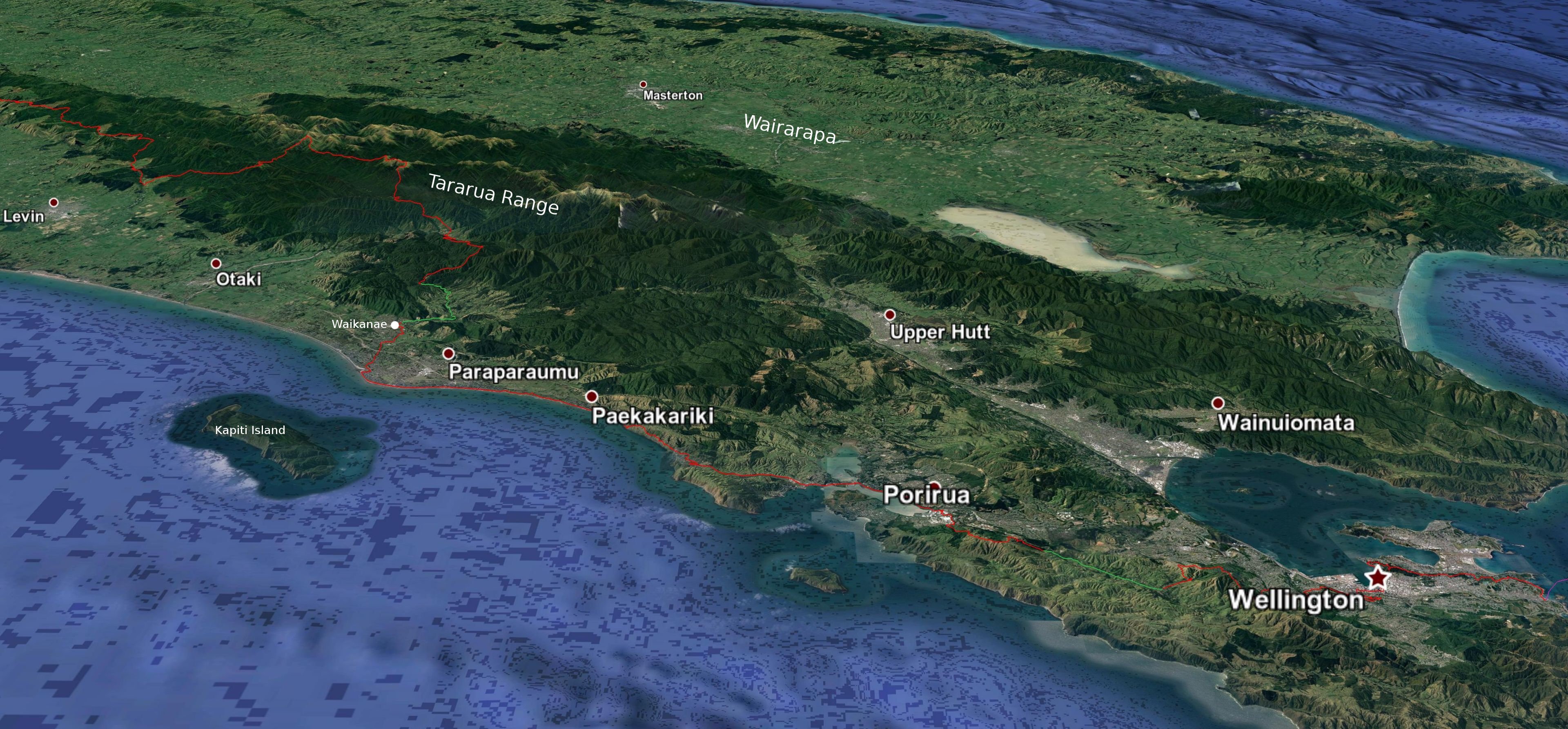
Click 3D map to enlarge, click again to zoom
Island Bay to Waikanae: 91.5 km, 4 days
1. Island Bay to Civic Square: 3 hrs 15, 12.5km (map 84)
3D view east: Island Bay to Civic Square
You will probably want to leave your pack, or most of its contents, in town while you do this bit. I’d also recommend tacking on the 45 mins walk to the Cable Car at the end in order to shave a bit off the walk to Porirua the next day, as this is quite a long walk, with steep uphill bits. You could begin by riding the Cable Car on that day to a start point of its upper terminus (runs every 10 mins from 7:30 am weekdays, 8.30am weekends, $5 one-way). Or even walk through to Ngaio station (2 hrs 45 from Civic Square), take the train back to Wellington ($5), and restart there the next day, so potentially allowing for different start and end points on following days, or simply shortening the day to Porirua. Exiting north of Mt Kaukau at the Old Coach Rd to Johnsonville and taking the train back to Wellington would get you further again in the first day (and mean less pack carrying). You could even do section walks with just a day pack all the way to Waikanae by using the train to return to Wellington city or a halfway point each evening.
Take a number 1 bus (Island Bay) to get to the beginning of the trail. The buses go every 12 minutes or so from the Wellington Railway Station on weekdays, starting at 6:14 am. (They go a bit less often on weekends, starting 7:12 am Saturday and 8:11 am Sunday – see the Metlink timetable). They travel through the centre of the city to Courtenay Place and then head south through Newtown. The journey takes 20 to 30 minutes. Get off at the very last stop, when the bus turns left after the long run down to Island Bay. Opposite is a children’s play area. Head through that towards the sea and at the right-hand end is a rock marking the beginning of the trail. Finding the rock is really the only hard part of the route through to the Civic Centre, as it is marked all the way to Oriental Bay with bright pink Southern Walkway markers. If anything, there are too many markers, spoiling the landscape.
To begin, cross the road to the beach side, and head east, around the foreshore to Houghton Bay. Turn left up Houghton Bay Rd, and turn left off that when you come to a gravel car park and a small level grassed area. Over on the left side of the valley above the field is a wide, grassed road cut into the side of the hill in an even upward incline. This takes you towards Mt Albert, the site of some radio transmission towers you can see from well below. At the top of the grassed road you continue on Buckley Rd, then turn down left on Mt Albert Rd a very short distance to cross over at the Southern Walkway signage. When you get to a flat area behind the radio towers the Southern Walkway heads off on a 4WD track at left and the TA goes up some steps to stay on the ridgeline. When the TA track seems to run out you will see a marker post with faded signage and a TA sign on it ahead of you. This bit is tricky, because the placement of the post suggests you keep going, but if you look carefully at it, a faded pink arrow is pointing to a track down at left for the route ‘to Mt Victoria’. So don’t go past the post. There are two other guideposts further down the track, also with badly faded signage and unhelpfully placed amongst weeds well back from the track. When the path branches, take the right fork. You are back on the Southern Walkway about now. Follow it to the top of an animal enclosure at the Wellington Zoo. Turn right and you reach Melrose Park. There is a tap by the sports changing rooms here.
A little bit of road walking takes you to the top of Manchester Street, where you cross over into the driveway of Truby King Park. (Truby King was a famous health reformer and founded the Plunket Society in 1907 to promote infant care.) Look out for the path downhill off the drive at right as you approach the house – it is marked with a pink Southern Walkway sign and takes you through pine forest. You temporarily exit the Town Belt at a zig-zag into Coromandel St. The route goes along Coromandel St, over a pedestrian crossing on busy Constable St, and up at right on Seddon Tce to pass the Canine Obedience and Croquet clubs to Alexandra Rd. (This is a departure from the Southern Walkway, so you will not see any pink markers along Coromandel St, and you have to watch out for the turn-off into Seddon St. The TA used to follow the Walkway, but I guess it was changed due to safety concerns, as the Southern Walkway crosses two busy roads that don’t have pedestrian crossings. I prefer the old route nevertheless: It turned right from Coromandel to Colville St, then left into Paeroa St and down at right to a track through trees to cross Crawford Rd and then Wellington Rd. Look for the shaped bits of curb on Crawford Rd that have been provided for crossing, but it can be hard to get a break in the traffic.)
You now wend your way alongside Alexander Rd up towards Mt Victoria. Down off to the left are sites where half a dozen scenes from the Lord of the Rings films were shot. One is where the Narzgul rode, hunting for the hobbits in the ‘get off the road’ scene, co-ordinates -41.294575, 174.791781 (S41º18.075′, E174º47.319′ – note that the tree base they hid under was a studio construction, so you won’t find it. Another is an old quarry at the top of Ellice St used for the Rohirrim camp at Dunharrow. You will see tourists parked along Alexander Rd looking for the sites. The TA and Southern Walkway don’t go to the Mt Victoria summit, with its classic postcard view of Wellington, but if you haven’t been it is worth the quick seven-minute diversion to pop up and have a look. (There is a marked summit track – in effect you just stick close to the road, passing some toilets (with a drinking fountain), and when you see a steep, grassy and dirt hill ahead, where the road forks, go straight up that to the pyramid-shaped Byrd Memorial and then on to the very top.) When the Southern Walkway takes a sudden left turn steeply down the hill on a wide pathway after a grassy area watch out for a pink marker at right that puts you on a narrow track to Palliser Road. It is easy to miss this marker. After crossing the road the track continues on along the side of the hill, crossing over two footpaths down to Oriental Bay. Ignore these and keep going to the final path downhill that ends close to the base of Carlton Gore Rd.
Once on the bay, walk along the promenade back to the city. There are toilets opposite the main sandy beach, as well as others beside the small beach following. There is a drinking fountain outside the Freyberg Pool just after the latter beach. After the Freyberg Pool you can hop down some steps to the water’s edge and walk along in front of the boatsheds for a more pleasant stroll than on the main footpath. Turn right to stay on the waterfront when the main road goes left and pass in front of a large apartment block and then the huge mass of the beige coloured Te Papa museum. After Te Papa the wharf turns right (north) and you will see the moored historic floating crane Hikitea. Beside that is a drinking fountain and water bottle top-up stand with the TA logo emblazoned on it. Don’t walk further along the wharf now, but steer a course past the Circa Theatre building, Shed 22 and the large concrete building with LED displays of sharemarket prices on the left, and the Wharewaka, with its faceted black roof and waka (Māori canoes), on the right. Go up the steps onto the road overbridge, with its roughly carved wooden sculptures by Māori artist Para Matchitt, and down into the Civic Square, with the public library before you (closed as of 2025 for strengthening) and the City Gallery Wellington on the right. There is a TA plaque set into the orange bricks on the ground just as you come down the stairs into the Square. (The Square is closed as at Nov 2025, but should re-open well into 2026. Just veer right off the overbridge behind the art gallery to Harris St, cross Victoria St, and continue through Chews Lane to Willis St.)
- The Marion Hostel – 13 Marion St, very central. A boutique kind of hostel. Rooms and dorm bed (with privacy curtains and own power points), about 10 mins from the trail, and opposite Coffee Outdoors hiking gear store, 027 284 3887.
- Cambridge Hotel and Backpackers – 28 Cambridge Tce, an 1883 hotel, not far from Courtenay Place and the Chaffers St New World supermarket, about 5 mins from the trail. 04 801 1950. Use promo code ‘ARAROA’ to get 10% off when booking on website.
- Nomads Capital Backpackers – 118-120 Wakefield St, very central, top-rating hostel, about 2 mins from the trail. 0800 100 066 freephone, 04 978 7800.
- Trek Global – 9 O’Reily Ave, behind St Mary’s Church, Boulcott St. Very central. Discounts to TA walkers who have contributed to the TA Trust. Only available by phone or in-person bookings and max advance booking is one week ahead. 0800 86 8735 freephone, 04 471 3480.
- Hotel Waterloo & Backpackers – 1 Bunny St, across from the railway station and near buses, about 10 mins from New World Thorndon supermarket on Molesworth St and about 1 min from the trail. 0800 225 725, 04 473 8482.
- Haka House Wellington – 292 Wakefield St. It is right next to the inner city’s major New World supermarket, 2 mins from the trail, and near the main bus route that goes through Courtenay Place. 04 890 7893
- Hostels you might find on the internet in out-of-date listings such as Wild Zebra Backpackers, Base Wellington and Laneway Backpackers have all shifted to long-term stay accommodation due to the impact of Covid on tourism.
- i-SITE Visitor Centre – Wakefield St, temporarily opposite bottom of Cuba St, 04 802 4860.
- Department of Conservation Visitor Centre – 18 Manners St, 04 384 7770.
- There are ‘metro’ (i.e. small) supermarkets at 68 Willis St (New World) and 280 Lambton Quay (Woolworths). The big ones in the city are New World at 279 Wakefield St (opposite Haka House) and 150 Molesworth St (probably a bit off your track unless you are staying near the railway station or in Thorndon). There is a Goodfor Refillery at 23 Jessie St, fairly central, with a huge range of bulk bin items; Moore Wilsons nearby on the corner of Tory and College Sts (it is in two halves, the fresh foods section frequented by the well-heeled and the bulk groceries department patronised by restaurateurs); and Commonsense Organics a bit further south up Tory St at no. 147.
2. Civic Square to Porirua: 9 hrs, 33.5 km (maps 84, 83)
3D view south-west: Civic Square to Ōhariu Valley
3D view west: Ōhariu Valley to Pukerua Bay
You might want to think about the location of supermarkets on your route north in terms of when to load up and where you are staying. There are the Wellington ones noted above. Then three large ones in Porirua, but you won’t reach these until after leaving the usual accommodation in Porirua, at Elsdon Camp. There is a New World at Mana and grocery stores/dairies at Plimmerton, Paekākāriki, Raumati and Paraparaumu Beach, and two decent sized supermarkets at Waikanae, but well after the El Rancho camp, if you are staying there.
Civic Square to the top Cable Car Terminus, Botanic Gardens: 45 mins, 2km
Exit Civic Square at its western entrance into Mercer St (with tramping stores Dwights and Bivouac on the left and Kathmandu outlet store on the right). Turn right into Willis St and cross over to the left-hand side as you head north. There is a TA plaque on the pavement here, outside the New World supermarket, and another down the road outside Macpac. The main Kathmandu store is back a little from Macpac on the opposite side of the road. Both are just before you turn left into Lambton Quay, Wellington’s most upmarket street. There is another TA plaque in the pavement around the corner and another about halfway down, outside McDonalds and just after Woolworths supermarket. If you want to go up in the cable car, the easy-to-miss Cable Car Lane is just before Woolworths. At the far end of Lambton Quay is a left turn into Bowen St, the beginning of your hike up to the top of the cable car.
On a fine day, a more pleasant alternative to going through Civic Square and the centre of town from Oriental Bay would be simply to continue around the waterfront from Te Papa until you are opposite Whitmore St. This is a wide street that offers drive-on access onto the wharf and a viewshaft down to the Beehive (NZ’s seat of government) and beyond to the tree-covered slopes of Te Ahumairangi/Tinakori Hill. Head down Whitmore and cross to its left side to reach the Lambton Quay/Bowen St corner.
Walk up the left side of Bowen St, cross The Terrace, and go up the steps to the large, white building with rounded corners in front of you. There is a TA plaque set into the footpath just before it. Go around the right-hand side and you will find yourself in Bolton St Cemetery. Straight ahead, above the tombstones, is a curved ramp leading to a bridge over the motorway. Take the bridge to the other side of the cemetery (it was cut in two by the development of the motorway) and follow the City to Sea Walkway and Northern Walkway signs. Sometimes they have the TA sign as well as you make your way past a playing field, the rose garden and a café all on the right and into a network of paths snaking up the hill. If you lose the signs, just keep heading uphill until you get to the red brick Carter Observatory. A little further south-east is the top of the Cable Car.
Cable Car Terminus to Mt Kaukau: 3hrs 15, 10 km
The cable car terminus was really just a scenic indulgence because you now go back down the hill again, albeit via a different route. Walk down to the main gates of the Botanical Gardens, by going a little more south than the way you came up, down the Downhill Walk (outlined on a map of the gardens by the cable car lookout). There is a rock with a large TA plaque on the start of the path. It goes down to the top of the children’s playground, passes the Tree House, and then the Sound Shell. The path is inset at intervals with a glass mosaic that apparently represents a flowering pohutukawa branch, with three green leaves and a spray of orange and red for the flower. Cross Glenmore St outside the gates and head north and then take a left turn up St Mary’s St when you get to the dairy with the glassed-in verandah above it. The Northern Walkway sign is at the top of this steep street. You follow this path up and around the side of the hill formerly known as Tinakori Hill, but more properly as Te Ahumairangi Hill (Tinakori is a misspelling of Tina-kahore, which was never the hill’s proper name anyway). Continue until you hit Weld St, go down it, cross Wade, then over Margaret St/Cecil Rd, and down Weld’s steps into Wadestown Rd. There are toilets and a pedestrian crossing at right. Cross over, turn left, and after about 50m turn right into Hanover St, and at the end of this there is a display board showing the tracks for the next part of the Northern Walkway. The track entrance is easy to miss – it is just behind the signboard! As on Te Ahumairangi Hill, there are tracks all over the place, and you depart from the Northern Walkway to follow TA ones for a while. The TA route is along the stream, though after a short section beside the stream you have to go up hill and then along the hillside before coming down again. There are TA signs to guide you. You eventually rejoin the walkway and end up on Waikowhai St. Turn right to walk north along this, through a roundabout where it becomes Ottawa Rd, and just after this point is the red brick Ngaio Town Hall and Library, with the last toilets on the route.
Continue on Ottawa Rd to pass the town hall and library, then turn left behind the building into Cummings Park. Stay above the children’s play area to take a track through to Awarua St. (If you are hungry, you can instead reach Awarua St by staying on Ottawa Rd to pass Cafe Villa (though I do not recommend the muesli) and join the street when it meets Ottawa Rd.) At the very end of the long, uphill Awarua St is Bells Track. This brings you up onto the ridge line. Then you go north to reach the summit of Mt Kaukau (445m). This is the high point with the huge transmitter tower on it that you would have seen from various points earlier. There are great views all along here, but it can also be very windy, and sometimes you may be in cloud. If you want to bail out, you can take the track downhill to the east from the lookout to Woodmancoate St and catch a train back to Wellington or, further on, leave where the Old Coach Rd starts and descend into Johnsonville, head east, and again, catch a train.
Mt Kaukau to Colonial Knob: 3 hr 20, 14 km
Continue north and then down off the ridge to the left on the Old Coach Road, until it joins the end of Rifle Range Rd. It is all well signposted. Continue straight through an intersection. Continue for about 5 km of road walking along Ōhariu Valley Rd. Then at right you will see a large sign marking Spicers Forest, a car park, and a wide sealed road behind a gate going uphill. Head up this road, and after some distance a small post marks the turn-off for TA walkers to the left. Note that despite the TA sign at the Spicers Forest turn-off, the map shows an alternative route at the head of Ōhariu Valley Rd. That should be fine too. In either case you will be in pine forest on what seems to be a mountain bike trail. It is marked with yellow/green circles on the trees. You come out to walk along a fence line and cross a stile. On the other side is a large sign claiming 2–3 hours to Elsdon Camp. It is more like an hour. The route up to Colonial Knob (468m) is marked with blue painted poles. Again, it may be very windy on the top, but there are really great views, extending from Wellington Airport in the south to Waikanae in the north, and off towards Australia in the west (no, you can’t see it!) If the weather looks like it is going to be really unpleasant on the top you can take the track for Raiha Rd from near the stile. Or earlier, don’t take the left turn of the Spicer Forest Rd, and continue along the forest road into Broken Hill Rd, past the landfill and again eventually reach Raiha Rd.
Colonial Knob to Elsdon Camp: 45 mins, 4 km
From here it is down the other, northern, end to come out by Camp Elsdon on Rahia St. You will probably want to stop here, as it is the only cheap place in Porirua. But note that it is another 40 mins or so to the supermarkets.
Elsdon Camp to Porirua Station: 40 mins, 3 km
Turn right (south) along Raiha St and after about 200m (beyond the intersection with Makaro St), immediately past number 41A and next to the 70 kph signs, turn left up the bank into the Raiha Walkway. This passes to the north side of a long line of pine trees. When it ends turn left a bit along a driveway (Heriot Dr) that serves Te Wānanga Aotearoa, a modern building with a tall carved pou (Māori pole) outside it. Turn right into Hagley St and across the roundabout and busy Tītahi Bay Rd. The railway station is in precisely the direction you are travelling (east), but there is a shopping mall and a jumble of buildings in the way. It the North City mall is open, it is quickest to enter that, get to the ground floor and keep going east, making sure to avoid the left branch when it divides near the end. You will now find the New World supermarket at your left when you exit and Station Road beyond that. Alternatively, go round the damn mall by walking right along Tītahi Bay Rd.
- Lois & Rohan, Ngaio – Near Cummings Park, Ngaio, 5 mins from the trail. Open Wed, Thurs, Fri, and Saturday nights. Walkers can camp for up to 2 nights for $15pp & can have a daily shower, use the washing machine & drier, charge devices, and ‘we provide free-range eggs for them to cook how they want, bread, spreads (often including fresh avocado) tea, coffee etc, shampoo, body wash, sewing kit etc.’ Please contact 24-48 hours ahead to check availability. 022 165 9233 (text only please), lois.hart2 @gmail.com (Confirmed correct Sept 2025)
- Camp Elsdon – 18 Raiha St, Elsdon, Porirua, 04 237 8987, camp_elsdon@xtra.co.nz. This is oriented towards groups but casual visitors are also welcome. The cabins are cheap ($35) and sleep 2–7 people, and there is a lodge that you can stay in if it isn’t full with a group. Sleeping bags required. Tent sites also, $30. Prices Sept 2025.
- There are three large supermarkets in Porirua. New World is about 150m north of the station, Woolworths 200m further north again, and Pak’nSave 200m more again.
3. Porirua to Paekākāriki: 6 hrs, 23.5 km (maps 83, 82)
3D view east: Pukerua Bay to Reikorangi
Porirua Station to Plimmerton Station 1 hr 45; Plimmerton Station to Pukerua Bay Station 1 hr 20; Pukerua Bay Station to Paekākāriki Station 3–3.5 hrs.
Beginning at the Porirua train station at Station Rd, walk north along the western side of the waterway and then turn right onto the road overbridge that crosses both the motorway and the rail line. Over the bridge, continue north on the side of the highway for about 500m until a pathway leads off the right. This links into Okowai Rd towards an area of pine trees. Enter the pine plantation via the driveway to the Adrenalin Forest high-wire confidence course and continue on the sealed road as it circles around and goes uphill to the Italianate Gear Homestead built in 1887 by meat magnate James Gear. (It has a café open over summer Wednesday to Sunday as at Oct 2022, and toilets in a separate building at the top of the grounds.) Walk along the driveway and out of the homestead grounds back onto Okowai Rd, opposite Aotea College. Continue north along the road, then left into Whitford Brown Ave and over the pedestrian crossing to Aotea Lagoon (more toilets here). Traverse the children’s playground at the north end onto Papakowhai Rd. About 800m north on this road take the pink pedestrian overbridge to Paremata Station and then the underpass off the platform to bring you back onto the right-hand side of the tracks. Continue through the car park and onto the footpath that takes you across the road bridge over the estuary at Paremata. At the end of the bridge go down the wooden walkway to the left and under the railway bridge.
Continue north again, with the railway line on your right and Ngāti Toa Domain further along on the left. If you need to visit a supermarket you can cross the railway line at Mana Station and pop into the New World supermarket just north of it. Otherwise, stay on the path until it goes around the foreshore and reaches Steyne Ave at the point where the street crosses the railway. Turn slightly left into Steyne Ave. Just before the shops and cafés, at the north end of the Plimmerton railway platform, is a sign for the Ara Harakeke Pathway (which you have been on since Paremata Station).
- Moana Lodge – 49 Moana Road, Plimmerton, 04 233 2010. Has shared room beds at $50 (Sept 2025) plus double, triple, etc rooms.
- Alicja Gear – 28 Muri Rd, Pukerua Bay, close to trail. Has a lawn for camping, plus offers showers. Also an Airbnb (Mount Welcome Shearers Cottage) which can be occupied for cheaper rates for TA hikers if arranged by phone: 022 087 7064.
The walkway is well marked and takes you to Pukerua Bay. It goes across Plimmerton Domain, then along Ulric St at the back of a light industrial area and into Northpoint St. A turn-off to the right 50m up puts you onto the pathway alongside State Highway 1 and Taupō Swamp to the Pukerua Bay shop. (The swamp is full of flax, or harakeke, and ‘ara’ means way or path, hence the name of the trail.)
Escarpment Track (Pukerua Bay shop to Paekākāriki Station: 3–3.5 hrs, 11.5 km)
Twenty or so metres north of the Pukerua Bay shop are some toilets with a large Te Araroa panel showing the route along the Escarpment Walkway from here. Top up on water as there is none that’s drinkable on the track. To get onto the track, continue north a few minutes to cross the pedestrian overbridge, take the right-hand path to backtrack parallel to the motorway on the other side, and turn left to the Pukerua Bay Station. Take the underpass beneath the railway to the station car park and turn left. From here TA signage is clear and frequent through to Paekākāriki. If you plan to do the Escarpment section as a section walk and are coming from Wellington, then check out the Metlink Explorer day pass train ticket. This should be cheaper than two one-way tickets. And if you are arriving by car it may be best to park at the station rather than the Pukerua Bay shop (which has limited parking) – or better yet, park at Paekākāriki and take the train back to start walking so your car is ready and waiting when you finish.
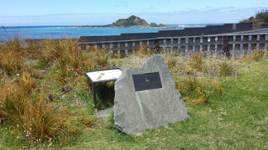
The track along the hillside is narrow and exposed to sun and wind, and at times goes far above the highway that wends around the coast. The official track notes warn people who suffer from vertigo not to attempt it, but if you have traversed the peaks and saddles of the South Island TA trail then you will not be worried. Even if you stumble and fall you won’t go down too far here. There are two swing bridges, but they are wide and well secured from swaying. The views out over to the South Island in the south-west and Kāpiti Island in the north-west are stunning. There is a certain amount of climbing up wooden stairways and, towards the end, a long descent to a section that runs close to the rail line. This finishes by ducking under the road overpass to cross to the west of the highway as you approach Paekākāriki. A pathway then runs through the trees parallel to the main highway. At its end, cross the railway line into Beach St and through the village to the sea.
If you don’t want to do the Escarpment Track, you can walk along the beach at Pukerua Bay and then on the footpath along Centennial Highway to Paekākāriki. Begin by turning left into Teihana Rd, just before the Pukerua Bay shop, then go right into Rāwhiti Rd. There is a track at the end of it to the beach. Turn right by toilets at the bottom and continue along the coast.
- Paekākāriki Holiday Park – 180 Wellington Rd, behind the surf club (20 mins from shops), 04 292-8292. Cabins (cheapest $100 for 4), tent sites, and a 30-person lodge with bunk rooms. Would pay to check that you can stay in the lodge as an individual rather than needing a large group. Also, if the website requires booking 2 nights minimum just phone and say you only want one.
- Fergus and Nicky offer a sleepout at 136 Tilley Road, Paekakariki. Laundry, bathroom, etc. facilities and meals. Hikers are welcome to take the train from Wellington, leave their stuff here, train back and walk the route. 021 163 3178 (primary number), 022 128 6294, fbwheeler@proton.me (Confirmed correct Oct 2024)
- Airbnb.com and bookabach.co.nz have other places to stay in the settlement and could be worth checking plus there is the Belvedere Motel (very cheap for a motel) and Finn’s hotel in Paekākāriki.
- Paekākāriki village has a dairy/grocery store, a couple of cafés, two fruit and vegetable shops and a pub. The church on the corner has a tap on its eastern side where you could fill up with (holy?) water.
4. Paekākāriki to Waikanae: 5hrs 15, 22 km (maps 82, 81)
This is an easy, straightforward section: basically along the beach until you reach the Waikanae River, then up the south bank, cross over a bridge and up the north bank until you get to SH1. Here is the detail:
From Paekākāriki village, head down Beach St to the beach, and turn right and walk for about 20 mins north, passing the community hall and sports club to reach the surf club. There are toilets here. (In fact, there is no shortage of toilets all the way along the section. Nor of cafés.) Go past the surf club, then find the wooden footbridge bridge over the stream. You will come to the McKays Crossing Track sign. That’s what you want. It is a dirt track through coastal dune lands. If the tide is not too far in you could walk on the beach, but there is plenty of beach walking coming up. The track ends at Whareroa Rd. Turn left towards the beach on this road to the picnic area and then right along a sealed road to a car park. Here is a sign reading ‘Coastal Track to Raumati’, and a TA marker. The northern end of the track was damaged by coastal erosion in 2018, and if it remains so you can either walk on the beach if the tide is low enough or use the Inland Track (named Te Ara o Whareroa Trail). At the end of the Coastal Track you join suburban roads, and here you can turn left onto the beach, or go a bit further to Jeep Rd and turn left to the beach there. If the tide is high it may not be possible to walk on the beach, so you will either have to use the rough, and at times sandy, platform above the beach, or use the roads that parallel the beach amongst the houses.
You will pass Raumati Beach village, which has quite a nice and well shaded picnic and children’s play area close to the beach, with an abundance of cafés and restaurants, a small Four Square, a dairy, and take-away outlets further back. There is a bridge over the stream. Continue on the beach and the next settlement is the larger Paraparaumu Beach, with a picnic area next to the beach and again, further back, more cafés, shops, and a small supermarket. There is some accommodation here (see below).
You leave the beach at Waikanae River estuary, which is preceded by two large yellow marine reserve marker triangles. Behind these is a track. If you can’t find it, it is just as easy to go around into the estuary and meet up with the road adjacent. A little way along the road opposite Hadfield Place is an interpretive display about the estuary. Take the track marked ‘Waikanae Estuary Walkway’ that leads from the display. It eventually starts going upriver. When you reach Otaihanga Domain cross to the north bank of the river on the large wooden footbridge and continue up river on this side. There is a small wooden bridge to the right further up. Go over this. You will still be on the north riverbank, and go under the huge concrete expressway bridge and eventually reach the SH1 bridge over the river. Turn left at the bridge on the downstream side and a few hundred metres along the side of the road to the north are the Waikanae shops. They include large Countdown and New World supermarkets. There are no backpackers in Waikanae and the El Rancho campground no longer takes individuals. I chunked my sections with a stop at Waikanae, but with El Ranho being unavailable this is now less feasible. However, the Kapiti Holiday Resort is only 4 km before El Rancho (though 9 km before Waikanae centre) so you could stay there and make a longer day the next (pretty long – about 11 hrs). Or, better, make this a longer day (32.5 km flat walking) and get to the end of Mangaone South Rd, with a café break in Waikanae. Or, use the train from Waikanae to go south to stay somewhere overnight and come back the next day.
- Marie Bismarck – A trail angel living near the trail at Paraparaumu Beach with camping, water and shower for Te Araroa hikers. mariebismarck@gmail.com. (Possibly not still operating – no reply to my emails Nov 2025).
- Kapiti Holiday Resort – 16 Beach Haven Pl, north of Paraparaumu Beach, 04 298 5932. Small campground, no cabins and no unpowered tent sites but you get a private bathroom, $52 for 2 people for a powered site (Sept 2025).
- El Rancho – 58 Weggery Drive, Waikanae Beach, 04 902 6287. You would have seen a sign for this on your way up the river. It now only offers accommodation for groups of 14 or more people, but I am leaving this listing here so you understand this and don’t assume you can stay.
- Birdsong Cabin B&B – Winara Avenue, Waikanae. Close to the shops. 04 293 8748.
- River Pā – 20 Reikorangi Rd, near Waikanae. Self-catering, hot shower, mattress in a hall, staying marae-style, $10 koha. 022 053 3618. (Confirmed correct Oct 2022)
Waikanae to Makuhika via the Tararua Range: 77.5 km, 4 days
The section through the Tararua Range that begins at the Pukeatua Track and goes through to Scotts Rd in the Manawatu section can be challenging tramping. The Tararua Range is notorious for mud, tracks broken by tree roots, fallen trees, numerous stream crossings, and wet, misty, windy weather. You can see from the km vs hours indicated that progress can be a slow 1.2km/hr in sections. There are great views on good days from the high, open ridges, but on bad days these can be dangerous places. Statistics show that the ridge tops are in cloud 78% of the days in a year: people do get lost and some have died from exposure. And 5,000mm of rain per year falls on the western side of the range (where you are going, with much of this in summer). By comparison, NZ’s notoriously wet Milford Sound, gets only a tad more at 6,400mm. So get a weather forecast before you start! Try NIWA for Arete Hut (indicative for the ridges you will be on), or YR for Mt Crawford, your high point for your first day on the tops. And consider a bit of extra food in case you get stuck in a hut waiting out the weather (or worse, lost).
Speaking of food. It will take you six to seven days to Palmerston North. So this would be the longest stretch on the TA after the Richmond Range and you will need to be carrying a fair bit of food unless you exit to Levin after the first three days.
5. Waikanae to Parawai Lodge, Ōtaki Forks: 8 hrs 45 mins, 24.5 km, (maps 81, 80, 79)
3D view north-west: Reikorangi to Waitewaewae Hut
This is 10 km road walking on sealed roads followed by a tramping track that includes an ascent of Pukeatua (812m).
From Waikanae village head south 150m from the railway station to Elizabeth St that crosses the railway line and heads east. It is the only road doing so from Waikanae. This becomes Reikorangi Rd after 1.5 km and roughly follows the Waikanae River. At all the following junctions take the left-hand road: At Reikorangi the road branches left to Ngātiawa Rd by a church. Take Ngātiawa Rd for a short distance then turn left into Mangaone South Rd (there is a shelter on the corner). Stay left when the road branches 5 km further on to reach the car park (no toilets) 2hrs walking from Waikanae at the beginning of the tramping track. You want the Pukeatua Track at right, not the Mangaone Walkway. They are clearly marked.
There is a gravel road and a gate and then a 4WD track through pine forest. The area adjacent to this is private land and you need to stay on the track. There is a small stream crossing a short way in from the car park, and then no water source until the end of this section. The track heads steeply up a ridge to Pukeatua and then down the other side along the ridge to another river valley, formed by the Waiotauru River. It is about 3 hrs 15 up and 2 hrs down. You encounter the Fenceline Loop Track near the bottom. Turn right into this for the quickest way down, then left, to reach one of the Ōtaki Forks campsites, with a toilet and water from a tap. There is an information board here showing all the places where camping is permitted (which is just about everywhere except the picnic area past the warden’s house). It is about 2 km further down the road to Parawai Lodge, just above the actual forks themselves, where the Ōtaki River meets the Waiotauru River. You go through the picnic area and across the swing bridge to reach it. Even if you don’t stay in the lodge, the best camping spots are near it, and you can access the river more easily than the designated camping areas along the road.
If you want to exit the track at this point it is 10km down the road to Ōtaki. This has been closed for several years due to a major slip but is now open again.
- Doc campsite Mangaone South road end – There are new toilets and three campsites here now by the car park at the start of the Pukeatua Track.
- Missy Sinai – Near end of Mangaone South track as well. Has a shower and campsites, 027 655 7012. (Confirmed correct Oct 2024)
- Otaki Forks DoC campsite – The first camping area you come to after coming down off Pukeatua and before Ōtaki Forks. Bookings not required. $10 per night, collected by campsite caretaker.
- Boilles DoC campsite – at Ōtaki Forks by the swing bridge that leads to Parawai Lodge. Cooking shelter, flush toilets. $10/night. Booking required.
- Parawai Lodge – Standard 18-bunk DoC hut. An older style of hut, well worn, but still comfortable. Booking not required.
- There is little point exiting to Ōtaki from Ōtaki Forks. If you really do want to get out of Otaki Forks, transport options are:
- Paraparaumu Taxis 04 296 1111; Kapiti Coast Shuttles 04 298 3335, 027 556 1735.
6. Parawai Lodge to Nichols Hut: 11 hrs 45, 18 km (maps 79, 78)
3D view north-west: Waitewaewae Hut to Makahika
Parawai Lodge, Ōtaki Forks to Waitewaewae Hut (16 bunks): 5 hrs, 10+ km (map 71)
Cross a swing bridge over the Ōtaki River. A hike up a hillside then detours to skirt a slip and develops into a well graded track along an old tram track. Unfortunately, this is interrupted by another slip detour that climbs around spurs high above the river for a considerable distance. It is marked by a large orange triangle heading up to the right. The track is extremely rough and difficult going, consisting of much up and down, tree roots, fallen trees and mud. The alternative of the old track may be a bit shorter but has its own problems and is not advised: you have to detour around the slip down to the river and then back up to the tram track guided by a combination of red spray-painted splodges, pink tape and white markers. The tram line ends at Saddle Creek and you follow a very rough track beside, and sometimes in, the creek up to the plateau. You may get wet feet in the process and the markers will be hard to see in places. Note that both the old track now affected by the slip and the new detour are shown on the NZ Topo map, but the official TA map marks the detour as the proper route. There is further commentary on the two options on the Tararua Tramping Club’s page.
Once you get near the hut a signpost marks a shorter, dry weather route down the Arapito Creek to the Ōtaki River. This is given as 20 mins, vs 30 for the alternative route marked on the TA map which skirts up around the river and is in fact about 40 mins and involves a fair bit of climbing. You will probably have to wade the Ōtaki River on the shorter route though, and it may or may not be clear where to climb up by a small creek to walk along the banks to the hut (the spot opposite the hut would require you to swim). Waitewaewae Hut is a pleasant one and, as noted, has swimming below.
Waitewaewae Hut to Nichols Hut: 6 hrs 45 mins, 8 km (maps 71, 70)
Continue along the riverbank and cross the Ōtaki River via the swing bridge. You are now in for a killer of a climb, gaining some 1000m in 3 km. Eventually you reach Junction Knob where you turn left for Mt Crawford (1462m). You could always go right at Junction Knob and walk the hour to Anderson Memorial Hut along the ridge if you want to spend more time on the tops, or if the weather is bad (Nichols Hut is 90 mins away) or you believe Nichols Hut will be full. But you will need to retrace your steps the next day. Otherwise, climb to Mt Crawford and then descend along a ridge, with three gentle climbs to minor peaks on the way, before you get to the shoulder just before Nichols peak. The hut is 10 mins down off to the right here.
The weather is always something to carefully consider before going onto the tops of the Tararuas. In strong wind or rain it may be better to wait for clearer weather at Waitewaewae, as once you are out of the bush and along the high ridges it is very exposed. The nearly 12 hrs it may take you from Ōtaki Forks to Nichols means you will be very tired by the time you are on the ridge tops, and being repeatedly blown over up there by gale force winds will only push your exhaustion to the limit.
- Waitewaewae Hut – Standard 16-bunk DoC hut.
- Nichols Hut – Standard 6-bunk DoC hut. It is small and a very cramped space for six people to share, should it be at capacity. And putting up a tent may not be very feasible as there is little flat or cleared land. If you end up stuck here in bad weather for a day or more with five others in the hut you will have an experience to remember!
7. Nichols Hut to Te Matawai Hut: 8 hrs 15, 11 km (map 78)
Nichols Hut to Dracophyllum Hut (2 bunks): 3 hrs 30, 5 km
Continue up to the top of Nichols and then left along a ridge line north, at right angles to the one you’ve arrived at from Mt Crawford. It is mostly through stunted bush but with open areas amongst tussock and small shrubs at the Kelleher and Puketoro peaks (both unmarked). Tiny Dracophyllum Hut is bright orange and in amongst the trees. The hut is named after the shrub/tree that often looks like something out of a Dr Seuss book, with a clump of slender leaves at the end of a long branch.
Dracophyllum Hut to Te Matawai Hut (18 bunks): 4 hrs 45, 6 km (map 70)
More ridge walking through bush, via Butcher Knob, ending with a strenuous climb up the clear tops of Pukematawai (1432m). Then you turn north-west down the Northern Crossing Track over open tops to a fork. Keep left and it is less than a kilometre through bush to Te Matawai Hut.
- Dracophyllum Hut – Basic 2-bunk DoC hut. Free to stay. You could potentially put up a couple of tents here if you need to stay and the hut is full, but there is not a lot of open ground.
- Te Matawai Hut – Standard 18-bunk DoC hut.
8. Te Matawai Hut to Makahika Camp: 8 hrs, 19.5 km (map 77)
Te Matawai Hut to Poads Rd, 6.45 hrs, 15 km (map 77)
You now go along the Dora Track, on Dora Ridge, passing Yeates Track on your right to arrive at Richards Knob. Turn left after Richards Knob instead of going right down Gable End Ridge track. The first part of this is slow and tough, and it takes about 3 hrs 15 mins to get to Waiopehu Hut, but the 9km downhill from the hut is a 3 hrs 30 mins of fast and easy walking. (If you stayed at Dracophyllum Hut then Waiopehu Hut would be the next logical place to stay.) Take the left track at the fork at the end of the ridge to emerge onto farmland where the route is indicated with blue discs. You then enter Poads Rd, which joins Gladstone Rd at a large one-way bridge after 1 km. Turn right and go north-east to Makahika Camp (3.5 km), past the wooden Greek Orthodox church. Or keep on the same direction south-west to go to Levin (9.2 km).
Alternative Route 1: Te Matawai Hut to Poads Rd via Gable End Ridge Track, 14 km (map 77)
The route from 2018/19 to 2023/24 took the Gable End Ridge track at the end of the Dora Ridge. This saved the difficult remaining part of the Dora Ridge section. However, it has its own issue, as the route was changed again in 2022 due to a slip in the Ōhau River gorge. So, when you get to the end of the ridge you now turn left to go up the Six Disks Track after crossing the suspension bridge over the Blackwater Stream. This joins with the Waiopehu Track on a ridge, and you turn right down this to emerge from the bush into farmland, where the trail is indicated by blue markers.
Alternative Route 2: Mangahao River track (maps 77, 76)
You may save time and effort with the Gable End route (at least when you could go down the Ōhau River at its end) compared with going via Waiopehu Hut, but a more radical shortcut again would be to take the right track at the fork mentioned above just before Te Matawai Hut down to Mangahao Flats Hut and the Mangahao River, with its No. 1 and 2 reservoirs. That will mean a longer day if you are coming from Nichols Hut, but you could stay at Te Matawhai and back-track a bit the next day. There will also be a fair bit of road walking down here (although compare that against the road walking of Poads and Gladstone roads), and you may be able to cut across before the second reservoir to join up with the Makahika–Mangahao Track. This may involve bush bashing, as there is no track. And finally, you will potentially miss out on the pleasures of Makahika Camp.
- Waiopehu Hut – Standard 18-bunk DoC hut. The original Waiopehu Hut was built in 1927 and was the first in the northern Tararua Range. The current one is more modern and rather nicer than Te Matawai. And you get great views from it.
- Makahika Outdoor Pursuits Centre – 865 Gladstone Rd. This offers residential outdoors courses for school kids, confidence building for the at-risk unemployed, and leadership courses for managers but the camp itself is not a public space, nor open to TA hikers to wander around in. However, Sally and John Duxfield who run it are also generous and welcoming towards TA hikers, and can provide a camping site, shower, toilet, outdoor kitchen and a power supply for charging devices (no wifi here, but mobile reception exists). To find the TA camping spot, go right, after you enter the double gates, and find the space outside the little black shed and white marquee. The owners can hold bounce boxes for you at no charge. They may be able to take you to Levin for resupply but ONLY IF they happen to be going. Alternatively, Levin Taxis (06 368 4179) charge $45 one way for a van, regardless of the number of people. Or you can do an online shop with New World and get the food delivered but you need to book this in 3 to 5 days before you arrive (delivery address is Top House, 865 Gladstone Road, Levin 5571). Avoid the Woolworths service. Cost to stay is $15 per person per night and you can pay with cash into a box in the little black hut (whare). Pre-paying electronically in advance is possible too – bring a receipt with you. This is used to support Sally and John’s youth justice programmes. Please don’t abuse the pair’s hospitality: remember that their home is not a hotel; and don’t help yourself to food or other supplies in the camp kitchen. 06 367 8438, 021 725 593 (text, don’t leave phone message) or email director@makahika.co.nz (Checked Oct 2022)
- Levin Holiday Park – 38 Parker Ave, 06 368 3549.
– Always check the Trail Status pages of the official Te Araroa website for recent changes or alerts on the trail.
– To download this page see instructions on the Home page.
– Make a donation to support this site.
Updated 15 March 2026
