
 Click 3D map to enlarge; click again to zoom
Parata Rd, south of Ramarama 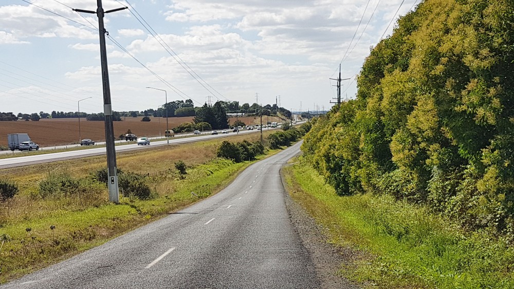
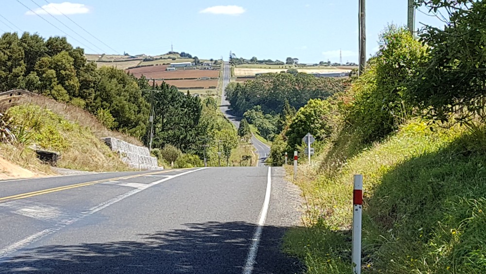
Hillview Rd, south of Ramarama 
Great South Rd, just north of Drury 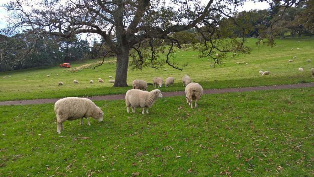
Sheep on Maungakiekie – One Tree Hill 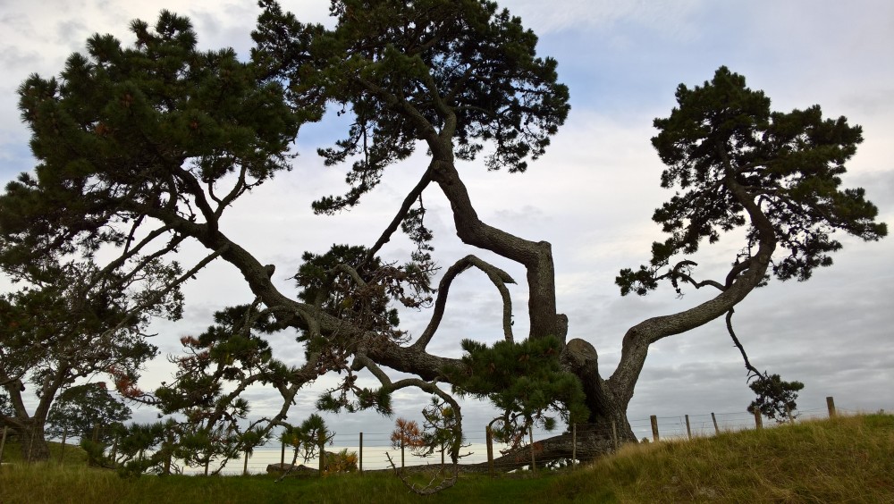
Pine tree on Maungakiekie – One Tree Hill 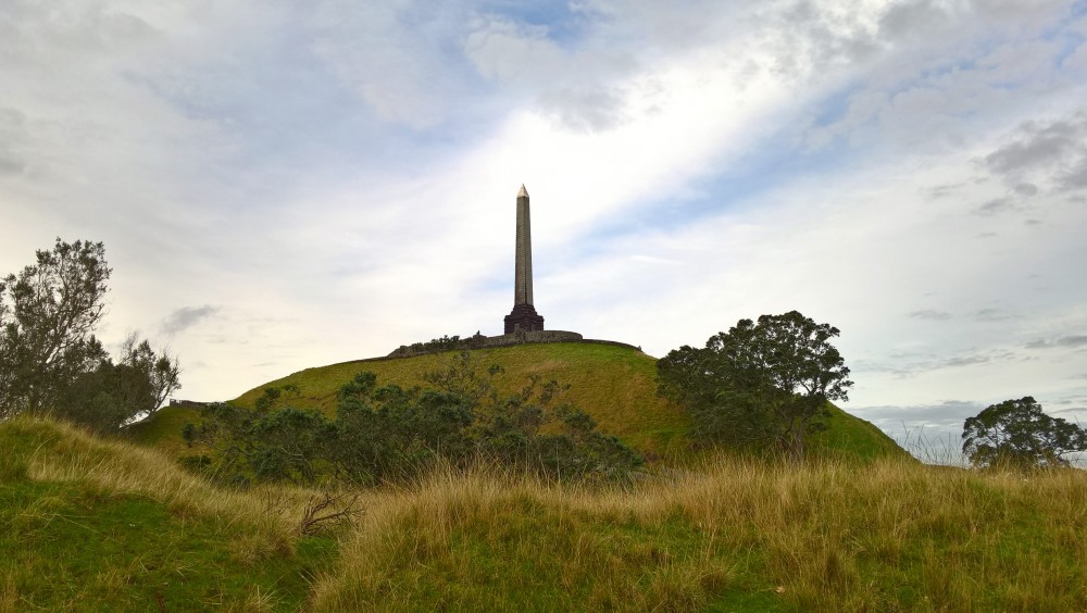
Maungakiekei – One Tree Hill 
Puriri Drive, Cornwall Park 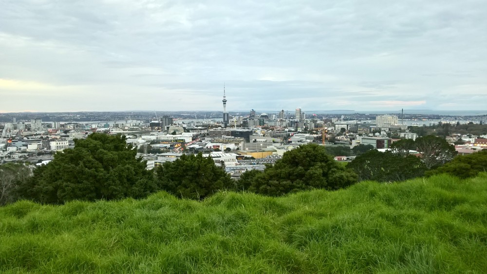
City from Mt Eden 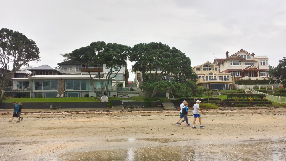
Beachfront homes Takapuna, North Shore 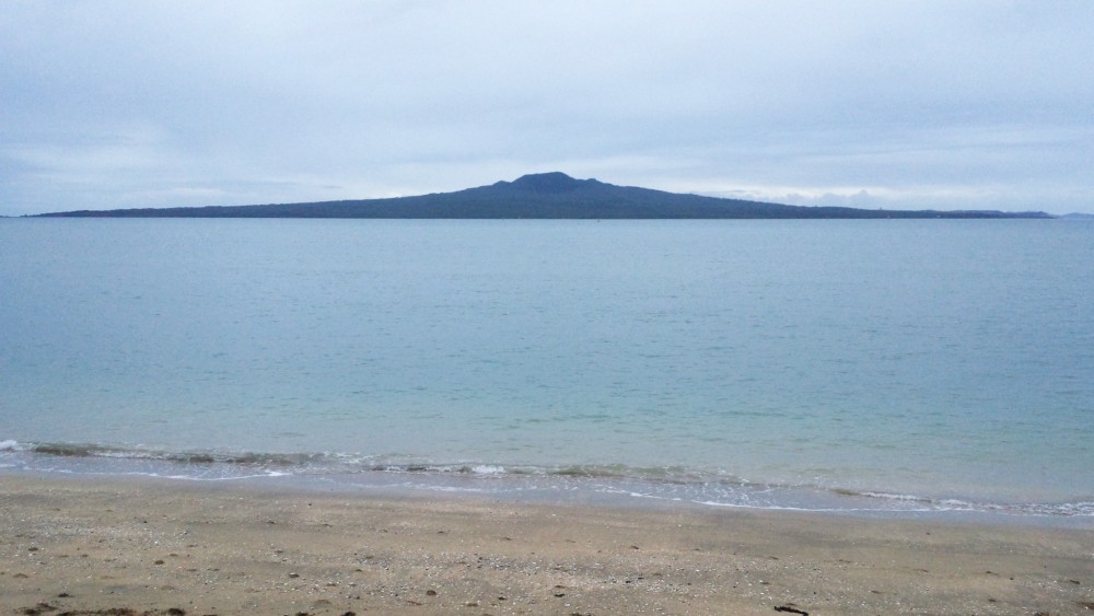
Rangitoto from Takapuna 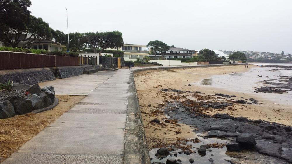
Beach front walkway, Milford, North Shore 
Birds on wires, Rothsay, North Shore 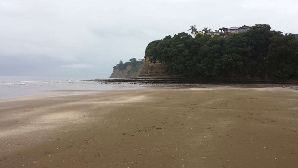
Beach and head, North Shore 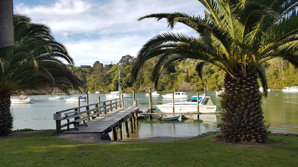
Stillwater campground 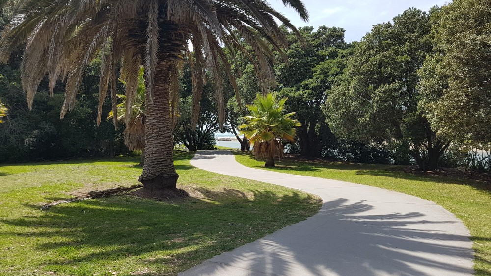
Path to Orewa Beach 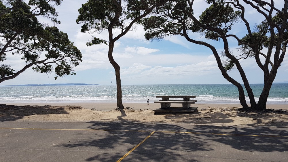
Orewa waterfront 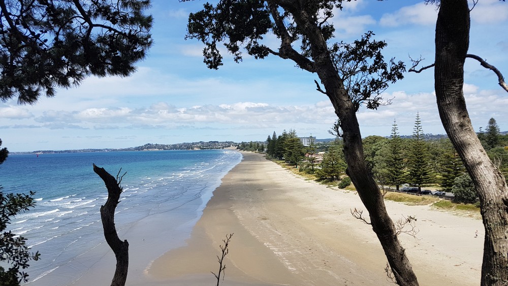
Orewa Beach 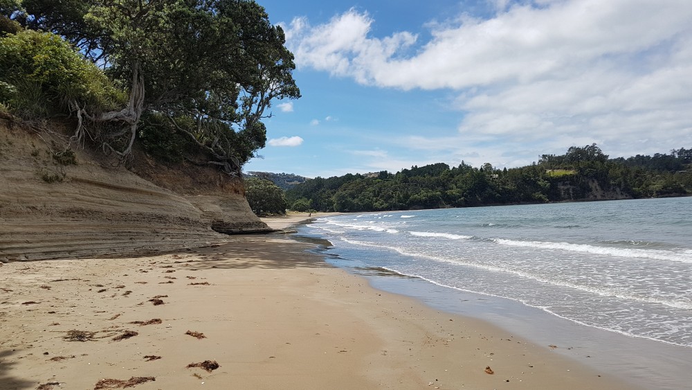
Hatfields Beach 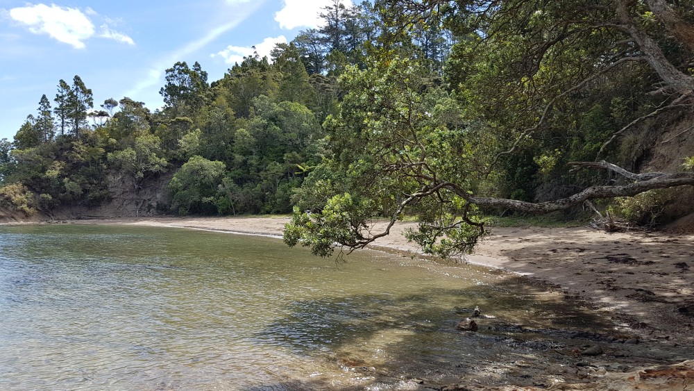
Between Hatfields and Wairewa Beach 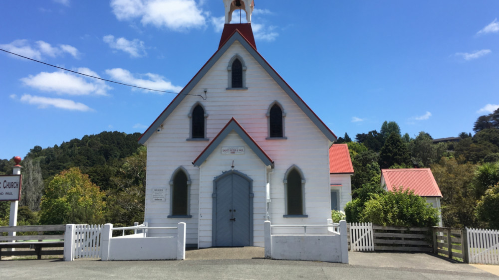
Church at Puhoi 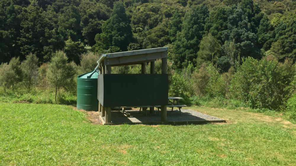
Remiger Rd campsite Puhoi 
The old boat, near Govan Wilson Rd 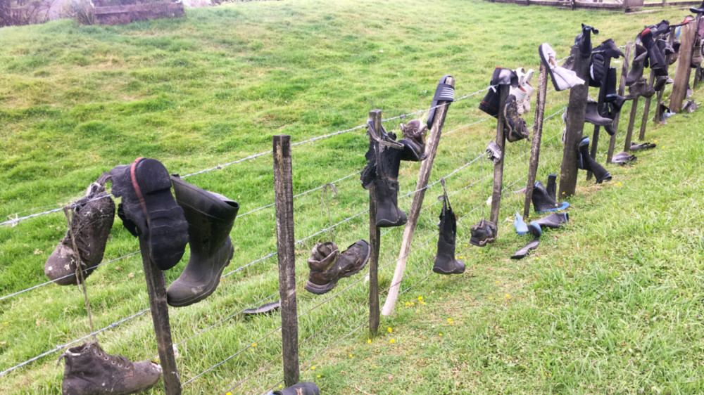
Gumboot fence, Govan Wilson Rd 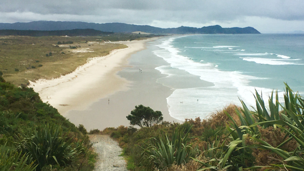
View from Te Ārai Point of Pākiri Beach north
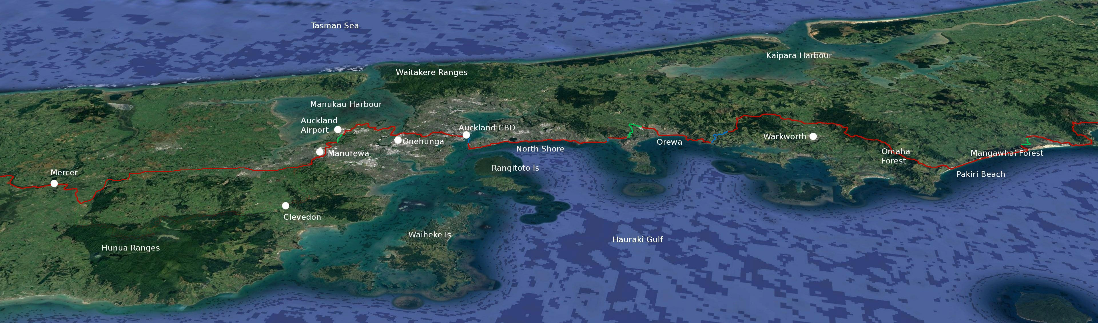
Mercer to Auckland CDB waterfront: 95 km
3D view west: Mercer to Auckland CBD
39. Mercer to Ramarama: 7.5 hrs, 29 km (maps 34, 33)
In general, the route from Mercer to Auckland city (increasingly known by its Māori name of Tāmaki Makaurau) is difficult to break up into useful stretches due to lack of reasonably priced accommodation. I did it by staying at the Ramarama motor camp, but that is now closed. Your options around here are now staying at Heavens Rest near Bombay, 23 km from Mercer, or Lynley Jacobs, 25 km from Mercer (both listed at the bottom of this section). Or you could take a train into the Auckland CBD from Pakuranga or closer in, and stay in town and leave your gear there to train back and keep walking. With few suggestions to offer on how to break up the section from Mercer to Auckland with places to stay I have simply chunked it for convenience as follows (let me know if you have a solution to the accommodation desert in this region):
Mercer to Ramarama: 29 km
Ramarama to Manurewa: 18 km
Manurewa to Ambury campground, Māngere: 30 km
Ambury to Auckland ferry terminal: 20.5 km
Mercer to SH2: 3 hrs, 12 km (map 34)
Walk the marked route from the Mercer Service Centre that follows the motorway north for 1.5 km. It runs down below and at the left side of the motorway. Turn right to go under the motorway and the railway line. Get onto McIntyre Rd, a little-used gravel road serving only a few houses. There is a school bus shelter a short way along. As you gain elevation there are views across the Fish and Game swampland, and a relaxing shady section after its start at Kellyville Rd. After heavy rain and when the river is running high, this route may be under water – in which case, use the Koheroa Bypass as an alternative. The natural swampland here is how much of the land in the region looked before it was drained and modified for farming. Where the road ends is a pump station with an Archimedes Screw for drainage. Continue following a drainage ditch along the side of the swamp and then take a sharp right-hand turn to follow the stopbank, another ditch, and the Mangatawhiri River. From the stopbank you can overlook a little-seen corner of NZ, with its Dutch Polder-style agriculture (where land is surrounded by banks and constantly drained by pumping, since it lies below the level of surrounding waterways). The stopbanks can be dense with thick grass, making progress slow. In autumn Paspalum grass seed heads will layer their horrible sticky secretion all over your legs and poles. This does wash off in water though.
Halfway across there is a steel post with an orange marker to denote a crossing over the Mangatawhiri River. So turn left to cross, climb the stopbank on the other side and follow it for 330 metres to a farm track. Follow this for 1.8 km (it becomes Dobson Rd), to a farm gate and turn onto a farm track at left. Follow this for 450m, to another left turn, then go 140m to a right turn. Keep on this for 620m and follow a line of trees to reach a farm gate that enters onto Serpell Rd. Follow this to SH 2 – a very busy and dangerous highway. If the river is too high to cross, just keep going to reach SH 2, and turn left onto it and continue to reach the TA route at Serpell Rd. This was the official route until 2023/24, but it means more walking on a dangerous stretch of highway.
Due to storm damage and kauri die-back disease the former Hunua Ranges section has been closed for some time and there seems little prospect of it re-opening. (View the map on the Auckland Council website and look for the Mangatawhiri Track to see if it remains closed – see these old TA maps to check to location: map 31, map 30, map 29). Key track closures are the one through the Mangatawhiri Forest at the beginning, and the Cossey-Wairoa Track at the end of the TA Hunua Ranges section. So the current route is along busy roads all the way to Manurewa. A previous official option was to take some back roads via Clevedon. This preserved the section out of the Hunua Ranges through Clevedon. This was then abandoned, apparently because the roads were felt too dangerous (most have little roadside margin and are probably well used by traffic) but possibly also because part of Klimpton’s Track after Clevedon was closed due to kauri die-back. This is now open but a key part may be significantly overgrown. Given that there is no cheap accommodation at Clevedon, the slightly greater distance (Mercer to Manurewa is about 52 km this way, vs 46.5 km on the current official route), the possibility of dense gorse on Klimptons, and the road safety issue, I’m now concurring with the TA Trust and support the route that goes straight through built-up areas from Bombay to Manurewa.
But just a word about kauri die-back disease before we go further, as it affects several parts of the trial northwards and it is a serious business. The disease is spreading among kauri trees in the Auckland and Northland regions. It is a soil-borne fungus that attacks the roots and lower trunk of the trees and eventually kills them. There is no known cure and it is spreading like wildfire, killing an iconic species of native New Zealand tree. Many other types of vegetation are dependent on the kauri, so there is a risk that we won’t just lose the trees but whole forests. The disease is mainly spread by humans. It is crucial that you don’t walk anywhere near the roots of these trees as you are likely to pick up the fungus on your footwear and spread it further. The roots can be very close to the surface and extend a long way from the tree. So use boardwalks where provided and clean your footwear using wash stations (and don’t forget your poles). Just spraying anti-fungus solution on your shoes isn’t enough. You need to get all the soil off them in the first instance, as that’s where the spores will be. And then you have to be careful you are not just washing the soil to a location where it can infect further trees.
SH2 to Ramarama: 5 hrs, 17km (map 34, 33)
Turn left at SH2 and walk alongside it for 2km. This is an unpleasant stretch and you do need to take care with traffic. Then turn right into Irish Rd and left at its end into McMillan Rd. A short distance around a corner is the start of the Mount William Walkway. This runs for 4.5km and traverses, naturally, Mt William (373m). It comes out on Puketutu Rd (which runs exactly on the boundary of the Auckland and Waikato regions at this point). Continue on, then go right into Razorback Rd. This becomes Bombay Rd, and as it takes a slight left, turn into Paparata Rd at right. Turn left into Barber Rd after Bombay School.
If you couldn’t face walking the 2km on SH2, you could walk a short distance to the right from Serpell Rd on SH2 to take the earlier TA route of going up Pinnacle Hill Rd at a corner with a school and bus shelter. It is a moderately busy road, but there are lots of manicured lawn frontages in front of lifestyle properties to walk on. This joins the busier Parapara Rd and you end up at the corner with Barber Rd, as above.
Barber Rd is a fairly quiet stretch. Continue on it as it becomes Hillview Rd and crosses over Portsmouth Rd. Hillview eventually runs alongside SH1 and meets Ararimu Rd. You are now at Ramarama.
- Heavens Rest B&B – 180A Mill Rd, Bombay, about 1.2 km south-west from the trail intersection of Paparata and Barber roads. Rooms and cottages. TA walkers discount and pick-ups, drop-offs. See website for TA package under ‘Packages & Deals’ (not at all cheap though). 022 312 1462 (Robert) info@heavensrest.co.nz
- Lynley Jacobs – Located near the intersection of Barber and Portsmouth roads. Beds and tent spaces, showers, wifi. Lynley is a past TA hiker. She asks that you contact her 2–3 days before arrival. 027 378 8804. (New listing 2025/26)
40. Ramarama to Tōtara Park, Manurewa: 5 hrs, 20 km (maps 33, 32)
Turn right into Ararimu Rd then left Ramarama Rd. This area is all new and it can be a bit confusing. Some maps may not be up to date with the new roads either. There is a track at the end of the road to the corner of Jack Stevenson and Toiawaka roads. Keep going in the same direction on Toiawaka Rd. This crosses Bill Stevenson Rd and then passes Ross Stevenson Rd on the left (who are these guys!?). Cross Quarry Rd to continue on Fitzgerald Rd and then take the right fork into Drury Hills Rd. Turn left into Waihoehoe Rd. This ends up at the Drury roundabout, a pretty unpleasant, truck stop kind of conglomeration of shops and petrol stations, but the way north out of it via Great South Road is quite tolerable walking on a footpath.
The official route has you detouring the shopping centre of Papakura by turning left into Park Estate Rd. (The section here up to the Botanical Gardens was devised in 2024, after I had walked through the area, so the following is what I have pieced together from the official SoBo notes.) Turn right from the Great South Road into Goodwin Dr, then left into Chichester Drive and cross the Beach Rd traffic lights to continue north on Elliot St. Before this road turns right take Lakeside Dr off to the left. It ends in a path through a park to Rushgreen Ave. Stay left on the path when it branches before this point. When Rushgreen turns right a path continues towards the water and then over a spiral pedestrian bridge across the motorway. This leads to the Southern Path, a walking and cycling pathway that takes you for 1.7 km.
The pathway ends just after a major complex of on/off ramps and a flyover and deposits you on the Great South Road once more. When you get to the roundabout with Weymouth Rd on the left and Alfriston Rd on the right, turn into the latter. Then go left on Claude Rd to Hill Rd. After crossing the motorway you come to the entrance to Auckland Botanic Gardens on the left. The gardens are set within the larger Tōtara Park. Make your way in a broadly north-west (i.e. left) direction running parallel to the motorway to Puhinui Creek. Before you cross the creek join a path going west (left) beside the creek and under the motorway. If you want toilets, these are halfway into the gardens beyond the pond. Cafe Miko is just inside the entrance to the gardens. Note that the TA route through the Botanic Gardens has changed in recent years and some TA signage may still to be updated.
Your accommodation in this area is mostly motels (The Rayland Motel or Manukau City Lodge are not far off the trail a little further on) or B&Bs (including ones on Airbnb). The Gardens Bed and Breakfast is at 85 Wairere Rd (021 616 989), so right on the trail just before Tōtara Park and not too expensive. North-west across the gardens is the somewhat more expensive Homeleigh Bed and Breakfast (8 Corokia Pl, Tōtara Heights, 021 708 431). But perhaps the best idea is to find a trail angel – check the TA App, the TA Facebook site and the trail angels Facebook site.
- Applaud B&B – 46 Flanagan Rd, about 300m off-trail at left as you approach the railway crossing into Drury while on Waihoehoe Rd. Usual B&B prices (see Booking.com) but also has tent space. Txt 0274 928 965 Robert. (Confirmed correct Nov 2025)
- Conifer Grove trail angel – Papakura/Manurewa. Off Southern Pathway, near Walter Strevens Drive exit, near grid ref 5898.4 N (about 16 km north of Ramarama). Tent spaces and shower. Member of TA trail angels group. Prefer a pm through Messenger. Joanne Schroeder, 027 255 2275. (New listing 2025/26)
- You could always take a train at several points along the route into the CBD for overnight accommodation. This would be an opportunity to find somewhere cheaper to stay and drop off gear you don’t need for this section. There are train stations at Papakura, Takanini, Manurewa, Manukau and Onehunga. A station is scheduled to open at Drury as well. It takes about 50 mins from Manurewa to Waitematā (Britomart) Station in the CBD. Check out the Auckland Transport website for more information.
41. Tōtara Park, Manurewa to Ambury campground, Māngere: 7 hrs, 28 km (maps 32, 31)
Go under the Southern Motorway and along the true right-hand bank (north side) of the Puhinui Stream through an underpass beneath Great South Rd. (Note the Trail Alerts diversion in place for 2025 as work is done on the stream. You keep left after going under the motorway to reach David Ave. Go right into it and then left to Orams Rd and right onto the Great South Rd.) Follow Great South Rd 400m north and turn left into Kerrs Rd for 500m or so before picking up the stream track through parkland again at right. This exits at a major intersection on Wiri Station Rd. If you wish, you can go right into Wiri Station Rd over the motorway for about 350m to Manukau Railway Station, from where you can catch a train into central Auckland, and a further 300m to Westfield mall, where there is a full range of shops, including a Woolworths supermarket.
Otherwise, head left on Wiri Station Rd for 2.5 km, over the railway lines to the second set of traffic lights, then right into Roscommon Rd, then left into Vogler Dr, right into McLaughlan Rd and left into Aerovista Pl. Don’t follow the road all the way to the end but keep straight ahead down a gravel drive between buildings to the gravelled track that follows Puhinui Stream. Cross the bridge at its end and follow the fence line at left over a paddock to end up at left of the house at the top of the hill. There is a pleasant small park here and toilets at the road end. Head down the road (Prices Rd).
At the north end of Price Rd turn left into Puhinui Rd and west walk for 3 km. Footpaths have been constructed along this stretch. When it reaches Tom Pearce Drive go north and then east to walk parallel to the airport. (The airport is 15 km from Tōtara Park in Manurewa and 19 km to Onehunga, should you be landing at Auckland and wanting to knock off a bit straight away). Pass the McDonalds restaurant and turn right and north into George Bolt Memorial Drive. This is the main route into Auckland Airport, and it is pretty busy, so find a good place to cross to the other (west) side as soon as you can, unless you want to visit the Airport Shopping Centre, with its large supermarket and many fast-food outlets about 500m along the road. You could certainly consider stocking up at the supermarket, as the ones in the centre of Auckland where you will be headed are small metro-style ones. Though Takapuna, just after the central city, could be another option with a large supermarket.
If you are a frequent visitor to Auckland Airport you may have wondered who some of the airport roads were named after. Tom Pearce was the was president of the NZ Rugby Football Union in the 1970s and a strong supporter of racially selected South African teams. George Bolt was a pioneering NZ aviator, flying the country’s first airmail in 1919, among other achievements.
You may decide you want to stop at the airport and get into the centre of Auckland to stay in a backpackers’ hostel. There are two options besides taxis and shuttles. The Skydrive airport bus runs every 30 mins and takes about 45 mins to Queen St for $20 (as of September 2025). Note that the AT Hop card can’t be used on it, but senior citizen Gold Card holders do get a discount. A little-known and cheaper alternative is to take the orange Air Bus, which departs every 10 mins, to Puhinui station and get a train from there to Waitematā Station, at the bottom of Queen St. This takes about an hour and you can use a gold AT Hop card to get free transport on it most times if you are over 65. And I believe that a shuttle to any of the accommodations in Māngere is a relatively cheap further option.
Anyway, assuming you are instead going to keep ploughing on to Ambury, turn left after 1 km on George Bolt Memorial Drive into Ihumātao Rd and walk for 3 km to leave behind airport hell. It is a surprisingly busy for a rural road, and that’s because there are two large factories near its end. Turn right into Oruarangi Rd after the big Services Foods plant and then left into Ihumātao Quarry Road. A track through the Otuataua Stonefields begins at the end of the road. The area is so named because Māori trapped the sun’s warmth by piling up stones to extend their kūmara-growing season. The Māori garden mounds, the storage pits, and the drystone walls of later Pākehā farmers are still prominent in this area. Ihumātao has been subject to a Māori land dispute and has had protestors occupying the area and blocking traffic on Ihumātao Quarry Rd. TA walkers are free to pass, though respect for sensitivities involved is recommended.
You now more or less follow the water’s edge towards Onehunga. You pass some bird hides and cross the Oruarangi Creek on a pedestrian bridge along the Māngere Foreshore Track (aka Watercare Coastal Walkway) that takes you past restored wetlands and sewage treatment ponds and sees you cross a bridge over the outflow from the Māngere Lagoon, a former volcanic crater with remains of its cone in the centre. Behind that is another, much higher volcanic cone, the site of Māngere Domain. These volcanoes are part of the Auckland volcanic field that consists of about 48 mini-volcanoes. The field is dormant but not extinct and a new volcano could pop up any time. The last eruption occurred only 600 years ago and created Rangitoto Island.
There are unmarked tracks branching off all over the place along this section and it is easy to waste time going the wrong way. A map in this Auckland Council brochure is somewhat helpful, but if you are using a TA trail app you should be fine. Generally, chose the paths that follow the shoreline, except after the bird hide and bridge, where you turn inland. Note that the dotted line on the NZ Topo Map that runs along the shoreline from this point doesn’t really indicate a track and the going is quite difficult along this, so don’t think that it will be a shortcut. When you come to a large gate at right and a road end on the other side, go through the gate, then immediately left through a small gate. The gravel becomes grass, and a sign invites you to ‘feel free to wander’. Not very helpful, but no need to go right down to the shore again. There are yellow posts that seem to mark the route you want. When you swing east and reach a gate don’t try to stick to the shore at left, but go through the gate and head along a fence line and then turn left onto a gravel path and through the final gate. There is a TA sign here.
The Ambury Regional Park campground is through the very first gate described above, and off to the left. You probably can’t go through the second gate to get to it directly. There is a ranger’s house and a basic campground with drinking water, toilets and barbecues. You have to pay online now. Alternative places to stay are Airport Skyway Lodge, a somewhat rundown 2-star motel), and the Auckland Airport Kiwi. These are both approximately on the corner of Kirkbride and McKenzie Rd, and involve a bit of a detour to get to. Note that Island Rd is probably locked and there is no shortcut now across the block between Greenwood Rd and Kirkbride Rd. If the Ambury Park Campground is closed or full you could always consider stealth camping at the Māngere Lawn Cemetery! It is also on the corner of Kirkbride and McKenzie roads.
- 50 Prices Rd – Through a gap in the pine trees on a concrete drive at about grid ref 5902.4N. This is the road that takes you from the small park after Puhinui Stream to Puhinui Road. Camping (free, though charge for the shower). Also indoor accommodation of two rooms with double beds and a single, with bathroom, $40 (Sept 2025). 0274 337 314 (John). (New listing 2025/26)
- Ambury Regional Park Campground – 43 Ambury Road Māngere Bridge, 09 366 2000, info@arc.govt.nz Forward bookings essential. Campground stated as closed from 1 June to 16 October, but this is only for vehicles: TA hikers are OK.
- Auckland Airport Kiwi Motel – 144 Mackenzie Rd, Māngere, located near the Skyway Lodge and more upmarket. Includes restaurant, continental breakfast, free 24-hour shuttle to/from airport. They used to have a backpacker block called Kiwi Airport Backpackers, but that has gone now. I had a bad experience here with an officious receptionist who insisted on a photo ID and who would not accept any substitute. 09 254 4488.
- Airport Harbour Motel – 6 Onehunga Harbour Rd, Onehunga, 09 399 2641.
42. Ambury campground, Māngere to Ferry Terminal, Auckland CBD via Coast to Coast Walkway: 5.5 hrs, 20 km (maps 31, 30)
The route from Onehunga is across the Auckland Isthmus that divides the Pacific Ocean / Te Moana Nui a Kiwa from the Tasman Sea / Te Tai-o-Rēhua. The region is also known as Tāmaki Makaurau (‘the spouse desired by a hundred lovers’) for its fertile volcanic slopes, sheltered fishing sites, strategic command of land routes, access to sea routes on either coast as well as to the greatest waterway in New Zealand, the Waikato River. At its narrower points Māori used to drag canoes over from the Hauraki Gulf to the Manukau Harbour.
As with the section that follows, from Devonport to Long Bay, the TA maps are not detailed enough to show exactly which streets to take. You can do without them by following these notes though. There are also large blue signs along the route to mark the Coast to Coast Walkway but these are not quite frequent enough to guide you without a supplementary aid such as notes or a map.
From the TA sign mentioned above you follow the paved Kiwi Esplanade footpath across the peninsula and then around the waterfront on its north side to Coronation Rd and across the inlet on the new pedestrian bridge at the site of the old Māngere Bridge. If you need to stock up on food, turn south on Coronation Rd before going over the bridge and a few hundred meters along are takeaways and small supermarkets at the Māngere Bridge shops, though Onehunga 2.5 km ahead offers more options. On the other side of the bridge stay on the coast at left, past Airport Harbour View Motel on Onehunga Harbour Rd, then on Orpheus Drive, to cross a footbridge just past the Manukau Cruising Club over the four-lane motorway to Onehunga Bay Reserve and the start of the Coast to Coast route. The Onehunga Shopping Centre (including a Bin Inn at 132 Onehunga Mall) and train station are about 500m east of here. From the footbridge you can spot your next objective – the obelisk marking the top of Maungakiekie/One Tree Hill.
From the north side of Onehunga Park on Beachcroft Rd go north up Horns Reserve by Normans Hill Rd, then turn right into Arthur St and left into Quadrant Rd. You come to Jellicoe Park. You first see some historic buildings on the corner, including the brick military blockhouse built in 1860. It was very strategically sited, giving a commanding view over possible Māori attack routes to the south and east. Walk east along the park’s margin on Grey St to the stone arch entrance and then diagonally cross the park on the sealed pathway to the other stone arch, built to commemorate the dead of WWI. Return to Quadrant Rd, which soon becomes busy Manukau Rd. Stay north along this, through the Royal Oak roundabout and a shopping area, including a Pak’nSave supermarket at left after the roundabout. (The TA route departs a little from the Coast to Coast route by going straight along Manukau Rd from Quadrant Rd, so ignore the blue sign that suggests you go left on Trafalgar St.)
At Cornwall Park/Maungakiekie One Tree Hill Domain take the road into the domain and pass the Stardome Observatory on your left. Keep left on Olive Grove when Bollard Ave branches off at right. You may wish to go up to the top of the volcano at the next turn-off at right and you can take a track down the other side so you don’t have to retrace your steps. There are tracks all over the mountain, so it pays to spot your next volcano, Maungawhau / Mt Eden, from the top of One Tree Hill so you know which direction to go down. Mt Eden is the more westerly flat-topped mountain. (If you were wondering about the name of Maungakiekie / One Tree Hill, the original ‘one tree’ was chopped down in 1852, and in recent times the single pine on the summit was attacked by a Māori activist in 1994 before being later removed due to damage. And the Māori name means the mountain of kiekie, a forest vine. The mountain was once the site of a pa (fortified village), holding several thousand people. Māori terracing and kūmara storage pits are still visible.
If you are sticking to the lower road, keep going to a very large roundabout, passing the information centre and toilets on your way, and exit onto Pōhutukawa Drive going north. After it crosses Greenlane West Rd this becomes Puriri Drive, lined with puriri trees.
Eventually, Puriri Dr meets Manukau Rd again. Head diagonally right across the crescent-shaped piece of land between the two arms of road that run from Puriri Dr to Manukau Rd in order to enter Kimberly Rd and across Melville Park. On the other side, turn right into St Andrews Rd. This almost immediately becomes a driveway through the University of Auckland Faculty of Education and then a path through some buildings before becoming a drive again, past tennis courts. Keep Mt Eden ahead as your goal and you won’t get lost. Turn left into Epsom Drive. If you keep going west a few hundred metres you come to Mt Eden Village, with many cafés and the like. There is also a Commonsense Organics store at 284 Dominion Rd, which is good for stocking up on stuff you can’t find in supermarkets. But to stay on the route, turn right into Cecil Rd and left into Owens Rd. A path leads off this at right into Mt Eden Domain. Here is another volcano you may wish to climb, Maungawhau / Mt Eden, Auckland’s highest at 196m. Not only does it have a great view but the crater on the summit is almost perfectly formed. Whau trees, whose wood is as light as balsa and was once used by Māori for net floats, still grow on Maungawhau (‘the hill of the whau tree’).
The trail passes a small forest of tōtara and rimu on the volcano’s southern slopes. There are a confusing number of tracks and roads on the mountain and it is easy to get disoriented. The official route goes north on the road from where the initial track meets it. Then back south up a track to the road around the summit and down the road on the east side and then north. If you don’t wish to go to the top, keep going north on the road when the track first meets it. Your aim is to get to the north end of the domain where Puhi Huia Rd exits onto Clive Rd. Take Clive Rd north-east away from the domain (not north-west, where it skirts it). This gets you to Mountain Rd, which goes north, crossing the motorway. On the left just before the motorway you will see the unusual and massive Spanish Mission-style building (complete with Moorish turrets) of Auckland Grammar, the city’s prestigious boys’ school. At busy Khyber Pass Rd, Mountain Rd meets Park Rd on the other side. You can turn right down Khyber Pass Rd to the major shopping area of Newmarket. Otherwise, keep going on Park Rd to Auckland Domain.
From the corner with Carlton Gore Rd, take the path down behind the cricket grandstand and onto the driveway going left. Keep on the left-most drive to go to the left of the duck pond and Wintergarden Café. (On the right beyond the café is the Wintergarden (hot house) itself and Auckland War Memorial Museum dominates the skyline on the rim of the volcano Pukekawa further uphill.) The first path you come to going downhill at left is the paved Centennial Walkway. This takes you to Grafton Gully. At the bottom, cross over onto Grafton Rd, which heads up to Symonds St and its surrounding University of Auckland precinct. Continue into the narrow, tree-lined Alfred St through university buildings and turn right into Princes St alongside the popular Albert Park. (You can duck down through here to the Auckland Art Gallery and the main city-centre thoroughfare of Queen St.) At the end of Princes St go down through the pocket-sized Emily Place Reserve to Emily St. This takes you down to Customs St. At Queen St, turn right and walk to Quay St. The ferry terminal is the large sandstone and brick Edwardian building right opposite, on the waterfront (naturally enough). If you want to know more about Māori culture of the region check out Te Wharekura near the ferry terminal. Open Thurs to Saturday, 10 to 4pm, free entry.
- Auckland Transport for bus, train or ferry information, 0800 10 30 80 freephone or 09 366 6400. Generally you pay with an AT Hop Card, but credit or debit cards as well as Apple Pay, Google Pay and Samsung Pay on phones can now also be used. Same price as Hop Cards. It can be worth getting a Hop Card if you are over 65 though (cost is $10), as you can get free travel after 9am all day on weekdays, which is better deal than some NZ cities. And, of course, free travel in the weekends. This includes the ferries too. You have to get a special ‘gold’ AT Hop Card; unlike Wellington, you can’t just flash your regular government Gold Card. The process is a bit complicated, so check it out in advance. The AT phone app is worth downloading for planning travel.
There were once over 30 hostels in Auckland, but many closed down due to Covid, either temporarily or permanently, and it’s hard to keep up with the current situation. Suffice to say that the ones in the centre of town tend to be party places in multi-story buildings and those further out are located in homely surrounds of large old houses. Inner city hostels closest to the ferry terminal are Garden Hostel, Metro Adventurer, Surf ‘n’ Snow, Frienz. A little further away is the well-rated Attic Backpackers on Wellesley St (though I didn’t see anything too special about it when I stayed there, aside from a good kitchen and nice balcony area). Choice and Lylo are also a bit further back. Then further up the hill towards Karangahape Rd are Silver Fern, Hobson Lodge, Haka House, City Lodge (YMCA) and Newton Lodge. Quality cheap hotels include the Ibis and Abstract Hotel. There is plenty to do in and around Auckland of course (consider Waiheke Is, Rangitoto Is or Piha), but if you just want to keep going you could easily skip the city and head over to the North Shore and stay at the motor camp in Takapuna and resupply there (see below).
- Attic Backpackers – 31 Wellesley St, Auckland Central, 09 973 5887.
- Silverfern Backpackers – 234 Hobson St, 09 300 6340.
- Lylo – 54 Cook St, Pod accommodation. 09 379 6633.
- Choice Backpackers – 10 Wellesley St, 09 309 8802.
- Surf ‘N’ Snow – 102 Albert St, Auckland. 09 363 8889.
- Metro Adventurer – 51 Hobson St (near the Sky Tower), 0800 112 128.
- Frienz Backpackers – 27–31 Victoria St East, 09 307 6437.
- Columbia Apartments – 15 Whitaker Place, Grafton, Auckland, 09 973 8600. Might be taken up with long stayers? I am not seeing any free rooms for months.
- Haka House – 5 Turner St, off top of Queen St. 09 956 7408.
- Former Auckland hostels that closed due to the impact of Covid on tourism include the YHAs, Fat Camel, Queen St Backpackers, Base, Nomads, and Brown Kiwi. Some might come back?
3D view west: Auckland CBD to Mangawhai Heads
43. Devonport to Dacre Cottage via Okura River: 8 hrs, 30 km; or via land detour: 10 hrs, 39.5 km (maps 30, 29)
The all-tide route follows the coast north on cliff-top tracks, pedestrian shortcuts, steps and footpaths. The route was the first fully marked-up urban TA section and there are frequent TA signs. Parts of the signed route are very steep. There are steps and narrow grassy tracks which may become slippery in wet weather.
It is also possible to walk almost all the way on the shoreline, but Auckland Council does not recommend this route. Rocks may be very slippery and unstable underfoot. Because high sandstone cliffs are subject to sudden rockfalls, please keep at least 10 metres out from the cliffs. You will need to take careful note of the time of low tide, as there are several points where you can be cut off by the rising water. Check tide times on the NIWA website. Enter Murrays Bay as a representative location in the drop-down list of locations. You will see low tide times indicated by the negative height numbers. If you want to walk the whole way during one low tide you will need to make sure low tide is at the mid-point of your walk and don’t take the walk too slowly (by sitting around in cafés or going to a supermarket, say). There is no foreshore route between Milford Beach and Castor Bay, and Wairau Creek cannot be safely forded at any stage of the tide. If you are unsure of the state of the tide, play safe and follow the signs of the all-tide route. Also, after heavy weather events, some parts can be affected, so follow marked alternatives or self-navigate the streets.
There are toilets at almost every beach, and sometimes drinking fountains as well.
Devonport to Long Bay Regional Park via North Shore Coastal Walk: 6 hrs, 23.5 km
You will need to end up at Long Bay when it is low tide for the crossing of the Okura River, so plan ahead on when to start and if it is best to break the walk with overnight accommodation along the route so you can be at the river estuary at the right time.
There is an Auckland Transport map of the whole walking route, but I’m not sure it adds anything to the official TA map except for showing the location of all the public toilets.
Take the ferry from Quay St over to Devonport. They go every 15 mins during the commuter period and every 30 mins in the middle of the day. On weekends it is every 30 mins. You can go inland a bit to Devonport’s cafés and shops (I recommend Lily café at 12 Wynyard St). The suburb is known for its well-preserved heritage buildings dating from the 1880s and is a popular tourist destination, but expect high-priced boutiques and restaurants as a result. Devonport is also the home of NZ’s navy, and you can visit the Torpedo Bay Navy Museum on King Edward Parade. As for the TA trail, head east along the coast on King Edward Parade. Then turn left into Cheltenham Rd. The TA notes give you two options here: continuing on Cheltenham Rd to Cheltenham Beach, or turning into Takarunga Rd and walking over Maungauika / North Head to Cheltenham Beach. There is a network of tracks over and around the head. North Head is a popular visitor site for its gun emplacements, built in the 1880s when a Russian invasion was feared. There are tunnels (you will need a torch) associated with the guns that have been subject to much urban legend, including beliefs that they are still stacked full of live explosives, inhabited by ghosts, or store some dismantled vintage aircraft.
The TA trail used to go round North Head just above water level on a track carved into the rocks or built above them, but this is closed part of the way round now. Perhaps you could detour round the closed part by walking on the rocks at low tide, but I’m not sure. Even if you can, there is always the risk that you will slip on seaweed-covered rocks and twist or break your ankle, so I don’t think it’s worth the risk. However, if you want to give this a go, start the coastal route around the head by walking through the Torpedo Bay Navy Museum grounds at the far eastern end of King Edward Parade.
Once on Cheltenham Beach, walk its length and exit at Bath St Reserve into Bath St and turn right into Vauxhall Rd to go up and over into Narrow Neck Beach. Exit onto Old Lake Rd and turn right into Hamana St. This becomes Seacliffe Ave. Turn left into Winscombe St, walk past Takapuna Grammar School and Belmont Intermediate School to turn right into the busy Lake Rd. Keep right when it turns westwards to branch off into Clifton Rd and go to the end to enter Takapuna Beach. This route involves quite a lot of road walking but the coastal alternative is hard going over jagged rocks. Along Takapuna Beach and other parts of the North Shore Coastal Walk you can fantasise about which of the multi-million dollar homes you would have and be amazed at how many prime sites are ruined with atrocious architecture (clear evidence that money can’t buy good taste). At Takapuna Beach there is a small motorcamp at the north end (8.5 km on your walk from Devonport) and a large shopping area inland. This includes Goodfor Refillery, a great place to stock up on the sort of bulk-bin (often organic) foods you can’t buy at supermarkets, at 360 Lake Rd. To get to the shopping area take Hauraki Rd left off the trail for about 300m just before Takapuna Beach and then turn north on Lake Rd. There is a medium-sized Woolworths on this road. Turn right into The Strand, say, to get back onto the beach.
Takapuna to Milford: You can walk all the way along the beach and rocks from Takapuna to Milford Beach in anything but very high tides. Between the beaches the route follows the North Shore City heritage trail Takapuna–Milford Walk and crosses private property thanks to the owners’ goodwill. Please respect the environment and the privacy of local residents, and do not trespass on private property. The pathway in this area is not properly constructed all the way, so take care.
Milford to Castor Bay: You can’t get between these two beaches on the water’s edge at any state of the tide. Nor can Wairau Creek be safely forded say the official notes, though a spring low tide and some wet legs may well get you through. From Milford Reserve at the north end of the beach cross the Wairau Creek footbridge onto Inga Rd, which becomes Beach Rd as you go north. A ‘Walkway’ sign and TA signage marks a path between houses off at right at the letterbox for no. 61A. This takes you to the Esplanade which goes to Castor Bay Beach Reserve. (If you miss the path, turn right into the Esplanade when it meets Beach Rd.) Then go up what looks like a private driveway (signposted Rahopara Pā), follow the John F Kennedy Memorial Walkway through Kennedy Park to Beach Rd and turn off at Huntly Rd to get to the sands of Campbells Bay. Kennedy Park is worth visiting to see the gun emplacements and observation building that were disguised as holiday homes to foil aerial observation by the Japanese during WWII.
Campbells Bay to Murrays Bay: Along the beach find the Possum Ladder Track up to View Rd. It is heavily festooned with TA signage so you won’t miss it. Sea Dog Alley at right just before the road joins Beach Rd and will take you to Whitby Cres. Forde Way, opposite the intersection with Kowhai Rd, will take you to Mairangi Bay. From the north end of the bay take the Crows Nest Rise Walk along the cliff tops to Murray’s Bay. However, there is also a popular concreted coastal walk on top of a pipeline from Mairangi to Murray’s Bay that is easy walking if the tide is not too high.
Murrays Bay to Browns Bay: Again, a cliff-top path (the Cliff Top Walkway) will take you between the two bays. You come out at Churchill Rd. Go straight ahead, inland, then turn right into Rothesay Bay Rd to arrive at Rothesay Bay beach. A walkway from the north end of the bay follows the cliffs and comes out at Beechwood Rd. Head down this past two or three houses then turn into a path between houses at right. There is a shopping area one street back from the beach at Browns Bay, with a large Woolworths supermarket at the southern end and a Bin Inn at 12 Inverness Rd in the centre.
Browns Bay to Long Bay: Running off Manly Esplanade at the northern end of the beach is the Lotus Walk. This takes you to Sharon Rd, which joins Beach Rd. This goes to Waiake Bay, with the suburb of Torbay behind it. At the north end of the bay turn right into Waiake St off Beach Rd, then left into Rock Isle Rd, and right into Rewi St. This turns sharply left to become Cliff Rd. At its end, Cliff Rd turns into Gilberd Pl and then Oneroa Track to the Long Bay Regional Park.
There are many motels and B&Bs along the whole North Shore section, as well as supermarkets and cafés. Takapuna has the largest range of shops. Other centres are Devonport, Milford, Mairangi Bay and Browns Bay. There are only two campgrounds, with the small Takapuna ground being right on the route and handy to a major shopping area and the North Shore Motel and Holiday Park being 1.5 to 2 km off-trail. There is NO camping at Long Bay Regional Park, but you could always bus south from there to find somewhere to stay (see link below).
- Devonport Motel – 11 Buchanan St, Devonport, 09 445 1010. Fairly expensive but with character.
- Karin’s Villa – 27 Clarence St, Devonport, 09 445 8689. Minimum 2 nights stay. German spoken.
- North Shore Motels & Holiday Park – 52 Northcote Rd, Northcote, 09 481 1200 or 0508 90 90 90 freephone. Camping, cabins and motels.
- Takapuna Beach Holiday Park – 22 The Promenade (north end of Takapuna Beach), 09 489 7909, 0800 872 3224. Campsites, caravans, motel & cabins. The camp is quite small and popular and has seen better days. It is well sited on a great beach though.
- Browns Bay Olive Tree Motel – 24 Glencoe Rd, Browns Bay, 09 929 4616.
- Consider Airbnbs all the way up the coast, as there some on the clifftops with million-dollar views. Not too expensive if you are a couple.
- Auckland Transport for bus or train information to/from Long Bay Regional Park, 0800 10 30 80 freephone or 09 366 6400.
- North Shore Taxis, 09 488 8000.
Long Bay to Dacre Cottage via Okura River: 2 hrs, 6.5 km; or via road detour: 4 hrs, 16 km (map 29)
If the tide is dead low you can walk across the Okura River estuary. Check the NIWA tide service and also consider the amount of recent rain and wave height from wind or swell. To make this crossing, walk the length of the Long Bay Regional Park, passing the male nude beach at Pōhukukawa Bay just before Piripiri Point. At the very north end of the park go down to the water’s edge and walk across to Dacre Point. At its deepest the water should be up to your hip for an average low tide (but chest high for a neap low). Starting from the northernmost point of the Long Bay Reserve and taking an arc left to Dacre Point should point you up on the river bar, so avoiding a deeper channel further into the inlet. There are oyster beds and sharp rocks in some places, which can be hard on bare feet. As the tide was too high when I came through to cross, I quote the official TA notes for north bounders here:
“Come off the cliff track into the beach, turn right towards the river mouth 100m then cross to the fourth pole from the mouth [i.e. fourth from the open sea]. You are looking for thin metal posts, not big white ones, which are further upstream. The fourth pole should have an orange marker attached, although this has been dislodged after storms on occasion. Once at the fourth pole turn slightly left and head due west to the tip of Dacre Point.”
The notes also make a point about stingrays that feed in shallow estuaries like this. They are not aggressive, but standing on one will give both you and it a fright. Splash the water or poke ahead with your pole to move them on.
As for alternatives to the estuary crossing, one involves a lot of road walking and the other two are currently not options. The one previously suggested in the TA notes was to cross further up the estuary where the water is shallower, from Okura River Road to a spit opposite and then down the Okura Bush Walkway to Dacre Point. Another was to walk around the estuary on the East Coast Rd and go back down Haigh Access Rd to the start of the Okura Bush Walkway on the other side of the inlet. But the walkway from Haig’s Rd to Dacre Point is now closed and has no foreseeable prospect of reopening, so both these options are off the cards right now. Check the DoC web page on the Okura Reserve.
The only alternative to fording the estuary then is to get onto the East Coast Bays Rd by walking up Glenvar Rd (or Vaughans Rd) from the Long Bay Beach car park and walk to Ara Weiti Rd and go down this. It is 16 km by this route from the beginning of Long Bay Regional Park to Dacre Cottage. This is not a particularly pleasant route, nor safe on some of the roads. You could always catch a bus from Long Bay to Silverdale to avoid the whole section: bus 861 to reach SH1 in Albany, then an NX1 bus. The journey takes about 1 hr 30 mins.
- Dacre Cottage – Camping only. The public can stay as an organised group for a fee, but TA hikers can camp as individuals by the historic cottage for no charge. There is a toilet and water supply. Please respect the historic (1855) nature of the volunteer maintained cottage. A donation towards the work of the management committee might be an idea – see the weblink.
44. Dacre Cottage to Puhoi: 8 hrs 45 mins +, 34.5 km incl kayak; road alternative: 8 hrs 30 mins, 31.5 km (maps 29, 28)
Dacre Cottage to Stillwater: 45 mins, 3 km (map 29).
However you get to Dacre Cottage, walk north from there along the Okura Bush Walkway to Duck Creek Rd. Don’t be tempted to walk out on a white sandspit with pine and macrocarpa trees on it, as this route just leads you into mangroves. Stay closer to the land. The track joins the road and you pass the Stillwater Boating Club (which may have toilets for public use and has in the past served meals Wed–Sun from 5pm).
- Stillwater Motor Camp – 2 Duck Creek Rd has CLOSED. This is a tragedy as it was an idyllic spot and had mattresses in a hall for TA walkers. The only option along this section is free camping near Dacre Cottage (which has water and toilets) or the two, expensive, choices below:
- Feijoa Collage – 389 Duck Creek Rd, Stillwater. Self-contained home on a rural property on the trail. Jane: 021 037 5338. On Airbnb, where it is 2 nights minimum stay.
Stillwater to Orewa Estuary: 3 hrs, 13 km
Keep going north from the boating club on Duck Creek Rd. It turns south-west and winds around a bit, over hills while generally going west, becoming Spur Rd, and eventually joining the East Coast Rd some 5.4 km from the boating club. Turn right and north into this road and proceed for 2 km. Turn right into Forge Rd, and then quickly left into Tavern Rd at the Placemakers depot. At the bottom of Tavern Rd on the left an inconspicuous path goes under the Hibiscus Coast Highway bridge. You continue on the other side on Silverdale St, past a NZ Post shop on the left and a Binn Inn on the right to a roundabout at the Silverdale Centre, with various large stores, ATMs, food outlets, and a Woolworths supermarket on your right. There is a Macpac outdoors store in here and a Kathmandu store further north on your right. At the next intersection turn left into Millwater Parkway. Follow this 1 km to Longmore Lane on the right. A path leads from the end over a bridge and then you take the first left onto Te Ara Tāhuna – the Orewa Estuary shared cycle/walkway.
Go under the bridge at the end of the walkway and you can come up on its seaward side to walk over to Orewa Beach (and the large motorcamp). But you may wish to cross on the inlet side of the Orewa River, as there are high-tech toilets just over the bridge. There are more toilets further along the beach, roughly opposite the shopping area. The shops are one block inland (on Moenui Ave and Moana Ave) about a third of the way along the beach. Expensive cafés line the Hibiscus Coast Highway behind the beach, but there are cheaper places a street or so back in the shopping area.
A shorter (8 km) and more pleasant alternative to walking through the mega-store world of Silverdale might be to get a ride on a boat across the Weiti River from the Stillwater boat club to the Whangaparaoa Peninsula. From there get onto Riverhaven Dr and then Scott Rd. Get over to Vipend Rd, and after some distance it joins with Whangapararoa Rd. Glenelg Rd soon turns off this at right. Go down here to a green area that leads to the sea front. Walk north-west along the shore to Walton St. Take this to Rosario Cres, keeping left when the crescent loops around to itself, to find the path down to the shore labelled Amorino Park. Follow the path here to the bridge over the Orewa River. This was the official TA route for a brief moment in 2018 until someone probably decided the chances of getting a boat ride outside of weekends and holidays were slim. You do miss out on resupply options in Silverdale, but there are decent sized supermarkets in Orewa.
Orewa Estuary to Wenderholm: 3 hrs, 11.5 km
Walk to the end of the beach. You can walk round the beach to Hatfields Beach at low tide but there is a great view on the inland route. To take this, walk along the Hibiscus Coast Highway (HCH) up the hill to Oceanview Rd. This doesn’t exactly meet the HCH but you get to it by a path leading off at right from a concrete driveway to two houses just after the bus stop on the crest of the hill. A public walkway leads off Oceanview Rd and down steps to Hatfields Beach / Otanerua.
The next section is to Waiwera, once the site of New Zealand’s largest hot springs water park. There is a current plan to redevelop the site as a ‘world-class bathing and wellness destination’ by the end of 2027. You can walk around the coast to Waiwera Beach at very low tide (if the tide is not dead low maybe you can short-cut over the first section of hill and find the remaining coastal route more manageable). The mid-to-high tide alternative means walking on the Hibiscus Coast Highway, as there are no cliff-top tracks. If you are doing the beach/rocks route, as soon as you get to Waiwera Beach get onto Waiwera Pl, which leads diagonally away from the beach at the southern end. This joins Waiwera Rd. Then turn right by the mini-mart to cross the Waiwera River on the Hibiscus Coast Highway bridge. On the other side, turn off at right to the Perimeter Track around the peninsula of Wenderholm Regional Park. This track begins by going uphill – you don’t want the one that takes you to the water’s edge. Pass through the grounds of the historic Couldrey House to the car park where there is an information board and map of the park, as well as toilets. No camping in the regional park except at the Schischka campground (see below). You can always skip this walk around the peninsula if you are pressed for time and instead take a shortcut by continuing on the Highway, but round the peninsula is a very pleasant walk.
- Orewa Beach Holiday Park – 265 Hibiscus Coast Highway. Cabins $100 (at peak times), glamping twice or more this price. Powered campsites $55 at peak season, $35 other times (Sept 2025 prices). 09 426 5832.
- Red Beach Top 10 (aka Pinewoods Motor Park) is another camp in the area, a bit over 1 km east of the south side of the Orewa River Bridge, near Red Beach, at 23 Marie Ave. 09 426 4526.
- Pillows Lodge (aka Orewa Beach Backpackers, BBH) – 412 Hibiscus Coast Highway, Orewa. Ensuite rooms and dorms. 09 426 6338.
- Between Waiwera and Hatfields Beach – In the shallow bay after Hatfields Beach. Tent sites (free), cabin with bed and couch, and cottage (koha for latter two). 021 756 593, James and Cynthia Mackenzie, james@seaforth.co.nz. (New listing 2025/26)
- Schischka campground – Wenderholm Regional Park, about 1 km west of the jetty. This is a regional park campground where you are supposed to book in advance and no cash payments can be made on arrival. 09 366 2000, option 1 for booking 8am to 8pm (but you will still have to pay online or at a service centre). Easiest to book and pay online I think.
Wenderholm to Puhoi: by kayak, 2 hrs, 7 km; on foot 1.5 hrs, 6 km (map 28)
Walking from Wenderholm Regional Park to Puhoi is on the road (marked in purple as the Puhoi to Waiwera Bypass on the TA map), but you can hire a kayak to paddle to Puhoi, provided the tide is right (and is the TA Trust’s preferred route). The cost is about $50. The operators are in Puhoi and they will bring the kayak to you by road and can take your pack back with them. You will need to pre-book the kayak. Probably the best state of tide is mid-tide to just after high tide, so the current is going in your direction and there is enough water to make the trip interesting. Check tides with NIWA: if you use the drop-down list of locations on this site then Matakana River is pretty close to Puhoi River.
The river bypass is a 6 km road walk: Go to the end of Schischka Rd, past the camping ground, and turn right onto the Twin Coast Discovery Highway (named the Hibiscus Coast Highway before Orewa). This then branches, with the left lane joining up into a new section of SH1 that emerges from two tunnels, and the right being the old highway and called Pōheuhue Rd from this point. Stay right on Pōheuhue to skirt the Puhoi River for 2 km and then go left under a motorway bridge to Puhoi Rd to reach the village.
Puhoi was settled by Europeans in 1863 from Bohemia, now part of the Czech Republic. There is a general store (109 Puhoi Rd, open 7am–7pm), three or so cafés, tearooms (the best probably Puhoi Cottage Tearooms (see below), open Tues–Sun 10–4), an historic pub and two or three cheap Airbnbs in the area. The official TA notes say you may be able to camp somewhere in Puhoi if you ask around nicely (e.g. at Puhoi Pub) but officially there is no camping around the village. However, there is the Remiger Rd campsite 4 or 5 km west of the settlement on the trail. The store has the usual selection of groceries that you would expect of a small settlement dairy – i.e. you would be better resupplying in Orewa or Silverdale.
- Puhoi Kayaks – 84 Puhoi Rd, Puhoi (Opposite the Historic Puhoi Church), 027 2841672. Operating daily 1 Sept–30 June (closed Christmas Day).
- Auckland Sea Kayaks – 09 213 4545, operating throughout the summer months. They cover the Auckland region so may be less geared up for you to kayak the Puhoi River economically.
- Puhoi Cottage Tea Rooms – Offers accommodation to TA walkers (tent sites and camper trailer). 50 Ahuroa Rd, 300m from the village. 09 422 0480, 021 2882 554, info@puhoitea.com
-
Pip Beagley – Puhoi, 900m from the trail. Self contained loft for up to 6 people to share, 3 person caravan, and tent sites. Power, water, hot showers, compost toilet. Text 021 722 266, pipbeagley@gmail.com.
- Puhoi Pub – Cnr Saleyards & Puhoi Rd, Puhoi (limited accom, with three single rooms $80 each and four doubles, $140), 09 422 0812.
- Remiger Road campsite – At end of Remiger Rd. DoC campsite with free camping and a small shelter, picnic tables, a water supply (needs treating ideally) and a toilet. Camp on the grass by the shelter to avoid squashing plantings of young trees and shrubs.
45. Puhoi To Waiwhiu and Sheep World Caravan Park: 9.5 hrs, 29.5 km (maps 28, 27)
Puhoi to junction of Remiger and Ahuroa Rds via Puhoi Track: 2 hrs, 5 km (map 25)
Please remain on the track at all times for personal safety and to protect the kauri trees on the route from kauri die-back disease (spread by walkers’ shoes). Begin by crossing the river opposite the general store into the Puhoi Domain. A track leads here to the graveled Cook Rd. There are two routes up. The one via the Arthur Dunn memorial lookout is more direct but steeper and can be slippery when wet. After about 2 km on Cook Rd, turn off at left to a track through native bush and kauri to pine forest. Near the end there are spectacular young kauri on the left and you ford the Puhoi River to Remiger Rd. Walk along this road and continue when it becomes a track.
Note that this section had been closed up until 12 Dec 2024 and the option then was to take Puhoi Rd (aka Ahuroa Rd) instead. If you are pushed for time you could still do this. It is not a busy road. This would also be the route to take if the Puhoi River is in flood.
Dunns Ridge Track: 1 hr, 2.5 km (toTolhopf Rd)
Cross some stiles onto the track up the ridge and along a fence line. Keep strictly to the route over farmland and do not freedom camp in this area. You pass the ‘Sugarloaf’ rock formation. A stile is in place if you want to climb up to this very peaceful & picturesque spot with beautiful views across the valley and out to the coast. You may get cellphone reception here and along some of the other ridge lines that follow. You then pass through Dunns Bush (a QEII reserve), following orange markers, then down a fence line on a ridge to a gate and a car park. Turn right to go down the road (Tolhopf Rd) through a rural subdivision to its intersection with Ahuroa Rd.
Moir Hill to Waiwhiu (SH1): 5.5 hrs, 16 km (1 hr on Kraack Rd to SH1)
Much of this is along operational forestry roads, so watch for trucks and don’t wear headphones. Go straight up along a 4WD track (Barkers Rd) from the Ahuroa/Tolhopf roads intersection to Moir Hill. This takes about 30 mins. Stay on this grass/clay track and don’t be tempted by the gravel forestry road nearby. There are few markers. Pass the transmission tower at the top and head west along a forestry road on the ridge 4.5 km to the end of Matthew Rd (there may be a ‘private property’ sign on the gate at the road end, but TA walkers are allowed on the part you have been on). After 1 km turn right into Woodcocks Rd and then left into Edgerly Rd 500m further on. At the end, cross the stile and follow the marked fence line down the ridge. Go right into Old Kaipara Rd, then keep left when it takes a sharp turn to become Streamlands Swamp Rd. (Warkworth is about 4 km east of this point over a small bridge, and has a Binn Inn and Woolworths supermarket if you wish to resupply.) After a short dog-leg east at Kaipara Flats Rd, go up a ridge on Smyth Rd. This is a hard slog uphill with no shade for most of it. Turn off at right as you near the top to go across to Kraack Rd and onto Kraack Hill. There is a DoC sign to mark the turn-off. Kraack Rd is actually an overgrown forestry road, but its start is well marked with orange triangles and a DoC sign – just don’t keep your head down all the way up Smyth Rd or you might miss it! Keep right when the road first branches, but go straight through the next intersection and then right (still on Kraack Rd) to Waiwhiu and across SH1.
If want to get to Warkworth, 6.5 km south-east, the rest area at the intersection is probably the only place to catch a lift. Sheepworld Caravan Park is 2 km down the road, and though this stretch is extremely busy, for most, or all of it, you can walk behind barriers. (It may be worth noting that this piece of road is considered one of the deadliest in the North Island in terms of crashes! A taxi or hitchhiking might be an alternative option – see below.)
The Auckland Transport network goes as far as Warkworth and a bit beyond, so if you need to head back to Auckland it is pretty easy from Warkworth. You take a 995 bus to the Hibiscus Coast Station and transfer here to a NX1 bus. Travel time 80 minutes. And a 997 bus from Warkworth will take you to north-west Matakana and the end of the line at Omaha. Matakana is a country get-away from Auckland, with a Four Square, café and accommodation options. The village and surrounds are well populated with expensive B&Bs and boutique attractions. Only one or two of the Airbnbs are priced below $100. There are some trail angels down there though – see below under Waiwhiu to Pakiri.
- 396 Moir Hill Rd – 1 km off trail, and about 11 km from Puhoi. Converted woolshed with bunk beds and camping. Koha. 027 447 7159 (Stu, TA alumnus.) (Confirmed correct Oct 2024)
- Roma and Graham, Totara Bend – Woodcocks Rd, between Edgerley and Matthews roads, on the trail. Campsites and shower, plus cabin and self-contained unit. Water available too. Phone or text ahead. 021 75 9991. About map grid ref 5967 N, about 15.5 km from Puhoi. (Confirmed correct Feb 2024)
- Kraak Hill Rd – 1.7 km before SH1, after the forestry gate (which must be just after Kraak Hill and a road intersection), a campsite provided by local farmer. Drinking water from tap beside doors of green barn across driveway. Owner asks you not to wash in this water as the tank may run dry in summer and they depend on it too.
- Sheepworld Campground – 12 L. Phillips Rd, just off State Highway 1, about 2 km south of Waiwhiu (and 4 km north of Warkworth). Cabins, camping, on-site caravaning. 09 425 9962.
- Dome Café – 496 State Highway 1. Café has been closed for several years (as at July 2025) but camping for TA walkers has become available again behind the fence at the back of the café, and work is progressing in 2025 to create a shelter and cooking area here for TA hikers, so reducing the need to go to Sheepworld. Maybe the café itself will open again, but progress on renovation seems very slow. There is fresh water here and a toilet around the decking of the café. Please respect the privacy of the people living in the house.
- Warkworth i-Site Visitor Information centre – 1 Baxter St, Warkworth, 09 425 9081.
- DoC – Warkworth, 0800 275-362 (not a visitor centre)
- Warkworth Taxis – 54 Burtram St, Warkworth, 09 425 0000
- Long distance InterCity buses pass through Warkworth.
- Walton Park Motor Lodge – 2 Walton Ave, Warkworth, 09 425 8149, 0800 425 022, info@waltonpark.co.nz
- Sails Away – 17 Wickens Place, Warkworth. Accommodation includes shared rooms from $40/person. 021-203 9854.
- Tail Angel Carolyn – Warkworth, but may be able to pick you up from Dome Valley. 021 274 1724. (Confirmed correct Nov 2025)
- Trail Angel Bob – Sandspit Rd, Warkworth (east of the town). Tent sites. 021 026 80267. (Confirmed Oct 2025)
- Trail Angels Todd & Kip – Warkworth, can pick up from Dome. LGBTQ friendly. 021 654 043 (Todd). (Confirmed correct Nov 2025)
46. Waiwhiu to Pākiri: 10 hrs, 26 km (maps 27, 26)
Waiwhiu to Matakana Valley Rd: 6 hrs, 15 km
Over SH1 is the currently closed Dome Café. There is DoC signage for the Dome Forest Walkway here. The track ascends about 1 km to the lookout on a tourist-grade track, where there are views across the Mahurangi Peninsula to the Hauraki Gulf. Then it is a scramble around large rocks and some up and downs along the ridge to the Dome trig (336m). This is the hardest part of the route, as the track becomes narrow, muddy, crossed with roots, and steep in places. The bush track then continues to follow along the ridge line through attractive podocarp and broadleaf forest with glimpses of the surrounding countryside and coast.
After 3 hours, the track eventually joins a private forestry road. This forestry area is open daylight hours only, and no camping or fires are permitted. Turn left as you exit the track onto the road downhill and then right onto Waiwhiu Valley Rd, another forestry road. Ignore the bypass on earlier maps where you kept going and then turned right, and right again, to follow a long ridge uphill – as of October 2024 this area is now dangerous due to logging operations. After 300m branch off at left to cross the Waiwhiu Stream (there is a long drop toilet about here) and follow it upstream for about 1.3 km before climbing steeply. If the stream is running very high, there is a concrete ford earlier, but no clear track once you are across. Turn right when the uphill track meets another at a high point to turn north-east past Conical Peak and down to Govan Wilson Rd. It is 3 km along Govan Wilson Rd to the intersection with Matakana Valley Rd. Govan Wilson Rd is a very dusty unsealed road, and quite busy at the beginning and end of day. A face mask is recommended. The small settlement of Matakana is 6 km south on Matakana Valley Rd.
- Campsite near Govan Wilson Rd – The people who own the home near a rusty bus offer a tent site, a composting toilet and possibly water. Entrance gate is on the left before an old boat, 100 or 200m before Govan Wilson Rd. The house is after the campsite. $20 koha.
- Matakana Information Centre – Matakana Cinemas Foyer, 2 Matakana Valley Road, Matakana, 0274 204 990, Matakanainfo@xtra.co.nz
- Matakabs – Matakana taxis, 09 422 2244, 0800 522 743, bookings@matakabs.co.nz
Matakana Rd to Pākiri via Mt Tamahunga (Te Hikoi o Te Kiri) Track: 11 km, 4 hrs (map 26)
Go north on Matakana Valley Rd for 450m to a narrow, steep and slippery track that goes downhill to a short boardwalk over a swamp, across a bridge and and then takes you up the other side of the valley in a short, steep climb to a well-formed track to a grassy knoll with views (between gorse). There is a toilet at about gridline 5981N apparently, though I didn’t see it. The track takes along a ridge to the highest point of Tamahunga (437m) through the Omaha Forest. There is a weather satellite tracking station on the peak, and a helipad after this with potential for camping, but no water there. You then descend and climb steeply again over rough and sometimes muddy and slippery ground along a fence. After a short distance, the track runs alongside the fence line of two pine plantations and turns east at the second one over farmland. Then you come to a trail junction. Take the turn left down the ridge. There is a DoC toilet about 120m from the turn, off the trail down the spur to Rodney Rd on the right. (And 250m off the trail at the B&B Pakiri Paradise on the Ridge, 505 Rodney Rd, there is a campsite with water for $10). If you are not going to the toilet or Pakiri Paradise, go down the left turn through farm pasture to the southern end of Bathgate Rd. Pass the school and cross over Pākiri Rd to continue in the same direction north on Pākiri River Rd to Pākiri Beach Holiday Park and the beach itself.
- Pākiri Paradise on the Ridge – 505 Rodney Rd, Pākiri, 021 066 2108 rosiewilk@xtra.co.nz. On Airbnb. $187 + fees but camping also available for $10. No shower for campers, and you have to use the DoC toilet some distance away. About 5 km before Pākiri, 200m off-trail, map grid ref approx 1755.6 E, 5983.3 N. (Confirmed correct Feb 2024)
- Pakiri Beach Holiday Park – 261 Pākiri River Rd, 09 422 6199. Camping, cabins & motel units as well as bunk beds in shared room ($30 to $40 depending in time of year). Discounts to TA walkers. Camp store stocks a variety of food, drinks, toiletries, fresh milk and bread but not really enough for full resupply (9am to 5pm summer – same hours for reception, so you may need to get there early). Book well in advance in summer: Christmas to New Year period is usually very full.
- Pākiri Beach Cabanas – Rooms with a view 5 mins walk from exit at Pakiri Beach. Cabins have private facilities. Ask about meal options. On Airbnb. Phone or email for TA hiker deal. From $70pp. 021 832 466 (Adriane), adswin@y7mail.com.
47. Pākiri to Mangawhai Heads: 7–8 hrs, 26 km, (maps 26, 25)
It’s now 11 km walking along the beach north. There are three issues to be aware of. First is that the area is the nesting ground for the critically threatened NZ fairy tern, the country’s most endangered bird, with a population of only about 40 birds. Their nests are simply scoops in the sand above the highest high tide mark, usually in areas with shell fragments to disguise the eggs. Many eggs, and indeed chicks, are crushed because people walk on them. However, in this situation the parents are usually above you, screeching and dive bombing, so pay attention when you experience this. The birds usually nest about 1 km apart to avoid competition, so each nest is very isolated. Many of the nests are fenced off to try and ensure breeding success. Another bird that nests on the beach is the NZ dotterel, a small, long-legged bird with a brown specked back. Populations are declining where there are no active protection efforts. They commonly nest around river mouths. Which leads to the next issue:
The other thing is that streams and rivers you need to cross as you walk the beach can sometimes be deep after heavy rain and/or with high tides. If you need to go inland to find a safer place to cross watch out for bird nests. In general, it is preferable to avoid sand dune areas altogether for this reason. And, in the unlikely event you have a dog with you, note that they commonly destroy nests and kill chicks, so really need to be under strict control. On one stretch they are prohibited altogether.
The third issue is that walking on sand can result in a lot of UV bouncing off it onto your face, even though you may be wearing a hat. So remember to protect your face with sunglasses, suncream, a scarf, lip cream, or whatever.
So, head to the beach from the road end near the camping ground and cross the Pākiri River estuary at the spit. Even at high tide the water should not be too deep, but sands and water flows are always changing. Go north on the beach. Take plenty of water. At the end of the beach is a road end, with roped guides onto the beach. Head up this and a little way along the road is a white post with a ‘no dogs’ sign that marks the track at right that takes you over Te Ārai Point, to another, more pleasant, road end with toilets at a car park. No tent camping allowed over the point or at the car park. Then you resume beach walking for 3km. A little over halfway along there is a stream crossing that can be up to thigh height (as can others on this section, so best do it at low tide, but they should be crossable at any tide). Then you turn inland through another section of the Mangawhai Forest at a road end (Pacific Road) marked by roped poles onto the beach again and turn right when it joins Black Swamp Rd. Aside from the first section through pines, it is mostly an unshaded stretch of road into Mangawhai.
After passing the Riverside Holiday Camp (one of 2 camping grounds in and around Mangawhai) cross the estuary on the Insley St Bridge. Then turn right into Moir St, past a Four Square and several takeaways at Mangawhai Village and then left into Molesworth Drive. As you pass an information centre (run by volunteers, email: mangawhaiinfo@gmail.com, no phone) and the golf course on your left, turn right uphill into Findlay St to find a walkway around the estuary. Just past the Mangawhai Heads Holiday Park you get onto Wintle St, which takes you to the end of this section at the Mangawhai Heads car park. For resupply in the area the best bet is the big new New World about 1 km north of the Mangawhai Village, plus two smallish Four Squares – the one already mentioned in the village and one at the heads (3 Wood St).
Following accommodations in approximately south-to-north order:
- Riverside Holiday Park – 41 Black Swamp Rd, 09 431 4825. Tent sites, caravans, units, kitchen, laundry, wifi and TV/games room. (Black Swamp is a road name I’m sure the holiday park camp would like to change!)
- Mangawhai Travellers Rest – 4 Insley St, Mangawhai Village (opp 4 Square and just over the bridge as you come into Mangawhai). Various low-cost accommodation options including camping. Free wifi, recharging, shower and toilet. 09 431 5389, 021 0237 7242 (Alan/Lisa).
- Mangawhai Village Apartments – (Formerly Tudor Oaks Motel) 47 Moir St, Mangawhai. Close to trail. 021 658 265.
- Mangawhai Camping – Basic cottage or camping in the orchard with water, electricity and toilet in small orchard near shops and takeaways at Mangawhai village and 10 mins from New World supermarket. Koha of $10 pp appreciated. Oh too wun 796 496. Hosts Mark and Kerry. (Confirmed correct Feb 2024)
- Mangawhai Lodge – 4 Heather St, Mangawhai Heads. Upmarket and just before the golf course. 09 431 5311, 027 496 0029.
- Mangawhai Heads Holiday Park – 2 Mangawhai Heads Rd, Mangawhai Heads. Motel-style units, cabins, tent sites, some right on the beachfront. 09 431 4675.
- Leabourn Passenger Services – Shuttles and tours, 09 423 7416, 0800 994 404, info@leabourn.co.nz
- Mangawhai Information Centre – 180 Molesworth Drive, Mangawhai Heads, by the Mangawhai Museum, mangawhaiinfo@xtra.co.nz. See their site for timetable for the free bus that operates 25 Dec through to January, and on summer-autumn public holidays.
– Always check the Trail Status pages of the official Te Araroa website for recent changes or alerts on the trail.
– To download this page see instructions on the Home page.
– Make a donation to support this site.
Last updated 8 November 2025
Header photo: Auckland central city looking north on a rainy day from Mt Eden crater
